Download Here (PDF ~ 5 meg)
Swamp School Course Offerings
Wetland Delineation
Introductory Courses
This program is designed for students who are new to wetland delineation techniques. During the workshop we present methods and procedures that are easy to understand and follow. Upon completion of the course, students will be able to identify a wetland and be able to describe its limits using the latest US Army Corps of Engineers Wetland delineation manuals and Regional Supplements. This class is perfect for individuals entering the wetlands delineation field for the first time, or for seasoned professionals that have stepped away from the wetlands business and need to quickly catch up with regulatory changes. This class can be taken online, in person, or as a blended course.
Wetland Delineation Refresher Training
The Swamp School has put together an online refresher workshop that will bring students up to speed on the latest regulatory changes, technical advancements, and changes students need to know about the USACE Regional Supplements. This is a 4-module short course that covers topics such as National Hydric Soil Indicators, Waters of the U.S., the Point Intercept Method, and wetland hydrology calculations.
Antecedent Precipitation Tool Workshop
Determining the hydrological conditions of a wetland is a critical step to filling out a wetland data form. We have created this 3-topic online workshop to help students familiarize themselves with using the Antecedent Precipitation Tool (APT), Wetland Water Budget Modeling Software (Wetbud), and the Probability of Streamflow Permanence (PROSPER) tool.
OSHA Safety Training: Wetland Assessment
To help you stay safe we want you to join us for our online wetland OSHA training program. We cover approximately two hours of material that covers the important safety topics mentioned in the description, plus a few tips and tricks we have learned from working in the field. The class is offered online and on-demand.
Advanced Courses
Certified Hydric Soils Investigator
This course consists of twelve online modules that will assess students’ knowledge of the USACE Hydric Soil Indicators for all 10 regions. Students are welcome to complete the class at their own pace. The class will conclude with a review of their field work and a final exam. Upon completing the course, students will earn a Certified Hydric Soils Investigator certificate that is valid for 5 years. This certification is eligible for renewal with additional continuing education.
This course consists of twelve online modules that will evaluate the students’ knowledge of the USACE Hydrology Indicators for all 10 regions. Students are welcome to complete the class at their own pace. The class will conclude with a review of their field work and a final exam. Upon completing the course, students will earn a Certified Wetland Hydrologist certificate that is valid for 5 years. This certification is eligible for renewal with additional continuing education.
This course consists of twelve online modules that will study region-specific species and cover the most common wetland plants in each of the USACE regions. Students are welcome to complete the class at their own pace. The class will conclude with a review of their field work and a final exam. Upon completing the course, students will earn a Certified Wetland Botanist certificate that is valid for 5 years. This certification is eligible for renewal with additional continuing education.
This course consists of twelve online modules in which we will study how to identify areas of land that would be subject to the Clean Water Act and the Rivers and Harbors Act regulations as administered by the US Army Corps of Engineers and the US Environmental Protection Agency. In addition to the modules, there is a field practicum examination that students must schedule with their instructor. The examination is performed at a local wetland site with the teacher monitoring the test virtually. Upon successful completion of the class, students will earn a Certified Wetland Delineator certificate that is valid for 5 years. This certification is eligible for renewal with additional continuing education.
Wetland Botany
Basic Botany for Wetland Assessments
This course covers basic plant identification skills including field guide selection, how to use both dichotomous and polyclave keys, tips, and tricks to quickly narrow down a species, and what to do when you cannot identify a plant. This 4-module course also includes common botanical terms, and a review of plant parts. Upon completion of this course, students will possess the knowledge and skills needed to effectively use plant field guides and accurately identify wetland vegetation in the field.
Winter Wetland Tree Identification
Trees are one of the most reliable indicators of wetland vegetation. This 2- week workshop will present tips, tricks, and techniques for identifying a tree’s species, by bud, twig, bark, pith, and bundle scars. We will examine some of the more common wetland trees found east of the Rockies. Using real winter samples collected in the field, we will help prepare students for winter wetland delineations.
The Common Sedges, Grasses, and Rushes of the Northeast and Mid-Atlantic
Sedges, grasses, and rushes are always a challenge for any wetland professional. This session will focus on the most common sedges, grasses and rushes found in wetlands in the Northeast and mid-Atlantic region. It covers portions of the Eastern Mountains and Piedmont, North-central and Northeast, and the Atlantic and Gulf Coastal Plain Regional Supplements to the US Army Corps of Engineers Wetland Delineation Manual. Learn quick tricks for identifying rushes, sedges, and grasses in this 2-module workshop.
In this 2-module course, we will first present some of the more common wildflowers found in the northeast and mid-Atlantic region. Then we will review the form, function, USACE wetland indicator status, and habitat of each wildflower species. We will also provide some quick tips and tricks to help students identify flowers in the field.
Appendix B of the Regional Supplements includes a highly accurate Point Intercept Sampling Procedure for Determining Hydrophytic Vegetation. In this 2-module course, students will learn how to set up study plots and collect data using a wetland densitometer. Each student will be provided with their own Swamp School densitometer as part of their tuition fee. Special point intercept data forms will be provided as well as a written procedure for the Point Intercept Method.
Wetland Soils
Field Guide to Hydric Soil Identification
The Swamp School has developed a systematic, easy-to-learn approach to quickly identify hydric soil indicators. This is a process that can be used for any soil type to quickly zero in on the proper indicator list. This method eliminates entire groups of indicator types based upon the soil’s physical features. Our systematic process walks students to the proper indicator quickly and accurately.
Environmental Engineering
Monitoring Courses
This 12-week program will present the latest state of the science protocols for monitoring and managing wetland communities. These methods are used for both constructed wetland mitigation projects as well as existing wetland habitats. During each module, we will discuss techniques and procedures for specific aspects for monitoring, such as designing a monitoring program, ground water, soil, wetland vegetation, macro-invertebrates, fish, birds, and QA/QC.
Developing Wetland Water Budgets
Establishing an accurate estimate of the anticipated water budget of a wetland is critical to a project’s success. This course will teach the student how to create a water budget for an existing or planned wetland site. Students will learn how to identify sources of water and the type of landform the site is in, the several types of mitigation that can be designed, how to quantify water discharge in all forms, and how to ensure that the potential site meets the technical and regulatory aspects of the design. At the conclusion of the course, there will be a presentation to introduce a Wetland Water Budget Modeling Software product called Wetbud.
Design Courses
At the completion of the course, the student will be able to describe the physical, chemical, and biological processes of a wetland. The design process includes the documentation of the ecological processes necessary for restoring and enhancing wetlands. The student will prepare a water budget and properly size a proposed wetland system. They will also identify the methods used to restore, manage, maintain, and monitor the wetland system. The class highlights the existing and potential functions of a prospective restoration site and will conclude with a functional wetland site design to determine associated opportunities and constraints. The class can either be taken online or in-person.
Functional Mitigation Design for Dam Removals
This online workshop includes a complete explanation and demonstration of the design model for dam removals. We will use a real field site to collect data at an existing dam removal mitigation bank. We will compare the pre-removal data with the as built and field data and model the overall ecologic uplift for the project. Students will then view a virtual field trip to a real dam mitigation site for data collection and demonstration of the design model. Using the virtual data, students will run the design model on a dam project in their local area.
Living shorelines are a biological solution to erosion at the water’s edge. The goal of this class is to prepare a living shoreline design. Many state and local jurisdictions have specific design criteria for various construction parameters. Students are assigned to review their local permitting requirements. The four topics that will be covered include sun and shade studies, wildlife utilization, water quality, and the US Army Corps of Engineers Nationwide Permit for Living Shorelines.
Environmental Assessment
Site Assessment Courses
Phase I Environmental Assessment Training
The online Phase I Environmental Assessment course will give students an understanding of how to perform a Phase 1 Environmental Site Assessment following the federal requirements under the ASTM 1527-21 ruling and the All-Appropriate Inquiry (AAI) rule.
Data Collection for Environmental Professionals
Environmental professionals collect data and observations for analysis, which is then used to make decisions. We need to be able to collect relevant data in the appropriate sample sizes, to measure our environment with the least amount of error.
Environmental Justice Analyses for NEPA Procedures
The Swamp School has compiled the recommended practices and procedures developed by the Interagency Working Group on Environmental Justice (EJIWG), the Council of Environmental Quality (CEQ), the Environmental Protection Agency (EPA), along with other federal agencies, to create this environmental justice analysis online course. As a result of this training, students will know how to screen for at-risk minority and low-income communities in an action area. They will plan to initiate meaningful involvement with said communities. They will also be able to evaluate the impact analyses to determine whether there are disproportionate and adverse effects towards a minority or low-income community.
Sustainability: A Business Perspective
This online course offers an in-depth exploration of the relationship of environmental science to business. It focuses upon the triple bottom line (TBL) of business. The course is broken up into three categories: natural capital, human capital, and financial capital. In addition, it offers material across key business functions—operations, marketing, and strategy. Topics such as climate change are presented with both sides of the current debate so that students can have rich classroom discussions.
Ecological Assessment Courses
Endangered Species Act Consultation Training
Federal Agencies and their contractors are required to comply with Section 7 of the ESA to perform any major construction projects. The Endangered Species Act Consultation online course clarifies the process of conducting an endangered species assessment. Upon completion of this online course, students will understand how to initiate a consultation and provide the deliverables needed to the appropriate agency.
Ecological Risk Assessment Training
An Ecological Risk Assessment (ERA) is a practice of determining the effects of human-caused changes on animals, plants, and the environment. A properly conducted assessment will allow you to prioritize the actions that you will take to mitigate risk. This course will provide students with the information and techniques needed to make an accurate and reliable Ecological Risk Assessment of a potential project.
The Habitat Conservation Plans course is designed to provide students with the knowledge required to successfully prepare a comprehensive Habitat Conservation Plan and much more. In this course, students will learn how to develop a description of the proposed project, determine the biological resources that will be affected, and develop a Habitat Conservation Plan.
Stream Restoration
Introductory Courses
Ordinary High Water Mark Field Delineation Training
The National Ordinary High Water Mark Field Delineation Manual for Rivers and Streams Interim Draft Version is out for use and public comment. The Interim Draft of the National OHWM Manual provides draft technical guidance for identifying aquatic resources that may be subject to regulatory jurisdiction under Section 404 of the Clean Water Act (CWA) and/or Sections 9 and 10 of the Rivers and Harbors Act of 1899 (RHA). The Swamp School has developed a comprehensive curriculum based on the OHWM and is pleased to offer this as part of our wetlands and waters program. We offer this class online and on demand. This class will include a significant amount of field practice working with local streams and rivers.
Perennial and Intermittent Flow Classifications
This workshop will instruct students on the USACE and USEPA methodologies to determine whether a stream, river, or surface water channel is perennial or intermittent. To make this determination, a combination of flow classifications and field data are needed to establish perennial or intermittent flow.
Advanced Classes
Stream Restoration I: Stream Physics
This first online course of this program is focused on the physics of the stream and the energy patterns associated with it. The emphasis will be to identify how water and land interact based upon several physical features.
Stream Restoration II: Assessment Techniques
This workshop will demonstrate how to measure the physical aspects of the stream discussed in Part 1. Students will measure these physical characteristics with the help of virtual in-the-field demonstrations provided in the presentations.
Stream Restoration III: Stream Ecology
This program is focused on the biologic aspects of the stream. This includes an examination of the riparian edge and extends into the aquatic flora and fauna of the stream.
Stream Restoration IV: Stream Design
By gathering the data derived from the first three parts, we can move into design. This program will provide the information needed to look for solutions for physical and ecological stream impairments. Using examples from several successful stream restoration projects, we will highlight what works and what should be avoided.
Stream Restoration V: Stream Monitoring
A successful stream restoration project must include a sound monitoring plan. This workshop will include discussions on the latest monitoring protocols and techniques.
Popular Programs
-
 USACE Wetland Delineation with Regional Supplements$1,699.00
 -
 100 Wetland Plants Field Guide (NE)$29.99
 -
 Phase I ESA Masterclass: Essential Training for Environmental Professionals$1,099.00
 -
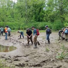 A Field Guide to Hydric Soil Identification$299.00
 -
 2023 Amended Waters of the US Rules (Webinar)$199.00
 -
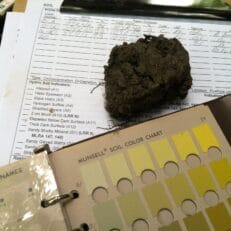 USACOE Hydric Soil Indicators$399.00
 -
 Class Extension Application$500.00
 -
![Wetlands and Real Estate [2025]](https://swampschool.riversagency.com/app/uploads/2022/03/wre2022-231x231.jpg) Wetlands and Real Estate [2025]$159.00
Wetlands and Real Estate [2025]$159.00 -
 Endangered Species Act Consultation Training$1,099.00

