Urgent Call for Chainsaws and Supplies: Help Us Clear the Way in Western NC

I just returned from western NC and need to share an urgent update. While essential supplies like food, water, and fuel are arriving thanks to church groups and other organizations, the real challenge is distributing them. Downed trees are blocking roads and access points, making it extremely difficult to deliver these resources where they are most needed.

I spent several days cutting trees, many of which were massive oaks, over 30 inches in diameter. In the process, I burned through 4 bars and 5 chains. The trees are old and tough, and after sharpening a chain five times, both the chain and bar are done. We urgently need more chainsaws, but even more critically, we need chains and bars.

The Swamp School is launching a chainsaw collection, and we need your help. While monetary donations are appreciated, the real need is for physical chainsaws, chains, and bars, which are in short supply. We’re looking for popular brands like Stihl, Husqvarna, and Poulan Pro, with 16” and 18” chains being the most useful. Please send matched chains and bars if possible.

Donations can be sent to the Swamp School office (address below), and we will personally deliver them to western NC once we have a substantial collection.

Your immediate help can make a real difference.

Thank you!

Marc Seelinger
marc@swampschool.org
(877) 479-2673 – Work
swampschool.org
Please ship your donations to:

The Swamp School
315 S. Salem St., Suite 310
Apex, NC 27502

Maximize Your Success: Advanced Wetland Mitigation Banking Strategies for Environmental and Financial Gains

Wetland mitigation banking has emerged as a critical tool in environmental conservation, offering a unique approach to offsetting the impacts of development on wetland ecosystems. For environmental consultants and land developers, mastering the advanced techniques in wetland mitigation banking not only ensures compliance with environmental regulations but also maximizes financial returns. In this article, we’ll explore the key strategies for successful wetland mitigation banking and how they can lead to both ecological and economic success.

Understanding Wetland Mitigation Banking

Wetland mitigation banking involves the restoration, creation, enhancement, or preservation of wetlands to compensate for losses incurred by development projects. These efforts generate credits that can be sold to developers who need to offset their environmental impacts. The demand for mitigation credits has been steadily rising, making wetland mitigation banking a profitable venture for those who can navigate its complexities.

Why is Wetland Mitigation Banking Important?

Wetlands play a crucial role in maintaining biodiversity, regulating water flow, and improving water quality. However, these ecosystems are often at risk due to urbanization and agricultural expansion. Mitigation banking ensures that when wetlands are impacted by development, new or restored wetlands replace their ecological functions, providing a net benefit to the environment.

Advanced Site Selection Strategies

The success of a wetland mitigation bank starts with selecting the right site. Not all sites are created equal, and choosing the best location requires careful consideration of various factors.

Key Considerations for Site Selection:

  • Hydrology: The water source and flow are the lifeblood of any wetland. Ensure that the site has a reliable water source, whether from surface water, groundwater, or a combination of both.
  • Soil Quality: The soil must support the wetland vegetation and provide the necessary conditions for water retention. Conduct thorough soil testing to determine its suitability.
  • Proximity to Impacted Areas: Ideally, the site should be located near the areas where development impacts are occurring. This increases the value of the credits generated and makes the bank more appealing to potential buyers.

Selecting a site with these characteristics not only enhances the ecological success of the mitigation bank but also boosts its market value. Sites with optimal conditions are more likely to generate higher-quality credits, which can be sold at a premium.

Designing and Planning the Mitigation Bank

Once a site is selected, the next step is designing and planning the mitigation bank. This phase involves creating a detailed mitigation plan that outlines the goals, objectives, and success criteria for the bank.

Essential Elements of a Mitigation Plan:

  • Hydrological Modeling: Use advanced hydrological models to predict water flow and ensure the wetland will function as intended. This modeling is crucial for designing water control structures and vegetation zones.
  • Vegetation Planning: Select plant species that are native to the area and well-suited to the site’s hydrological conditions. Proper vegetation planning is key to establishing a resilient wetland ecosystem.
  • Regulatory Compliance: Ensure that the mitigation plan meets all regulatory requirements. Work closely with agencies like the U.S. Army Corps of Engineers to secure the necessary permits and approvals.

A well-designed mitigation bank not only fulfills regulatory obligations but also maximizes the ecological and financial outcomes of the project.

Implementation and Construction Best Practices

The implementation and construction phase is where the mitigation plan comes to life. This stage involves grading the land, installing water control structures, and planting vegetation.

Best Practices for Implementation:

  • Grading and Excavation: Carefully shape the land to create the desired hydrological conditions. This may involve removing excess soil, creating channels, or building berms.
  • Water Control Structures: Install weirs, culverts, and other structures to manage water flow and maintain the appropriate water levels within the wetland.
  • Planting and Seeding: Use native plants and seeds to establish vegetation. Consider timing the planting to coincide with the wet season to increase the chances of successful establishment.

Proper execution during this phase ensures that the wetland will develop as planned, providing the necessary ecological functions and generating high-quality mitigation credits.

Monitoring, Management, and Maximizing Financial Returns

Long-term monitoring and management are essential for the success of a wetland mitigation bank. Regular monitoring helps track the progress of the wetland and allows for adaptive management if issues arise.

Key Monitoring Activities:

  • Water Quality Testing: Regularly test the water quality to ensure that the wetland is functioning as intended.
  • Vegetation Surveys: Conduct surveys to monitor the health and diversity of the plant community.
  • Wildlife Monitoring: Track the presence of key species to gauge the success of the wetland as a habitat.

Effective management not only maintains the ecological health of the wetland but also ensures that the mitigation credits remain valuable in the marketplace.

Maximizing Financial Returns:

  • Credit Pricing: Set competitive prices for credits based on market demand and the quality of the mitigation provided.
  • Marketing and Sales: Build relationships with developers and regulatory agencies to increase the visibility and attractiveness of your mitigation bank.

Conclusion

Wetland mitigation banking offers a win-win scenario for both the environment and developers. By mastering the advanced techniques of site selection, design, implementation, and management, you can create a successful mitigation bank that delivers significant ecological benefits while maximizing financial returns. As demand for mitigation credits continues to grow, those who excel in this field will find themselves well-positioned for long-term success.

Take the next step in your wetland mitigation banking success—register now to secure your spot in our essential webinar on wetland mitigation banking on October 24, 2024.

Transforming Wetland Delineation: The Power of AI and Chat Assistants

Wetlands are some of the most ecologically significant and sensitive habitats on Earth. They provide essential services such as water filtration, flood protection, and habitat for countless species. However, their complexity and the dynamic nature of wetland ecosystems pose significant challenges for environmental consultants tasked with delineating and assessing these areas. Traditional methods of wetland delineation, while effective, are often labor-intensive, time-consuming, and subject to human error. Enter artificial intelligence (AI) and chat assistants—technologies that promise to revolutionize wetland delineation by enhancing accuracy, efficiency, and accessibility.

The Role of AI in Environmental Consulting

Artificial intelligence has made significant strides in various fields, and environmental consulting is no exception. AI systems excel at processing vast amounts of data quickly and accurately, identifying patterns, and making predictions that can significantly aid decision-making processes. In the context of wetland delineation, AI can be utilized in several ways:

  1. Data Analysis:
    • AI can process large datasets, such as satellite imagery, soil samples, and hydrological data, to identify wetland boundaries and characteristics with high precision. Machine learning algorithms can be trained to recognize specific features and indicators of wetlands, reducing the time required for manual analysis.
  2. Predictive Modeling:
    • AI models can forecast environmental changes based on historical data, helping consultants anticipate how wetlands might evolve under different scenarios. This capability is particularly useful for understanding the impacts of climate change, land use changes, and water management practices on wetland ecosystems.
  3. Automation:
    • Many of the repetitive and routine tasks involved in wetland delineation, such as data entry and initial assessments, can be automated using AI. This automation not only speeds up the process but also minimizes the risk of human error.

Practical Applications of AI in Wetland Delineation

AI applications in wetland delineation are diverse and powerful. Here are a few examples:

  • Species Identification: Using AI to recognize plant and animal species from images is a game-changer. Models trained on large datasets of labeled images can accurately identify species based on features such as shape, color, and texture. This capability is invaluable for monitoring biodiversity and detecting the presence of rare or endangered species within wetlands.
  • Habitat Suitability Analysis: AI can analyze environmental variables such as soil type, water availability, and temperature to predict suitable habitats for different species. This analysis helps in planning conservation efforts and ensuring that habitats are protected and managed effectively.
  • Climate Impact Modeling: Predicting how climate change will affect wetland ecosystems is critical for developing adaptive management strategies. AI models can integrate various climatic and environmental factors to forecast changes in wetland areas, helping policymakers and conservationists make informed decisions.

Introduction to Chat Assistants in Environmental Consulting

Chat assistants, or chatbots, leverage natural language processing (NLP) to interact with users in a conversational manner. These AI-powered tools can provide quick answers to common questions, assist with data entry, and perform initial analyses, making complex AI models more accessible.

How Chat Assistants Work:

  • Natural Language Processing (NLP): Chat assistants use NLP to understand and respond to human language, allowing users to interact with AI models without needing to know technical details. This interaction simplifies the process of obtaining information and insights from AI systems.
  • User Interaction: By providing a user-friendly interface, chat assistants make it easy for users to input data, ask questions, and receive detailed responses. This ease of use is particularly beneficial for environmental consultants who may not have extensive technical backgrounds.

Applications in Environmental Consulting:

  • Customer Support: Chat assistants can answer frequently asked questions about environmental regulations, project timelines, and data requirements, providing quick and accurate responses to clients and stakeholders.
  • Data Collection: Guiding users through the process of entering environmental data ensures that information is collected correctly and consistently. Chat assistants can standardize data entry, reducing variability and improving data quality.
  • Preliminary Analysis: Performing initial assessments based on user inputs allows chat assistants to provide quick insights and recommendations, helping consultants prioritize tasks and focus on more complex analyses.

The Importance of Prompt Engineering

Prompt engineering is the process of designing prompts to effectively communicate with AI models. In wetland delineation, this involves creating specific instructions or questions that guide the AI to provide relevant and accurate responses.

Key Aspects of Prompt Engineering:

  • Designing Effective Prompts: Prompts must be clear, concise, and contextually relevant to ensure the AI model understands the specific task at hand. For instance, a prompt like “Analyze the soil data and classify the area as wetland or non-wetland” directs the AI to focus on relevant soil characteristics.
  • Contextual Awareness: The AI model must understand the context of wetland delineation, including the specific indicators of wetlands and the regulatory criteria used to classify these areas. This contextual awareness is achieved through training the model on relevant datasets and continuously refining the prompts.
  • Iterative Process: Prompt engineering is an iterative process where prompts are tested and refined based on the AI’s performance. This continuous improvement ensures that the model’s responses become more accurate and relevant over time.

Example Prompts:

  • Data Input: “Based on the following soil sample data, is this area classified as a wetland?”
  • Species Identification: “Identify the plant species in this image and determine if it is a wetland indicator species.”
  • Predictive Modeling: “Predict the impact of a 10% increase in rainfall on the wetland area over the next year.”

Case Study: Everglades Water Management

The Everglades, a vast and complex wetland ecosystem in southern Florida, presents a unique set of challenges for water management. Traditional methods often struggle to predict the complex interactions between hydrology and ecology. To address this, an AI model named was developed to simulate various water management scenarios using historical data on precipitation, water flow, and ecological responses.

How it Works:

  1. Data Collection and Preparation: The Ai gathers data from weather stations, hydrological sensors, and ecological surveys. This data is cleaned and preprocessed to ensure accuracy and consistency.
  2. Machine Learning Algorithms: The Ai employs supervised learning, neural networks, random forests, and support vector machines (SVM) to model complex relationships and make robust predictions.
  3. Training the AI Model: The training process involves splitting the data into training and testing sets, performing feature engineering, and iterating on the model to optimize performance.
  4. Running Simulations: Managers input scenarios such as changes in rainfall patterns or water release schedules, and the Ai simulates the impact on the ecosystem, including predicting water levels, flood risks, and habitat conditions.
  5. Insights and Decision Support: The Ai provides detailed reports on the predicted outcomes, helping managers make informed decisions that balance ecological and human needs.

Results and Insights: The Ai’s simulations have proven invaluable in optimizing water flow, improving habitat conditions for wildlife, and ensuring sustainable water use. By identifying optimal water release schedules and predicting potential flooding or drought conditions, Ai helps manage the delicate balance of the Everglades ecosystem.

Benefits and Challenges of AI in Wetland Delineation

While AI and chat assistants offer numerous benefits, there are also challenges to consider.

Benefits:

  • Increased Efficiency: Automating data analysis and routine tasks saves time and resources.
  • Improved Accuracy: AI models can process large datasets and identify patterns that might be missed by human analysts.
  • Scalability: AI systems can handle large volumes of data, making them suitable for extensive project areas.
  • Enhanced Decision-Making: AI provides data-driven insights that support informed decision-making.

Challenges:

  • Data Quality: The accuracy of AI models depends on the quality and completeness of the data.
  • Complexity: Developing and maintaining AI models requires technical expertise.
  • Cost: Implementing AI solutions can involve significant initial investment.
  • Ethical Considerations: Ensuring that AI systems are transparent and do not reinforce biases is crucial.

Join Our Webinar to Learn More

To delve deeper into these topics and explore how AI and chat assistants can transform wetland delineation, join our webinar on August 29, 2024, at 1 PM ET. This 90-minute session will provide valuable insights, practical applications, and a live demonstration of AI in action. Don’t miss this opportunity to stay ahead in the rapidly evolving field of environmental consulting. Register now to secure your spot.

For more details and/or to register, visit our Webinar Registration Page.

Understanding Jurisdictional Determinations: Pipes and Swales as Continuous Surface Connections

Background

The U.S. Environmental Protection Agency (EPA) and the Office of the Assistant Secretary of the Army for Civil Works (OASACW) recently issued a joint memorandum addressing the jurisdictional determination (JD) for NAP-2023-01223. This memorandum clarifies the criteria for wetlands to be considered “waters of the United States” (WOTUS) under the Clean Water Act (CWA), following the Supreme Court decision in Sackett v. EPA. This decision is pivotal in determining when wetlands are jurisdictional, requiring a continuous surface connection to navigable waters or other recognized WOTUS.

Summary

The joint memorandum returned the draft approved JD to the Philadelphia District for revisions, ensuring alignment with the Supreme Court’s Sackett decision. The Sackett ruling specifies that wetlands must have a continuous surface connection to waters recognized as WOTUS to fall under CWA protection. This blog post will delve into the critical role of pipes and swales in maintaining this continuous surface connection, thus impacting the jurisdictional status of wetlands.

Assessment of Adjacent Wetlands Consistent with Sackett

The Sackett decision mandates that adjacent wetlands must have a continuous surface connection with traditionally navigable waters or other WOTUS. This standard, first established in the Rapanos plurality opinion, does not require the wetlands and waters to be visually indistinguishable but emphasizes a clear, physical connection. It is important to note that the term “indistinguishable” in this context does not imply a visual similarity; instead, it refers to the physical and hydrologic connection that allows the wetland to function as part of the broader aquatic ecosystem.

Pipes as Continuous Surface Connections

Context and Application

Infrastructure Role: Pipes and culverts are essential for maintaining hydrologic connectivity across roadways, preventing flooding and erosion. They ensure a continuous flow of water between aquatic resources on either side of the road.

Jurisdictional Determination: During storm events and high water flow periods, these pipes help maintain a physical connection between wetlands and relatively permanent waters, supporting their jurisdictional status under the CWA.

Case Example: Wetlands Area #6

Location: Camden Wyoming, Delaware.
Connection: Wetlands Area #6 connects to Red House Branch via a 70-foot pipe under Willow Grove Road.
Hydrologic Role: This pipe ensures continuous surface water flow from Wetlands Area #6 to Red House Branch, meeting the criteria for an adjacent wetland.

Swales as Continuous Surface Connections

Context and Application

Natural and Constructed Features: Swales, which can be natural or constructed, convey water from surrounding uplands and wetlands. They often carry low-frequency and low-volume flows, which can be crucial for maintaining jurisdictional connectivity.

Evidence of Flow: Observations of water flow in swales, especially following precipitation events, provide critical evidence of a continuous surface connection between wetlands and relatively permanent waters.

Case Example: Wetlands Area #8

Location: Camden Wyoming, Delaware.
Connection: Wetlands Area #8 connects to Waters Area #2, a relatively permanent impoundment, via a 350-foot swale.
Hydrologic Role: Observations of water flow in the swale after rain events demonstrate the physical connection necessary for jurisdictional status.

Legal and Regulatory Framework

Clean Water Act (CWA) Provisions: Regulations at 33 CFR 328.3(a)(4) and 40 CFR 120.2(a)(4) outline the conditions under which wetlands are considered adjacent and thus jurisdictional.

Supreme Court Decisions: The Sackett and Rapanos rulings provide the judicial framework for the continuous surface connection requirement, emphasizing the importance of physical and hydrologic connectivity.

Factors Considered in Assessments:

  • Physical Indicators of Flow: Evidence such as surface water flow during storm events and physical connections like pipes and swales.
  • Length and Nature of Connection: The physical characteristics of the connection, such as length and whether it is manmade or natural.

Practical Implications

Recognizing pipes and swales as continuous surface connections has several practical implications:

  • Infrastructure Design: Encourages designs that maintain hydrologic connectivity, supporting wetland preservation.
  • Regulatory Compliance: Assists regulatory bodies and stakeholders in making informed jurisdictional determinations consistent with the CWA and Supreme Court rulings.
  • Environmental Protection: Ensures that connected wetlands receive appropriate regulatory protections, contributing to broader water quality and ecosystem health goals.

Conclusion

The joint memorandum provides detailed guidance on when pipes and swales can meet the continuous surface connection requirement for wetlands, emphasizing context-specific assessments. By examining physical connections and hydrologic evidence, regulatory agencies can make informed determinations that align with the legal standards established in Sackett and Rapanos. This approach ensures that wetlands that truly function as part of the broader aquatic ecosystem are appropriately regulated and protected under the CWA.

Keywords: jurisdictional determination, Clean Water Act, wetlands, continuous surface connection, Sackett v. EPA, Rapanos, pipes, swales, hydrologic connectivity, WOTUS, environmental protection, EPA.

The Chevron Overturn: A New Era for Environmental Law and Consulting

Chevron Blog

The recent decision by the U.S. Supreme Court to overturn the Chevron doctrine marks a significant shift in administrative law, with profound implications for environmental regulation. This landmark ruling will notably impact the workload of environmental consultants, who will find themselves at the forefront of navigating the new legal landscape.

Background on the Chevron Doctrine

The Chevron doctrine, established in the 1984 case Chevron U.S.A., Inc. v. Natural Resources Defense Council, Inc., has been a foundational principle in administrative law. It mandated that courts defer to federal agencies’ interpretations of ambiguous statutes within their regulatory domain, provided those interpretations were reasonable. This deference allowed agencies like the Environmental Protection Agency (EPA) considerable leeway in enforcing complex regulations such as those under the Clean Water Act, including the contentious Waters of the United States (WOTUS) rule​ (Home | Holland & Knight)​​ (Politico)​.

Increased Litigation and Regulatory Challenges

With the Chevron doctrine overturned, courts will no longer defer to agency interpretations of ambiguous statutes. Instead, they will exercise independent judgment. This shift is expected to trigger a wave of legal challenges against existing and new environmental regulations. Environmental consultants will play a crucial role in these legal battles, providing expert testimony, preparing detailed environmental impact assessments, and supporting legal teams in understanding and contesting regulatory interpretations​ (SCOTUSblog)​​ (Politico)​.

The legal uncertainty following the end of Chevron deference means that many regulations previously upheld under this doctrine are now open to re-evaluation. This scenario will likely lead to an increased demand for consultants to help navigate the evolving legal landscape and ensure compliance with regulatory requirements.

Need for Detailed Compliance Analysis

Without Chevron deference, the clarity on what constitutes compliance with environmental statutes will diminish. Companies and developers will require more comprehensive and rigorous analyses to ensure they meet the new standards set by independent judicial interpretations. Environmental consultants will need to conduct detailed investigations and provide robust documentation to demonstrate compliance with environmental laws, particularly those related to water quality and land use​ (Politico)​.

For instance, WOTUS regulations, which define the scope of waters protected under the Clean Water Act, could see significant reinterpretations. Environmental consultants will need to stay abreast of these changes and provide accurate assessments to help clients navigate compliance issues.

Policy Interpretation and Guidance

Environmental consultants will be essential in interpreting new court rulings and understanding their implications for existing regulations. The overturning of Chevron deference means that regulatory guidance from agencies may no longer carry the same weight, placing greater responsibility on consultants to interpret legal requirements and advise clients accordingly​ (SCOTUSblog)​.

This role will involve staying updated on the latest legal developments and providing clients with clear, actionable insights on how changes in the law affect their operations. Consultants will need to be adept at translating complex legal decisions into practical compliance strategies for their clients.

Updating Environmental Management Practices

Organizations will need to update their environmental management practices to align with the new legal landscape. This process involves revising standard operating procedures, training staff on new compliance requirements, and ensuring all practices meet the latest interpretations of environmental laws. Environmental consultants will be instrumental in guiding organizations through these updates, ensuring that all aspects of their operations are compliant with the new regulatory environment​ (Home | Holland & Knight)​​ (Politico)​.

The Supreme Court’s decision may lead to more stringent judicial scrutiny of agency regulations, requiring consultants to provide more detailed and scientifically robust analyses to support compliance efforts. This increased scrutiny will necessitate higher standards of environmental documentation and reporting.

Permitting and Project Delays

The process for obtaining environmental permits is likely to become more complex and time-consuming. Without the deference previously afforded under Chevron, agencies may face more challenges in implementing and defending their regulatory decisions. This complexity will extend to the permitting process, where more rigorous and detailed applications will be required. Environmental consultants will be essential in navigating these processes, ensuring that all necessary documentation and environmental impact analyses are thorough and meet the new legal standards​ (Home | Holland & Knight)​​ (Politico)​.

In summary, the Supreme Court’s decision to overturn the Chevron doctrine represents a significant shift in administrative law that will substantially increase the workload for environmental consultants. They will be required to provide more detailed compliance analysis, interpret new legal standards, update environmental management practices, and navigate a more complex permitting process. As the legal landscape evolves, the expertise and guidance of environmental consultants will be more critical than ever in ensuring that organizations remain compliant with environmental regulations.

Unveiling WOTUS: How NOHWM and SDAM Define Our Nation’s Waterways

Stream Site

Establishing Jurisdictional Waters of the United States (WOTUS) Using the US Army Corps of Engineers National Ordinary High Water Mark Manual (NOHWM) and Stream Duration Assessment Method (SDAM)

For environmental scientists, the determination of whether a wetland or waterway qualifies as a jurisdictional Water of the United States (WOTUS) is not just a regulatory necessity but a vital step in preserving our nation’s aquatic ecosystems. At the heart of this process are two pivotal tools provided by the US Army Corps of Engineers (USACE): the National Ordinary High Water Mark (NOHWM) Manual and the Stream Duration Assessment Method (SDAM). Together, these methodologies offer a comprehensive, scientific approach to delineating WOTUS, ensuring that critical water resources are effectively protected.

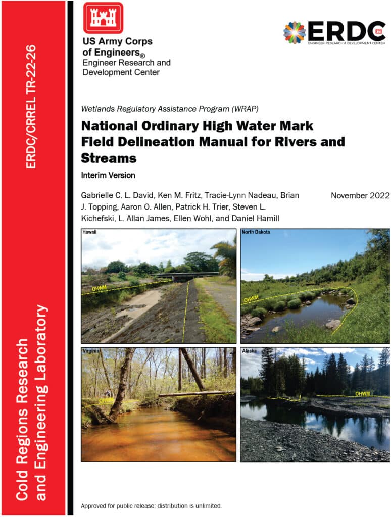
An image of the cover of the National Ordinary High Water Mark Field Delineation Manual for Rivers and Streams.

Diving into the National Ordinary High Water Mark (NOHWM) Manual

The National Ordinary High Water Mark (NOHWM) Manual serves as a detailed guide for environmental professionals to accurately identify the Ordinary High Water Mark (OHWM) in various landscapes. The OHWM represents the boundary between jurisdictional waters and upland areas, making it a crucial concept for environmental assessments.

Key Components of NOHWM:

  1. Physical Characteristics: The manual outlines physical indicators that signify the presence of an OHWM. These include:
  • Clear Natural Line: Look for a visible line on the bank formed by the regular presence of water.
  • Soil Changes: Notice differences in soil color, texture, or composition that indicate historical water presence.
  • Vegetation Patterns: Identify areas where terrestrial vegetation is absent or altered due to frequent inundation.
  • Litter and Debris: Examine the accumulation of organic and inorganic materials deposited by water flow.
  1. Regional Adaptations: The NOHWM Manual acknowledges the diversity of the US landscape, providing region-specific guidelines to account for varying hydrological and geomorphological conditions.
  2. Field Procedures: The manual details systematic field procedures, ensuring consistency and accuracy across assessments. This includes standardized data collection techniques, field forms, and documentation practices.

The Weight of Evidence Approach in NOHWM

A critical concept in the NOHWM approach is the “weight of evidence” (WOE) methodology. This approach ensures that multiple lines of evidence are considered when determining the OHWM, providing a more robust and defensible delineation.

Weight of Evidence Approach:

  1. Multiple Indicators: Instead of relying on a single indicator, the WOE approach integrates various physical, hydrological, and biological indicators. This multi-faceted analysis helps in cross-verifying the presence and extent of OHWM.
  2. Corroborative Evidence: Indicators such as changes in soil, vegetation patterns, and physical markings on the bank are examined together. Consistency among these indicators strengthens the determination of OHWM.
  3. Contextual Analysis: The WOE approach considers the broader landscape and hydrological context, including historical data and regional characteristics, ensuring that the delineation is not only accurate but also contextually relevant.
  4. Documentation and Transparency: Detailed documentation of all evidence and indicators used in the assessment is crucial. This transparency enhances the defensibility of the OHWM determination.
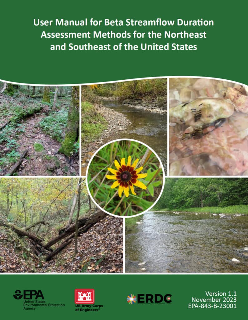
An image of the cover of the User Manual for Beta Streamflow Duration Assessment Methods for the Northeast and Southeast of the United States

Stream Duration Assessment Method (SDAM): A Closer Look

For scientists engaged in stream assessments, the Stream Duration Assessment Method (SDAM) is a game-changer. It allows for precise classification of streams based on their flow duration, which is essential for determining their jurisdictional status.

Stream Classifications:

  1. Ephemeral Streams: These streams flow only during and immediately after precipitation events. As a scientist, identifying ephemeral streams involves recognizing temporary water flow patterns and minimal biological activity.
  2. Intermittent Streams: These streams flow during certain times of the year, such as the wet season, but not continuously. Intermittent streams show clear signs of seasonal aquatic life and sediment patterns.
  3. Perennial Streams: Perennial streams flow year-round and are typically considered jurisdictional. These streams support continuous aquatic habitats and show persistent hydrological and biological indicators.

SDAM Assessment Process:

  1. Field Observations: Conduct site visits to observe physical characteristics like bed and bank features, sediment deposits, and biological indicators such as the presence of aquatic organisms and specific plant species.
  2. Hydrological Data Review: Examine historical flow records, precipitation data, and stream gauge information to understand the stream’s flow regime over time.
  3. Biological Indicators: Identify the presence of certain aquatic organisms and plant species that thrive in continuous or seasonal water flow, offering insights into the stream’s duration and consistency.

Integrating NOHWM and SDAM for WOTUS Determinations

The integration of the NOHWM and SDAM methodologies provides a robust framework for determining whether a water body qualifies as WOTUS. For environmental scientists, this integration involves a meticulous blend of physical, hydrological, and biological assessments.

Determination Process:

  1. Preliminary Assessment: Begin with a thorough desktop review, using maps, aerial photos, and existing hydrological data to identify potential jurisdictional waters.
  2. Field Verification: Conduct on-site inspections to validate preliminary findings. Observe physical indicators of OHWM and perform SDAM assessments to classify stream types accurately.
  3. Data Integration: Combine field observations with historical and current hydrological data. This comprehensive dataset aids in making well-informed determinations of a water body’s jurisdictional status.
  4. Documentation and Reporting: Prepare detailed reports that document findings, methodologies, and justifications for the jurisdictional status. These reports provide transparency and serve as a basis for regulatory decisions.

The Environmental Significance of NOHWM and SDAM

For environmental scientists, the accurate identification of jurisdictional waters is paramount. Here’s why:

  1. Protecting Ecosystems: Correctly delineating WOTUS ensures the preservation of vital aquatic ecosystems, protecting them from pollution and degradation.
  2. Ensuring Compliance: Clear identification helps landowners, developers, and other stakeholders understand their obligations under the Clean Water Act, preventing unauthorized activities that could harm protected waters.
  3. Resource Management: Informed decision-making for water resource management, conservation planning, and habitat restoration efforts becomes possible, benefiting both the environment and the communities that rely on these resources.

Conclusion

The National Ordinary High Water Mark Manual (NOHWM) and the Stream Duration Assessment Method (SDAM) are indispensable tools for environmental scientists working to delineate jurisdictional Waters of the United States (WOTUS). By applying these methodologies, the US Army Corps of Engineers ensures that water bodies deserving of protection under the Clean Water Act are accurately identified and managed. For environmental professionals, mastering these methods is not just about regulatory compliance—it’s about playing a critical role in safeguarding the health and integrity of our nation’s precious water resources. Through diligent application of NOHWM and SDAM, we can continue to protect and sustain our aquatic ecosystems for future generations.

Unlocking Wetland Potential: Your Guide to USDA’s Wetland Mitigation Banking Program

farm near wetland

Introduction to the USDA Wetland Mitigation Banking Program (WMBP)

Illustration of a farm adjacent to a wetland.

The U.S. Department of Agriculture (USDA) has allocated nearly $5 million in grants to support the Wetland Mitigation Banking Program (WMBP). This funding enhances the restoration, creation, or enhancement of wetlands to offset impacts from other locations. Since 2016, over $12.4 million has been awarded to partners in 11 states, leading to the establishment of 21 wetland bank sites.

The USDA recently presented a webinar focused on the Wetland Mitigation Banking Program (WMBP), which supports the development of mitigation banks to restore, create, or enhance wetlands. The webinar provided detailed insights into the process and requirements for establishing a wetland mitigation bank, covering topics such as program overview, application process, site selection, interagency review, Mitigation Banking Instrument (MBI), monitoring and management, credit release and sales, and case studies.

Webinar Summary

The WMBP Applicant Webinar provides detailed insights into the process and requirements for establishing a wetland mitigation bank. The following key topics are covered:

1. Program Overview

Wetland mitigation banking is a market-based approach that involves restoring, creating, enhancing, or preserving wetlands to compensate for unavoidable impacts on wetlands elsewhere. The program aims to ensure no net loss of wetland functions and values. Mitigation banks offer credits to developers and other entities needing to offset their environmental impacts.

2. Application Process

The application process involves several critical steps:

  • Project Proposal: Outline the purpose, need, and benefits of the proposed mitigation bank.
  • Site Plan: Provide detailed plans including maps, design specifications, and ecological goals.
  • Financial Assurances: Demonstrate financial capability to complete the project and manage the site long-term.

3. Site Selection and Design

Selecting an appropriate site is crucial. Key criteria include:

  • Ecological Viability: The site should support the target wetland type and functions.
  • Hydrology and Soils: The site must have suitable hydrological and soil conditions.
  • Connectivity: Proximity to other wetlands or protected areas can enhance ecological benefits.

Design considerations involve creating a site plan that outlines:

  • Grading and Hydrologic Modifications: Ensure proper water flow and retention.
  • Vegetation Plans: Use native species to establish a resilient wetland ecosystem.

4. Interagency Review

The Interagency Review Team (IRT) plays a pivotal role in evaluating and approving mitigation bank proposals. The IRT typically includes representatives from:

  • USDA: Provides guidance on agricultural and conservation practices.
  • USACE: Oversees compliance with the Clean Water Act.
  • EPA: Ensures environmental protection standards are met.
  • State and Local Agencies: Address regional environmental concerns and regulations.

5. Mitigation Banking Instrument (MBI)

The MBI is a detailed agreement that outlines the terms and conditions of the mitigation bank, including:

  • Objectives: Clear goals for wetland restoration or creation.
  • Site Plans: Detailed maps and design specifications.
  • Credit Release Schedule: Timeline for when credits become available based on performance milestones.
  • Long-Term Management: Plans for ongoing maintenance and monitoring to ensure sustainability.

Public notice and comment are integral to the MBI approval process, allowing stakeholders to review and provide feedback.

6. Monitoring and Management

Continuous monitoring is essential to track the bank’s progress and ensure it meets ecological performance standards. Key aspects include:

  • Monitoring Plan: Outlines methods for assessing vegetation, hydrology, and wildlife.
  • Adaptive Management: Strategies to address unforeseen issues and make necessary adjustments to management practices.

7. Credit Release and Sales

Credits represent the restored or enhanced wetland functions and are released in phases as performance milestones are met. The process involves:

  • Performance Milestones: Specific ecological benchmarks that must be achieved.
  • Credit Sales: Developers and other entities purchase credits to offset their environmental impacts, providing financial support for the bank.

8. Case Studies

The webinar highlights several successful wetland mitigation banks to illustrate best practices and lessons learned. These examples showcase innovative approaches to site selection, design, and management that have led to successful restoration and long-term sustainability.

Conclusion

Setting up a wetland mitigation bank with the USDA involves detailed planning, interagency coordination, and commitment to long-term ecological monitoring and management. Adhering to these steps ensures the success and sustainability of wetland mitigation banks. For more information, watch the full webinar here.

Precision in Environmental Restoration: Mastering Survey Techniques with Advanced Laser Levels

In environmental restoration projects such as stream, coastal, and wetland restoration, precise surveying is fundamental. Accurate mapping of biological features and benchmarks is crucial, and selecting the right surveying tools can greatly influence the project’s success.

An illustration of two men using a laser level for a restoration project.

Essential Surveying Tools

1. Dumpy Level

Traditional yet precise, the Dumpy level is excellent for small, detailed survey areas, measuring distances up to about 30 feet but requiring manual operation by two people.

2. Laser Levels

Modern laser levels, such as the Leica Rugby or Spectra Precision series, enhance measurement processes significantly. These devices extend measurement capabilities to the limits of visible distance and usually require just one operator, thereby increasing efficiency and reducing labor.

3. Surveyor’s Total Station

For highly detailed projects, the Trimble S Series Total Station combines electronic distance measurement with precise angular measurements, though it may provide more detail than necessary for basic biological assessments.

4. GPS Systems

While excellent for horizontal coordinates (x and y), GPS systems often fall short in accurately measuring elevation (z), with potential errors of several meters.

Detailed Procedure for Using Laser Levels

Setup and Calibration

  1. Choosing the Right Equipment: Invest in a high-quality laser level and a robust carrying case to protect the device in the field. Set up the level on a survey-grade tripod, which is typically sturdier and equipped with features like adjustable legs and steel spikes for stability.
  2. Finding the Optimal Location: Walk the site to select the best location for setting up the laser level. This spot should offer a clear line of sight to all points of interest and be positioned such that it minimizes the need to move the equipment frequently.

Example of Using a Laser Level in a Wetland Restoration Project

  1. Initial Setup: Place the laser level on the tripod ensuring it is well above the highest ground point to be surveyed. Attach the laser receiver to a survey rod, securing it at a height where it will detect the laser from the level.
  2. Leveling the Instrument: Use the built-in bubble level on the laser level to adjust the tripod legs until the mounting plate is level. Once the device is mounted, fine-tune its position using the leveling screws until the level is perfectly horizontal in all directions.
  3. Taking Measurements:
    • Begin by setting a local benchmark with a known or assumed elevation, for instance, 100 feet.
    • Position the rod at this benchmark and activate the laser level. Adjust the rod height until the laser receiver indicates a perfect alignment with the laser beam.
    • Record the rod reading; let’s say it reads 4.50 feet. This means the height of instrument (HI) is 104.50 feet.
    • Move to the next point of interest, place the rod directly on the ground, and adjust its height until you hear the steady tone of the laser receiver again. Assume this reading is 3.70 feet.
    • Calculate the elevation of this new point by subtracting the rod reading from the HI: 104.50 – 3.70 = 100.80 feet.
  4. Continuing the Survey: Repeat the measurement process for each point in the survey area. Always ensure the rod is perfectly vertical and the numbers are read correctly to avoid errors.

Recording and Analyzing Data

  1. Documenting Measurements: Use a survey notebook to record all measurements systematically. Note each feature’s location, the rod reading, and the calculated elevation.

Example Survey Notes Table

Point IDLocationRod Reading (feet)Height of Instrument (HI)Calculated Elevation (feet)Additional Notes
1Benchmark (BM)4.50104.50100.00Initial benchmark for the site
2Northern Wetland3.70104.50100.80Wetland edge
3Stream Entry2.85104.50101.65Entry point of stream
4Southern Ridge5.10104.5099.40Highest elevation point
5Central Meadow4.00104.50100.50Low-lying grassy area
  1. Analysis and Reporting: Once all data are collected, analyze the measurements to assess the topography and prepare detailed reports or maps as needed. These documents will support decision-making for the restoration project’s design and implementation phases.

Legal and Compliance Considerations

For projects that require certified accuracy, such as legal boundary determinations or floodplain mappings, collaboration with a licensed land surveyor or professional engineer may be necessary to ensure compliance with regulations.

By understanding and applying these detailed surveying procedures using advanced laser levels, environmental restoration professionals can significantly enhance the accuracy and efficiency of their projects, ensuring successful outcomes.

Understanding the 2023 Revised WOTUS Rule: Aligning Federal Water Regulations with Supreme Court Guidance

A beautifully illustrated waterway

The revised rule defining “Waters of the United States” (WOTUS) under the Clean Water Act was significantly influenced by the Supreme Court’s decision in the case of Sackett v. EPA. This 2023 amendment refines the scope of waters that are federally regulated, emphasizing the necessity for them to have more permanent, physical connections to traditional navigable waters.

Key Elements of the Revised WOTUS Rule:

  1. Narrowed Definition: The new rule focuses on waters that are:
    • Traditionally navigable waters, including oceans and large rivers.
    • Perennial and intermittent tributaries that contribute flow to traditional navigable waters.
    • Certain lakes, ponds, and impoundments of jurisdictional waters.
    • Wetlands adjacent to other jurisdictional waters that meet specific criteria for a direct hydrological surface connection.
  2. Exclusions: The rule specifically excludes:
    • Features that only contain water in response to rainfall.
    • Groundwater.
    • Many ditches, including most roadside and farm ditches.
    • Prior converted cropland.
    • Waste treatment systems.
  3. Implementation Status: As mentioned, the implementation of this rule is currently mixed due to ongoing litigation:
    • In 23 states, plus the District of Columbia and U.S. Territories, the 2023 rule is in effect.
    • In 27 other states, authorities continue to use the pre-2015 regulatory definitions pending further court decisions.
  4. Legal and Regulatory Framework: The rule is designed to align with the Supreme Court’s narrower interpretation which limits federal jurisdiction to those waters with a significant nexus to navigable waters.
  5. Impact on Regulatory Practices: This revision affects how businesses and landowners manage their land and water resources, particularly concerning permits for development and land use changes.

The practical application of these changes means that permit requirements may vary significantly depending on the state and the nature of the water bodies involved. This complexity underscores the need for ongoing legal guidance and compliance strategies for those affected by these regulations.

For complete details on the regulatory definitions and implications, you can view the official documentation and additional resources provided by the EPA on their WOTUS Rule Information Page.

Mastering Soil Analysis: How to Use the Munsell Soil Color Chart

Image showing woman using the Munsel Soil Chart.

Soil color is more than just an aesthetic attribute; it offers significant insights into the soil’s composition, fertility, and health. Professionals in agriculture, environmental science, and geology rely on precise tools to determine soil characteristics, and one of the most effective tools is the Munsell Soil Color Chart. In this post, we will explore how to use this chart to accurately identify soil color, providing a practical guide for anyone needing to conduct detailed soil analyses.

Understanding the Munsell Soil Color Chart

The Munsell Soil Color Chart is a standardized tool used to determine the color of soil. It is structured around three color attributes: hue (the type of color), value (lightness or darkness), and chroma (color intensity). The chart consists of a series of color chips with coded notations that represent these three attributes, allowing users to match soil samples with high precision.

Equipment Needed

  • Munsell Soil Color Chart
  • Clean white paper
  • A spade or soil auger
  • Water (optional, for moistening the soil)
  • Natural light conditions (preferably on a cloudy day or in shaded area)

Steps to Identify Soil Color

1. Collecting the Soil Sample

Begin by collecting a fresh soil sample from about 10-20 cm below the surface to avoid weathered or altered topsoil. Use a spade or an auger to extract the soil and place a representative pinch of it on a clean white paper.

Soil auger with a core sample.

2. Preparing the Soil Sample

Crumble the soil gently to remove any clumps and debris. For the most accurate color reading, the soil should be free of organic material like leaves and roots. You can choose to analyze the soil color when it’s dry or after moistening it with a bit of water. Moist soil tends to show the truest color.

3. Using the Munsell Soil Color Chart

Open your Munsell Soil Color Chart and begin comparing your soil sample to the color chips. Start by matching the hue, then adjust for the value, and finally, match the chroma. It’s important to conduct this comparison in natural light, as artificial lighting can distort the color perception.

4. Recording the Color Match

Once you find the closest match, record the notation from the Munsell Chart. This notation consists of the hue (expressed as a fraction or a number), followed by the value and chroma (e.g., 10YR 6/4, where “10YR” is the hue, “6” is the value, and “4” is the chroma). This notation allows you to communicate the soil color accurately in reports or analysis documents.

5. Interpreting the Results

The color of the soil can tell you a lot about its composition. For example, red or orange soil often indicates the presence of iron oxides, while gray soil may suggest organic content or water saturation. Understanding these nuances can help in assessing soil conditions for agricultural purposes, environmental assessments, and more.

Tips for Accurate Soil Color Identification

  • Consistent Lighting: Always use natural light for color matching, as artificial sources can alter how colors appear.
  • Moist vs. Dry Soil: Note that soil colors can vary significantly between their dry and moist states. It’s useful to assess both conditions if possible.
  • Regular Practice: The more you use the Munsell Soil Color Chart, the more proficient you will become in quickly and accurately matching soil colors.
Soil game

Conclusion

The Munsell Soil Color Chart is an invaluable tool for anyone involved in soil analysis. By following these steps, you can accurately determine the color of the soil, leading to better understanding and management of the land. Whether you’re a farmer assessing soil health, an environmental scientist monitoring restoration projects, or a geologist mapping out a site, mastering the use of this chart enhances your ability to make informed decisions based on the ground beneath your feet.