Restoring the Klamath River: A Journey of Cultural Revival and Environmental Healing

The following blog post is a summary of the article “Anything that can be built can be taken down”: The largest dam removal in U.S. history is complete — what happens next? by Lucy Sherriff, published by the BBC on September 3, 2024. To read the original article, click here.

Brook Thompson, a member of the Karuk and Yurok tribes from Northern California, has been fishing on the Klamath River since childhood, where fishing was a way of life. To her and her family, the river was not just a resource but a vital part of their culture and identity. However, in 2002, a massive fish die-off devastated the river, marking a turning point for her community. Thompson recalls how, at seven years old, she witnessed thousands of dead salmon along the shore, an event that had never been recorded in the tribe’s history. This tragedy was linked to low water flow from the Iron Gate Dam, which highlighted the detrimental effects of the dams on the Klamath River ecosystem and the tribe’s livelihood.

The Yurok and Karuk tribes have long opposed the dams, seeing their removal as essential to their survival. The dams blocked fish migration, severely diminishing salmon populations. The tribes’ deep cultural and spiritual connection to the river made the decline of salmon particularly painful. After years of activism and negotiations, the largest dam removal project in U.S. history was completed in 2024, opening over 400 miles of the river. This was a monumental victory for the tribes, as they had been told their demands were impossible. The return of the river’s natural flow brings hope for the recovery of fish populations and the tribe’s cultural practices.

The Klamath River basin, once one of the most productive salmon rivers on the West Coast, had suffered severely due to the dams. Salmon populations plummeted, and the tribes were forced to import fish for their cultural ceremonies. The dams also caused toxic algae growth, further damaging the water quality. The removal of the dams began in 2023, and although the water released downstream was initially dirty, the river has already begun to heal. Tribal members expect fish populations to recover significantly over the coming decades, with predictions estimating an 81% recovery by 2061.

Restoring the land exposed by the drained reservoirs is an ongoing challenge. The tribes, along with environmental organizations, have been working since 2011 to prepare for this restoration, collecting seeds from native plants to reestablish vegetation in the area. These efforts have involved hand-collecting seeds from hundreds of species, including culturally significant plants such as oak trees. The process has been complex, involving careful planning to ensure the genetic suitability of the plants for the local ecosystem. Despite challenges such as wildfires and drought, the restoration team has seen promising results, with wildlife beginning to return to the newly planted areas.

For Thompson and her community, the restoration of the river and the land represents more than just environmental recovery; it is also about healing their connection to their ancestral lands. The removal of the dams symbolizes the reclaiming of their role as stewards of the land, a responsibility passed down through generations. It offers hope not only for the future of the river’s health but for the survival of their cultural traditions tied to the salmon and the ecosystem. Thompson views this restoration as a forward-looking process, blending traditional ecological knowledge with modern scientific practices. While the river may never return to exactly what it once was, the tribes are committed to ensuring its future health for generations to come, believing that they can create a better, more sustainable future for their people.

Beavers as Ecosystem Engineers: Transforming the Landscape in Devon, England for Flood and Drought Resistance

The following blog is a summary of the article Research backs beavers in fight against flooding and droughts by the Devon Wildlife Trust, published online on May 29, 2024. To read the full article, click here.

A decade-long study conducted by the University of Exeter and Devon Wildlife Trust has highlighted the positive impact of beavers on flood and drought management in Devon, England. After being hunted to extinction 400 years ago, beavers were rediscovered living on the East Devon River Otter in 2014. It is unclear how the beavers found their way back, but their legal right to stay was granted in 2020. Forming close-knit family groups, these beavers now inhabit 20 family territories along the river. Beavers are also known as “ecosystem engineers”, as they reshape the landscape to suit their needs by constructing dams. These dams inevitably result in the creation of wetlands, which are prime habitat for the beavers, and an excellent form of flood control for humans. Why? Well, wetlands are able to store large amounts of water, which decreases flooding risks for the surrounding areas.

The research, which combined drone imagery with water depth monitoring, revealed that beaver-created wetlands in four territories stored over 24 million liters of water, equivalent to around 10 Olympic-sized swimming pools. These wetlands help mitigate flooding by reducing storm flows by 30% during heavy rainfall, offering protection to flood-prone communities downstream. Moreover, during droughts, such as the one in 2022, beaver wetlands released stored water slowly, maintaining river flows and creating “green oases” that support various wildlife species.

To further support the benefits of beavers, Devon Wildlife Trust is advocating for the expansion of beaver habitats and is working with two local, East-Devon based landowners through the Department of Environment, Food, and Rural Affairs (Defra)-administered Farming in Protected Landscapes Grant Scheme. Surrendering farmland to the beavers results in a loss of income for farmers, as they lose precious grazing and crop space. This initiative provides financial assistance to farmers, compensating them for that loss. The Farming in Protected Landscapes Grant Scheme is currently only working with Clinton Devon Estates and Bicton College, who are making space for beaver wetlands on their land. The resulting wetlands not only support diverse wildlife but also offer unique learning opportunities for students, as seen at Bicton College, where portions of their working dairy farm were turned into beaver habitat.

Devon Wildlife Trust next goal is to make this innovative “green finance” approach available to more farmers and landowners who are open to transitioning some of their land to wetland habitat. Ed Parrish, the Director of Land-based Operations at Bicton College, supports that goal, stating ” We would like to see this type of funding expanded so that other landowners can be rewarded for the benefits they are providing to the environment when they allow beavers to create wetland habitats.” Dr. Holly Barclay, the Trust’s Green Finance Officer, emphasized the importance of these natural solutions in addressing climate-related challenges such as increasing floods and droughts. The Devon Wildlife Trust aims to develop new funding streams that reward land managers for the societal benefits provided by beaver wetlands, highlighting the cost-effectiveness of these nature-based solutions in mitigating the effects of severe climate events.

Michigan Dairy Farm Ordered to Restore Wetlands After Violating Environmental Laws

The following blog is a summary of the article Farm must restore wetlands, by Eric Levine, published in the Sanilac County News on August 7, 2024. To read the full article, click here.

In a recent legal ruling, a Sanilac County dairy farm, Weaverland Farms, was fined and ordered to restore 69 acres of wetlands that were illegally destroyed. The case was adjudicated by 30th Circuit Judge Wanda Stokes on July 26, 2024, who ruled in favor of the Michigan Department of Great Lakes, Environment and Energy (EGLE). This decision marks a significant moment in the ongoing enforcement of environmental regulations in Michigan.

Background of the Case

The lawsuit against Weaverland Farms and its owners, Nelson, Connie, Arnold, and Ethan Weaver, was initiated by EGLE in October 2022. The agency accused the farm of unlawfully clearing 69 acres of wetlands, which were then converted into a cornfield to support the farm’s dairy operations. The wetlands were also reportedly used as a site to spread manure. This activity came to light during an EGLE investigation into a separate violation concerning the farm’s Concentrated Animal Feeding Operation (CAFO) permit. During this investigation, EGLE discovered that the farm had expanded a manure disposal field, encroaching into the protected wetland area.

Legal Findings and Rulings

Judge Stokes granted summary disposition in favor of EGLE, meaning the case was decided without a full trial because the judge found that there were no significant facts in dispute. The judge ordered Weaverland Farms to restore the 69 acres of wetlands immediately and imposed a $10,000 fine on the farm. In her ruling, Judge Stokes emphasized that the farm’s actions were clear violations of Part 303 of the Natural Resources and Environmental Protection Act (NREPA), which governs the protection of wetlands in Michigan. She noted that the farm, led by Connie and Nelson Weaver, had collectively used the cleared land for their dairy farming activities, despite being aware of its protected status.

Defense Arguments and Court’s Rebuttal

Weaverland Farms presented several defenses, all of which were dismissed by the court. One key argument was that the lawsuit should be dismissed because EGLE allegedly failed to provide a written notice detailing the specific violations before initiating the lawsuit. However, the judge found that EGLE had fulfilled its pre-suit requirements by providing a detailed statement of facts to the defendants, including the location and nature of the violations, and offering to meet with the farm to discuss the issues. The farm also argued that EGLE’s enforcement actions violated the Michigan Right to Farm Act, which protects farmers from nuisance lawsuits if they follow generally accepted agricultural practices. However, Judge Stokes clarified that the Right to Farm Act does not preempt state or federal environmental regulations, such as those under Part 303 of the NREPA. Therefore, the Right to Farm Act did not apply in this case. Another defense put forward by Weaverland Farms was that the required restoration and fine constituted an unconstitutional regulatory taking. The farm claimed that the economic impact of these requirements would render the property worthless, which they argued was contrary to their investment-backed expectations. However, the judge rejected this argument, stating that there was no evidence to support the claim that the enforcement actions constituted an unlawful taking of property.

Conclusion

The ruling underscores the court’s firm stance on the protection of wetlands in Michigan, highlighting the importance of compliance with environmental regulations. Judge Stokes concluded that there was no factual dispute that the wetlands existed on Weaverland Farms’ property and that the farm had indeed violated Part 303 of the NREPA. The judge’s decision to grant summary disposition in favor of EGLE and deny the farm’s motion for summary disposition indicates that the court found the evidence overwhelmingly supported the state’s case. This case serves as a reminder to agricultural operations in Michigan and beyond that environmental regulations must be strictly followed, and violations can result in significant legal and financial consequences. The restoration of the wetlands by Weaverland Farms is not only a legal obligation but also a critical step in preserving the environmental integrity of the region. The decision also reinforces the authority of EGLE and other regulatory bodies to enforce environmental laws and protect natural resources from unlawful exploitation. Despite attempts by Weaverland Farms to challenge the enforcement actions, the court’s ruling affirms the importance of environmental stewardship and the role of the judiciary in upholding laws designed to protect natural resources. The outcome of this case will likely serve as a precedent for future environmental enforcement actions in Michigan and may influence how similar cases are handled in other states.

The Climate Power of Soil

by Tom Clynes, Environmental Defense Fund

The following blog post is an article written for the Environmental Defense Fund by Tom Clynes that was published on May 31, 2024. To read the original publication, click here.

The ground under our feet holds more carbon than the Earth’s atmosphere and all its plants combined. And since almost half the world’s habitable land is devoted to agriculture, efforts to encourage farmers to trap and hold carbon in their soil are picking up speed. More and more farmers today are adopting techniques such as reduced tilling and cover cropping to improve the health of their soils. In addition to reducing fossil fuel and water use, these soil management techniques also hold promise for storing carbon. But soil has many secrets that scientists are just beginning to unravel. “We have to approach this with humility, because there’s a lot we don’t know,” says Jocelyn Lavallee, a soil carbon expert at Environmental Defense Fund. As interest and investment in carbon soil management grows, Lavallee and a team of EDF scientists are digging into the mysteries of dirt.

High-stakes science

Nearly all scientists agree that under certain conditions, soils can capture carbon dioxide from the air and keep it locked way. But less is known about the intricate biogeochemical processes that acquire carbon or release it when disturbances, such as plowing, break up the soil’s structure. Lavallee decided to pursue a graduate degree in soil research because of its implications for the climate. “Soil is a massive store of carbon, and it could go one way or the other,” she says. “It could be a huge source, or it could be a huge sink. It affects so much of the Earth’s future.

On U.S. farms, soil management techniques like cover cropping (planting crops that cover and enrich the soil) and reduced tilling (leaving the soil as undisturbed as possible) are on the rise. About 11% of farms plant cover crops and about 40% use minimal or no tilling, according to a recent USDA survey. By improving soil health, these techniques help farmers build resilience to extreme weather, such as intense droughts and flooding. They can also reduce soil erosion and nutrient loss and increase biodiversity. “These benefits will become more and more important to help farmers cope with the effects of a changing climate,” says Emily Oldfield, an agricultural soil carbon scientist at EDF.

Hands in the dirt

Oldfield worked on a small vegetable farm after college. “The farmer told me, ‘Sure, I grow vegetables. But I’m really a soil farmer, because it’s all about the soil.’ I pursued a PhD to understand more about this,” she says. “Soil represents this nexus between the physical, chemical, and biological – the many complex interactions that combine to support food production.” Oldfield and Lavallee are re-examining the models that carbon credits and other incentives rely on to estimate how much carbon is entering and staying in the soil. “We don’t really know if they represent what’s actually happening to carbon in the ground when farmers adopt certain practices,” says Oldfield. The reliance on models stems from an assumption: Because soil carbon content can vary vastly over a single field, it wouldn’t be economically or logistically feasible to collect and analyze enough samples to directly measure how farmer’s efforts to improve soil health affect carbon storage across large tracts of farmland. “We think that you can and should measure the impact of those practices,” says Oldfield.

EDF teamed up with researchers from Yale University, General Mills and Ecosystem Services Market Consortium to run a test. Using a set of soil carbon samples collected by General Mills on 45 farm fields is Kansas, they found that it was feasible to gauge carbon buildup over a large area by taking samples from a smaller subset of fields. “The study suggests that we can use direct measurements to establish reliable estimates of soil carbon,” says Oldfield. “Having these estimates will instill confidence in the climate impacts of these practices.” In some case, models might still be useful; EDF is leading work to understand where and how they can best fit in. The researchers hope their work can help inform the federally funded Soil Carbon Monitoring Network, a national effort to sample, measure, and monitor the impacts of conservation practices on soil carbon. It can also guide investments by companies trying to understand the climate benefits of various agricultural techniques. “It’s exciting to think that we have the chance to understand these very complex processes within the soil,” says Lavallee, “and the ways that we can use them to carry out climate strategies that work.”

North Carolina Wetlands at Risk

NC Wetlands at Risk

The following blog is a shorter version of the article Analysis: Millions of acres of NC wetlands can be developed due to SCOTUS, NC law by Adam Wagner, published in the Raleigh News & Observer on April 1, 2024. To read the full article, click here.

A large portion of North Carolina’s wetlands could lose protections due to the dual impact of a Supreme Court decision and a state law. When North Carolina lawmakers passed a provision in last year’s Farm Act that prevented development only in wetlands protected by the federal government, they couldn’t answer a key question: How many acres of wetlands here would lose protection? For North Carolina, the answers range from bad to worse, with the analysis determining that anywhere between 14% and 100% of the state’s non-coastal wetlands could be open to development. Those wetlands cover 490,000 to 3.6 million acres, many of them in the low-lying coastal plain. The wide range of risk in the analysis is due to ongoing litigation about what constitutes a federally protected wetland, said Adam Gold, an EDF manager for climate resilient coasts and wetlands in North Carolina and Virginia “The Supreme Court used really unclear language and this leaves the door wide open for potential interpretations.”

The timing of the North Carolina bill’s passage was just weeks after the U.S. Supreme Court’s 2023 Sackett V. EPA decision, a rollback of federal wetlands protections. The decision narrowed which wetlands the federal Clean Water Act protects to those continuously “adjoining” streams, oceans, rivers and lakes in the U.S. The N.C. Home Builders Association was a key force behind last year’s rule change in North Carolina, arguing that the change was introduced to prevent state environmental officials from regulating some isolated wetlands no longer protected by federal rules. North Carolina has other state and local rules that will protect many wetlands that could lose federal protections, Chris Millis, the Home Builders Association’s director of regulatory affairs, told The News & Observer. He pointed to riparian buffer rules, vegetated areas near streams; watershed protection overlays that limit development and require stormwater controls in areas that are important to drinking water supplies; and floodplain protections that curb development in flood-prone areas. Millis also pointed to a March 2024 memo from Assistant Secretary of the Army Michael Connor to the U.S. Army Corps of Engineers directing the agency to continue including wetlands that are no longer federally protected due to the Court’s decision in Corps mitigation projects. That means that even though a wetland might no longer be federally protected from development, the Corps could restrict development there. Citing reduced protections for some North Carolina wetlands, Gov. Roy Cooper vetoed the 2023 Farm Act, but legislators overrode Cooper’s veto.

Wetlands are a key point of regulatory conflict, with businesses and developers arguing that protections are applied too broadly, stymieing building projects that should move forward with ease. Environmental groups say wetlands are key to a clean environment because they filter pollutants out of water and protect against flooding. An acre of wetlands can hold between a million and 1.5 million gallons of water, according to the EPA. That’s particularly important in isolated wetlands found in the Piedmont or North Carolina mountains, Gold said. By retaining water, he said, those wetlands reduce the amount of floodwater flowing downstream, helping everyone in the stream or river basin below. “The wetlands that are most at risk after this decision are the ones that are most critical for flood storage because they are towards the headwaters of watersheds,” Gold said.

Another concern environmental lawyers have about the Farm Act is that it goes further to roll back protections than previous rollbacks, which were primarily focused on permitting the filling in of certain wetlands for development activity. Those wetlands are now no longer protected by state rules limiting the discharge of pollutants into water. With the new information in hand, environmental advocates hope to start making the case for additional wetlands protections when lawmakers return for the short session next month. David Kelly, EDF’s North Carolina president, wrote in an email that lawmakers either have to find a way to convince developers to avoid the losses of wetlands or significantly ramp up funding for wetlands conservation and restoration. “We believe it’s important that science helps inform the policy discussion on wetland conservation in North Carolina and beyond, with the consequences of the Sackett decision providing a clear example of the kind broad ambiguity and uncertainty that can result when policy making is not rooted firmly in science,” Kelly wrote. “We stand ready; if there are any areas of environmental concern that are affected, we’re open-minded and we’re not trying to develop in areas that are truly wetlands,” Millis said.

Exploring the Marvels and Challenges of Louisiana’s Coastal Restoration

The following blog post is a summary of the Saving the Wetlands article by Shenti Menon that appeared in the Environmental Defense Fund’s Volume 55, Number 1 Winter 2024 edition of Solutions magazine.

Photo courtesy of Getty Images

Louisiana’s coastline is a marvel, a dynamic landscape shaped by the mighty Mississippi River, but it’s also one of the fastest-disappearing places on Earth. Over the years, human interventions like levees and dams have disrupted the natural flow of sediment, causing the wetlands that act as a buffer against storms and floods to erode at an alarming rate. Since the 1930s, an area equivalent to the size of Delaware has vanished from Louisiana’s wetlands, leaving communities vulnerable to the increasing threats of climate change. Enter the ambitious project championed by the Environmental Defense Fund (EDF) and partners: the restoration of Louisiana’s coastal wetlands using the power of the Mississippi River itself. This groundbreaking endeavor, part of Louisiana’s $50 billion plan to bolster coastal resilience, seeks to counteract land loss by allowing the river to flow freely and replenish the disappearing wetlands.

The Mississippi River, flowing over 2,000 miles through the heart of America, carries with it rich sediment that has historically nourished Louisiana’s coastal ecosystems. However, human efforts to control the river’s course have disrupted this natural process, leading to the rapid disappearance of land. Levees and other structures built by the U.S. Army Corps of Engineers to manage navigation and flood protection have inadvertently starved the wetlands of sediment, exacerbating the effects of subsidence and sea-level rise.

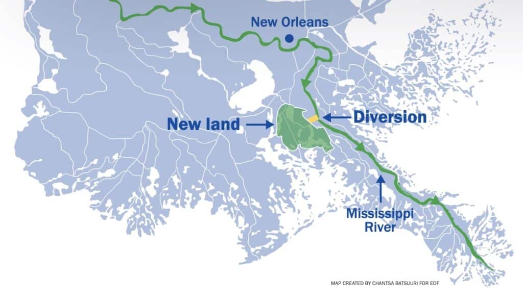
Represented in yellow, the Mid-Barataria sediment diversion will replenish the dying wetlands.

The Mid-Barataria Sediment Diversion project represents a paradigm shift in how we approach coastal restoration. Instead of fighting against the river’s natural processes, Louisiana is embracing them. Engineers will create a 2-mile-long channel to reconnect the river with the vanishing wetlands of Barataria Bay, allowing sediment-rich water to flow in and rebuild land. This approach mimics the natural diversions that occur when the Mississippi finds weak spots in its banks, carving new paths to the sea and depositing sediment along the way. Already, natural diversions like Neptune Pass in Plaquemines Parish have demonstrated the potential of sediment to create new land. Satellite images show muddy sediment flowing into coastal waters, where it accumulates and forms the foundation for new wetlands. With the Mid-Barataria Sediment Diversion, this process will be accelerated, restoring 20–40 square miles of wetlands over the next 50 years.

But the project isn’t without its challenges and controversies. Some stakeholders, particularly in the fishing industry, are concerned about the potential impact on their livelihoods. The diversion of freshwater into saltwater habitats could disrupt ecosystems and alter the distribution of fish and shellfish. However, proponents argue that the long-term benefits of coastal restoration far outweigh these concerns. By protecting and enhancing the natural environment, the project aims to safeguard not only vulnerable communities but also the rich biodiversity of Louisiana’s coast. Moreover, the project is not just about restoring land; it’s also about supporting the communities that rely on these ecosystems for their survival. Louisiana has allocated significant funds to mitigate the impact of the diversion on fisheries and other industries. Investments in new gear, oyster cultivation, and flood mitigation measures demonstrate a commitment to balancing environmental restoration with economic prosperity.

In addition to large-scale infrastructure projects, innovative initiatives are emerging to address the interconnected challenges of climate change and agriculture. Programs like the Regenerative Agriculture Financing Program, developed by EDF and Farmers Business Network, reward farmers for adopting climate-smart practices that reduce emissions and build soil health. By incentivizing sustainable farming methods, these programs not only mitigate climate change but also improve the resilience of agricultural systems. Louisiana’s coastal restoration efforts serve as a model for proactive adaptation to environmental challenges. By harnessing the power of nature and investing in community resilience, we can protect our precious coastal landscapes for generations to come. The challenges ahead are immense, but with collaboration and innovation, we can ensure a brighter future for Louisiana’s coast and its people.

#CoastalRestoration #MississippiRiver #Wetlands #Sustainability #Community Resilience #EnvironmentalStewardship #Innovation

Restoring the Penobscot River

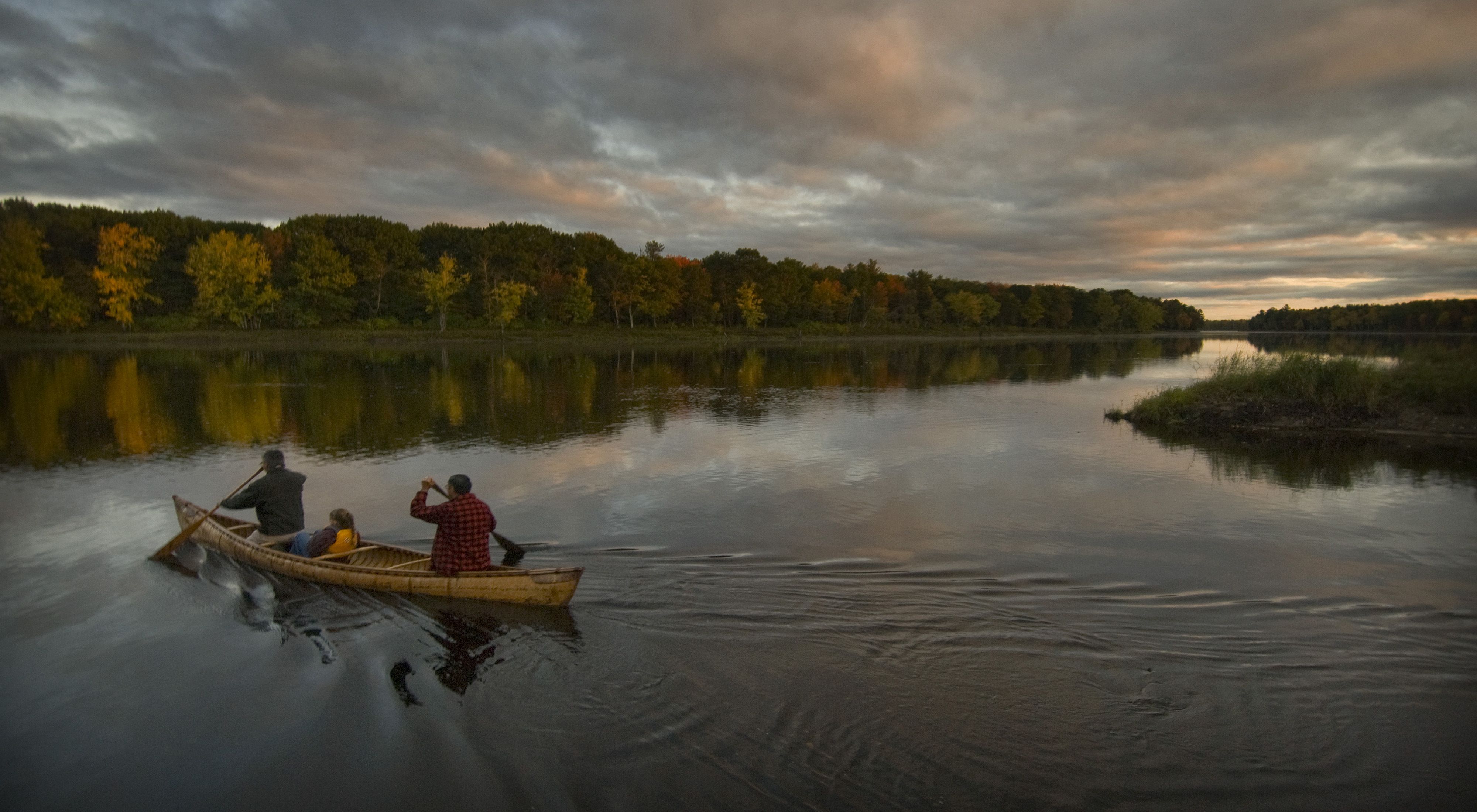
A family paddles across the Penobscot River in a birch canoe at sunset.

Article courtesy of The Nature Conservancy

An Unprecedented Project

The restoration of the Penobscot River is an unprecedented and innovative effort to remove two dams and build a state-of-the-art fish bypass around a third. As a result, thousands of miles of habitat along the Penobscot and its tributaries have been re-opened for 12 native species of sea-run fish. Because of this tremendous project, a multitude of benefits are being realized by biological and human communities in and along the river including skyrocketing fish runs, renewed historic recreational opportunities, and restored connections throughout the watershed.

The seeds of the project were sown in 1999 when PPL-Maine (formerly Pennsylvania Power and Light) purchased a series of dams in Maine. PPL approached the Penobscot Indian Nation who brought in several conservation organizations in hopes of creating a more cooperative and creative model for the dam relicensing process. Discussions with those groups led to a remarkable announcement four years later calling for removal of the Penobscot’s lowermost dams while maintaining hydropower production by increasing power generation at other dams elsewhere.

Partners for Restoration

The 2004 agreement outlining the dam removal process was signed by an unprecedented array of partners that came together to form The Penobscot River Restoration Trust, a nonprofit organization that worked with a variety of state and federal agencies to implement the restoration project. This partnership includes the Penobscot Indian Nation, American Rivers, Atlantic Salmon Federation, Maine Audubon, Natural Resources Council of Maine, Trout Unlimited, the Department of Interior, the State of Maine, and PPL-Maine. The Nature Conservancy joined as a full partner in 2006.

An Ambitious Path

In the first phase of the project, the Penobscot River Restoration Trust purchased the Veazie, Great Works, and Howland dams in December 2010. With support from NOAA and funds from the American Recovery and Reinvestment Act of 2009, and about half in private funds, phase 2 started in June 2012 with the removal of the Great Works Dam. Removal of Veazie Dam was completed in 2013 and a natural river channel that bypasses the Howland Dam was opened in late 2015. These efforts, along with a new fish lift installed by Brookfield Energy at the Milford Dam, thousands of miles of spawning habitat re-connected the main stem of the river to native fish for the first time in nearly 200 years.

The Fish Are Coming Back

Before the dams were removed, river herring counted as they travelled upstream to spawn hovered between a few hundred and few thousand a year. In 2023, more than 6 million of these important fish were counted in the Penobscot watershed during the spring migration!

Monitoring the Results

Researchers and conservationists around the world consider this project a prototype for other river restoration efforts, so it is important to fully understand and study the impacts of dam removal and bypass on life in and around the river including the people whose lives revolve around it. That’s why Conservancy staff are taking the lead as the Trust’s science team, charged with organizing and conducting research and monitoring efforts for the project to better understand the ecological impacts of this work.

A Model for Others to Follow

The Penobscot River Restoration Project resolved longstanding disagreements over how best to restore native sea-run fish and their habitat while balancing the need for hydropower production. It stands as a model of cooperation, innovation, and hard work for the benefit of nature and people.

We’re Not Done Yet

Work continues in the headwaters, removing barriers where roads meet tributary rivers and streams while improving those crossings so they better stand up to increasing flooding from big storms. Thanks to partners and supporters, more habitat is opening to fish and more people are seeing the benefits.

https://www.youtube.com/embed/0nu0v8oyLqA?rel=0&start=0&modestbranding=1&showinfo=0&enablejsapi=1 Butch Phillips (3:45) On restoring the Penobscot River

The Nature Conservancy logo

The Nature Conservancy is a nonprofit, tax-exempt charitable organization (tax identification number 53-0242652) under Section 501(c)(3) of the U.S. Internal Revenue Code. Donations are tax-deductible as allowed by law. Global sites represent either regional branches of The Nature Conservancy or local affiliates of The Nature Conservancy that are separate entities. This site is protected by reCAPTCHA and the Google Privacy Policy and Terms of Service apply.

© 2024 The Nature Conservancy Terms of Use | Privacy Statement | Charitable Solicitation Disclosures | Mobile Terms & Conditions | Notice of Nondiscrimination

Medicinal Wetland Plants

Photo: Judy Biss

Some of you might remember the 1992 movie, Medicine Man, starring Sean Connery, where he conducts research into a “cure for cancer” derived from native flowers.  The science of medicines derived from plants and other natural sources is not just the stuff of Hollywood movie studios, though.  Numerous medical treatments have been known for hundreds of years and have been used by indigenous peoples to treat everything from hives to headaches and much more.

Many common wetland plants have known medicinal properties.  Here are just a few of the many species you may encounter and what they could do for you in a pinch.  Some are so helpful that companies have produced commercial products based on the active ingredients found in these plants.

While the following plants are all relatively safe, it needs to be pointed out that this list is provided for informational purposes only and is not to be construed as safe for all, and that you should consult your doctor before attempting any of these remedies on your own.

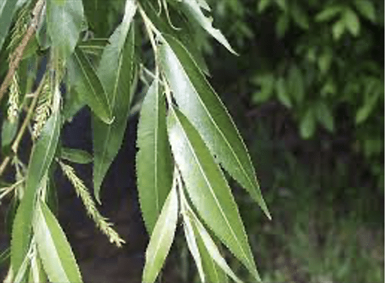
Black Willow – Salix Nigra L. EMP – OBL

https://greatplainsnursery.com

Willow bark extract is very similar in its analgesic action to quinine; the active ingredient is salicin which forms salicylic acid which is found in a number of herbal remedies used throughout the world, some dating as far back as the Stone Age. The willow first became known to Native Americans, who were in need of a fever-reducing agent and used willow bark tea as a remedy. The bark is anodyne, anti-inflammatory, antiperiodic, antiseptic, astringent, diaphoretic, diuretic, febrifuge, hypnotic, sedative, tonic. It has been used in the treatment of gonorrhea, ovarian pains and nocturnal emissions. It is taken internally in the treatment of rheumatism, arthritis, gout, inflammatory stages of auto-immune diseases, diarrhea, dysentery, feverish illnesses, neuralgia and headache. The bark can be used as a poultice on cuts, wounds, sprains, bruises, swellings etc.

Stinging Nettle – Urtica Dioica L.  EMP – FACU

t3.gstatic.com

Urtica dioica, often known as common nettle, burn nettle, stinging nettle or nettle leaf, or just a nettle or stinger, is an herbaceous perennial flowering plant in the family Urticaceae.

Nettles are a highly revered, nutritious spring green, eaten steamed or in soups and stir-fries. The sting disappears when the leaves are cooked or dried. The greens and tea of nettles are high in minerals, vitamins, and chlorophyll, namely Vitamin A and C and calcium, potassium, magnesium, and iron.  The leaves and seeds are used medicinally in teas and foods for allergies, arthritis, and as a kidney tonic. Russians are using the leaves in alcohol for cholecystitis (inflammation or the gall bladder) and hepatitis.

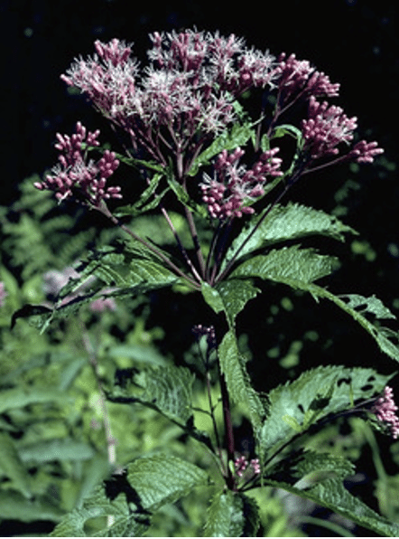
Spotted Joe-Pye WeedEutrochium maculatum L. EMP – FACW

W.D. Bransford @ Lady Bird Johnson Wildflower Center

Native Americans used the tea made from the whole plant of as a diuretic for dropsy, painful urination, gout, kidney infections, and rheumatism. The root tea was once used for fevers, colds, chills, sore womb after childbirth, diarrhea, liver and kidney ailments, and a wash for rheumatism. Its name was derived from “Joe Pye”, a 19th century Caucasian who used the root to induce sweating in typhus fever.

Common St. John’s Wort – Hypericum perforatum L. EMP – FAC

Jim Stasz @ USDA-NRCS PLANTS

Fresh flowers used in tea, tincture, or olive oil, was once a popular domestic medicine for treatment of external ulcers, wounds (especially those with severed nerve tissue), sores, cuts, bruises, etc. The tea is a folk remedy for bladder ailments, depression, dysentery, diarrhea, and worms. Contains the biologically active compounds choline, pectin, rutin, sitosterol, hypericin, and pseudohypericin. Recent studies (1988) have found that hypericin and pseudohypericin have potent anti-retroviral activity, without serious side effects. They are also being researched as an AIDS treatment.

Warning: Taken internally or externally, hypericin may cause photodermatitis (skin burns) on sensitive persons exposed to light.

Yellow marsh marigold – Caltha palustris L. EMP – OBL

www.wildflower.org

Marsh marigold roots were used by Native Americans to treat colds and sores, to induce vomiting, to protect against love charms, and as an aid in childbirth. A tea made from its leaves was also believed to relieve constipation.

Ojibwas mixed tea with maple sugar to make a cough syrup that was popular with colonists; this syrup was used as a folk antidote to snake venom. The plant contains anemonin and protoanemonin – both have marginal antitumor activity.

Warning: Sniffing bruised stems induced sneezing. Intoxication has resulted from the use of the raw leaves in salads or using the raw flower buds as substitutes for capers. Do not confuse with American White or False Hellebore, which is toxic. While parts of the plant are used medicinally, handling the plant can cause skin irritation, and uncooked parts are toxic to human consumption. This is due to irritant yellow oil called protoanemonin.

False daisy – Eclipta prostata L. EMP – FAC

False daisy is native to parts of North America where it has been collected in Massachusetts, and recently in Connecticut. False daisy is used in Chinese and Ayurvedic medicine against liver disease and to restore hair growth. The leaves contain nicotine which acts as an insecticide. It has been used in herbal medicine worldwide. In some parts of this country, it is considered a weed, and, in some areas, it is considered an endangered species. 

Cardinal Flower – Lobelia cardinalis L.  EMP – FAC

Thomas G. Barnes @ USDA-NRCS PLANTS

Native Americans used the root tea for stomachaches, syphilis, typhoid, worms, and an ingredient of “love potions”. Leaf tea was used for colds, croup, nosebleeds, fevers, headaches, and rheumatism. This plant was considered a substitute for Indian-tobacco, Lobelia inflata L., but with weaker effects; it was rarely used.

Warning: Potentially toxic; degree of toxicity unknown.

Purple Loosestrife – Lythrum salicaria L. EMP – FACW

Tea made from whole flowering plant (fresh or dried) is a European folk remedy for diarrhea, intestinal problems, and dysentery; gargle for sore throats; douche for leucorrhea, and as a cleansing wash for wounds and treatment of bacterial infections.

They also use it for swelling and as a drying agent. Women use it for menstrual problems.

Jewelweed – Impatiens capensis   EMP – FACW

Thomas G. Barnes @ USDA-NRCS  PLANT

Jewelweed has a long history of use in Native American medicine. When applied topically, sap from the stem and leaves is said to relieve itching and pain from a variety of ailments, including hives, poison ivy, stinging nettle, and other skin sores and irritations. The sap has also been shown to have anti-fungal properties and can be used to treat athlete’s foot. Thomas G. Barnes @ USDA-NRCS  PLANT

Crushed leaves or mucilaginous stem juice that is harvested before flowering can be applied on recent poison-ivy rash. A 1957 study found it effective, in 2-3 days, in treating 108 of 115 patients. Some people swear by the leaf tea as a poison-ivy rash preventative; others rub on the frozen tea, in the form of ice cubes, as a remedy. The poultice is also a folk remedy for bruises, burns, cuts, eczema, insect bites, sores, sprains, warts, and ringworm.  

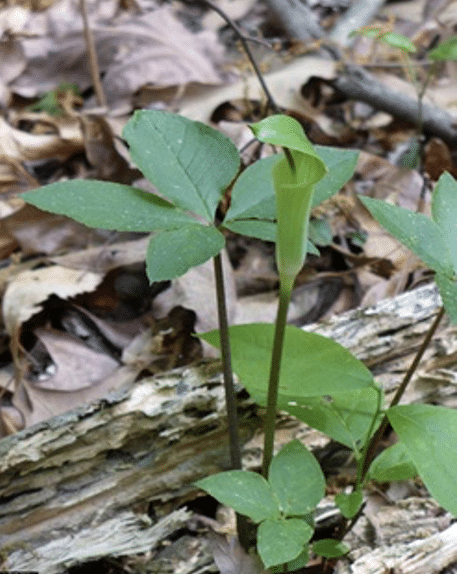
Jack in the Pulpit – Arisaema triphyllum L.  EMP – FAC

Jeff McMillian @ USDA-NRCS PLANTS Database

Native Americans used the dried, aged root for colds and dry coughs, and to build blood. Externally, the root was poulticed for rheumatism, scrofulous sores, boils, abscesses, and ringworm. Dried root tea was used as an expectorant, diaphoretic, and purgative, and for asthma, bronchitis, colds, cough, laryngitis, and headaches. Externally, for rheumatism, boils, and swelling from snakebites. The Chinese used related species to treat snakebites.

Warning: Intensely irritating. Calcium oxalate crystals found in whole fresh herb.

Herb of grace/Water Hyssop – Bacopa monnieri L. EMP – OBL

© Shirley Denton

Hyssop has astringent, emmenagogue (stimulating menstrual flow), relaxant, diuretic, and wound-healing properties. It stimulates mucus production, and is helpful in soothing sore throats, and coughs. It has also been known to help against asthma. Because it also relaxes muscle, it is helpful in aiding digestive problems. Its antibacterial properties make hyssop a good vermifuge (expels intestinal parasites). Hyssop essential oil has medicinal properties, but has also been linked to epileptic seizures, and should be taken with precaution.

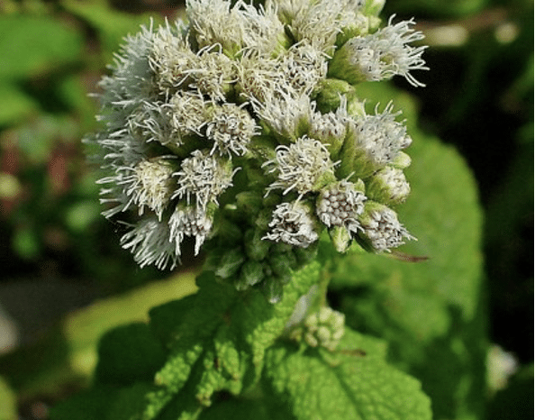
BonesetEupatorium perfoliatum EMP – FACW

Image credit: Wikimedia Commons

Boneset leaf tea was once used to induce sweating in fevers, flu, and colds; also used for malaria, rheumatism, muscular pains, spasms, pneumonia, pleurisy, gout, etc. Leaves were poulticed onto tumors. West German research suggests nonspecific immune system-stimulating properties, perhaps vindicating historical use in flu epidemics.

Warning: Emetic and laxative in large doses. May contain controversial and potentially liver-harming pyrrolizidine alkaloids.

References:

http://edibleandmedicinalplants.weebly.com­­­­­­

https://www.ncbi.nlm.nih.gov â€ș pmc â€ș articles â€ș PMC9385301

https://sites.google.com â€ș ccam â€ș useful-plants-in-vi-habitats

https://www.botanicgardens.org/blog/top-10-medicinal-plants

Making Way for Coastal Wetlands: A Look at Sea Level Rise and Urban Development

U.S. Fish and Wildlife Service

Coastal wetlands provide invaluable ecological and economic services for our coastal communities. To keep pace with sea level rise, these habitats need space to migrate upland. This may present a challenge in some highly urbanized areas. A recent study that calculated open and developed land near wetlands along the Southeastern coast of the United States sheds light on the fate of coastal wetlands at a regional scale, and provides context for improved coastal resilience efforts.

By Mary Schoell ‱ February 12, 2019

Borchert, SinĂ©ad M., et al. “Coastal Wetland Adaptation to Sea Level Rise: Quantifying Potential for Landward Migration and Coastal Squeeze.” Journal of Applied Ecology 1, no. 12 (2018): DOI:10.1111/1365-2664.13169

Approximately 39% of the U.S. population lives in coastal counties, which means that coastal wetlands and nearby communities intimately coexist. A coastal wetland can be defined as an ecosystem that undergoes tidal fluctuations, and includes habitats such as salt marshes, mangrove forests, and salt flats. These habitats provide a wide range of ecosystem services, or benefits to humans, such as flood protection from storm surges, land erosion control, improved water quality, and biodiversity of fish and shellfish species.

However, both development along the coast and anthropogenic climate change have made coastal wetlands particularly vulnerable. Under normal conditions, wetlands can naturally keep pace with changing sea levels. In a process called accretion, plants trap sediment, which increases the elevation of the wetland’s surface. However, due to climate change, higher rates of sea level rise are projected to “drown” many coastal wetland ecosystems. This means that sea levels could rise faster than a wetland’s natural accretion rate. For this reason, the retreat of these habitats upland into higher elevations is recognized as a way for tidal saline wetlands to survive in response to sea level rise. Available, undeveloped land in higher elevations is needed for migration to occur. This can prove difficult in urbanized areas along the coast.

In a recent paper published in the Journal of Applied Ecology, researchers from the United States Geological Survey (USGS) quantified areas along the Gulf Coast of the U.S. where wetland retreat could and could not occur due to development. Using land elevation and tidal data, they determined current coastal wetland boundaries and then calculated the amount of upland area that would potentially become wetlands by the year 2100 under three different future sea level rise scenarios (specifically, 0.5, 1.0, and 1.5 meters). They completed this assessment for 39 different estuaries, from Texas to southwestern Florida.

To assess differences in land use, researcher SinĂ©ad Borchert and her team first used the U.S. Fish and Wildlife Service’s National Wetlands Inventory data to identify coastal wetland habitat. Next, they classified areas of urban development within the projected wetland migration zones using two different datasets: an urban growth model called SLEUTH (Slope, Land use, Excluded, Urban, Transportation, and Hillshade) and the USGS’s National Land Cover Database. Using both habitat and elevation data provides a more accurate prediction of flooding zones at a regional level. Modeling such a comprehensive dataset has rarely been done in the past.

This study reinforces the idea that topography and coastal development dictate the fate of coastal wetland habitat. The results show that low-sloping coastal areas of Louisiana and southern Florida have the highest potential for landward wetland migration. However, wetlands will have to retreat over a larger area to reach higher elevations in these locations.

Urban development in these low-sloping, low-lying areas, such as in Miami, poses the greatest threat to coastal wetlands when sea levels rise. Instead of encouraging wetland growth, we can instead expect areas of high urbanization areas to promote increasing infrastructure development like concrete walls to combat sea level rise. This will result in shoreline “hardening”, or a greater disconnect between coastal wetlands and their upland environment, and ultimately wetland loss.

With the threat of rising sea levels, the need for communication between ecologists, economists, and town planners in coastal communities is more important than ever. This study offers a finer look at areas in the southeastern U.S. that can provide adequate space for coastal wetlands to keep up with sea level rise. It also highlights areas where development will stand in the way of wetland migration – or in other words, potential areas of future wetland loss. Identifying these regions can better direct conservation efforts to places of high priority.

Developing along the coast comes at a great cost in the long term. Losing coastal wetlands means losing ecosystems that protect us from storms, clean our water, and provide habitat for marine species that fishing industries heavily rely on. The results from this study can facilitate more informed and detailed management plans that promote the preservation of coastal wetland migration areas, and ultimately the invaluable ecosystem services that wetlands provide for coastal communities.

Parks Protect the Climate Too

One more reason to protect natural spaces and public lands

By Ben Jealous

September 11, 2023

I recently had the chance to speak at The Economist‘s sustainability conference, and I asked how many people in the audience spend time in our national parks. Hands shot up everywhere. Then I asked them to keep their hands up if they enjoy visiting parks on Labor Day weekend. Hands disappeared, heads shook no, and people chuckled.

So many of us want to get outside and enjoy nature, but we don’t want to wait in traffic for hours trying to get into a park. Demand for the national parks exceeds supply and, as the Sierra Club’s former executive director Carl Pope pointed out to me, Labor Day weekend traffic jams at our parks illustrate this perfectly. People across the rainbow of humanity that is America really want to visit the country’s wild places.

Historically, protecting natural spaces and establishing parks has been job number one for the Sierra Club. In 1890, John Muir led the movement to protect 750,000 acres in the Sierra Nevada as Yosemite National Park. Two years later, the Sierra Club was born. From our role in the creation and protection of parks like Grand Canyon and Grand Teton to our contribution to the passage of the Wilderness Act, which has protected 112 million acres of public land from reckless development, the Sierra Club has been—and will always be—an influential advocate for natural spaces.

Now we must double the number of parks in this country. And I don’t just mean the 425 National Park Service sites but also other federally managed places and state and local parks too. We want to ensure that every person, no matter where they live, can explore and enjoy our natural spaces.

This work goes far beyond the causes of conservation and access to the outdoors. We created parks to save souls (“places to play in and pray in,” as Muir wrote). Today we need them to preserve our collective future.

To avoid irreparable harm to the planet, we need to reduce climate-killing carbon dioxide in the atmosphere dramatically and quickly. Beyond ending our addiction to fossil fuels, one of the best nature-based ways to do this is to preserve natural spaces—especially where mature and old-growth trees act as carbon sponges.

Our national goal is to protect 30 percent of US lands and waters by 2030 to slow climate decay and biodiversity loss. Right now, only about 12 percent is protected. We must safeguard more land in the next seven years than we have in the past 100.

The benefits go beyond preserving wildlife habitats and providing more clean air and water. We can measure them in dollars.

The National Park Service says that for every dollar Congress invests in national parks, $10 is returned to the economy. And communities where we establish public lands as parks will be more resilient to the extreme weather that accompanies climate decline.

As we save more natural spaces, we must discard practices that have too often left out Indigenous communities. Since long before this was a country, Indigenous people have stewarded the landscapes they have called home. Co-management agreements like the one for Bear Ears National Monument recognize that Native knowledge is essential to the long-term protection of our lands and waters (see “Unraveling Manifest Destiny“).

As I write this, the Sierra Club is training state leaders across the country to accelerate the implementation of the Inflation Reduction Act. When President Biden signed it one year ago, the massive investment in growing America’s economy in such a visionary way earned him comparisons to President Franklin Delano Roosevelt. Leading our nation in doubling the size of protected lands would earn him comparisons to another Roosevelt. The Sierra Club’s job at this moment is the same as it was for our founder: to make the case in a way that can neither be ignored nor denied.

Ben Jealous is the executive director of the Sierra Club. | Photo by Ian Martin