Benthic Macroinvertebrates and the EPT Index

Benthic macroinvertebrates (BMI; no, not body mass index) are aquatic animals without backbones that are large enough to see without a microscope. They include worms, crustaceans, and immature forms of aquatic insects such as mayfly and stonefly nymphs and caddisfly larvae. BMI can be important indicators of water quality. Unlike fish, these organisms are not very mobile and are therefore less able to escape the effects of pollution and sedimentation. Many species of mayfly nymphs, stonefly nymphs, and caddisfly larvae are not very tolerant of pollution and can only survive in swift, cool, well-oxygenated water. Their presence is generally interpreted as a sign of good water quality.

One important index often used for water quality rating of perennial streams is the EPT index. This acronym stands for Ephemeroptera, Plecoptera, and Trichoptera, insect taxonomic orders for mayflies, stoneflies, and caddisflies, respectively. The abundance and richness of EPTs are very useful in determining water quality classification.

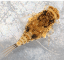
The mayfly order, Ephemeroptera, is Greek for “short-lived winged” referring to the short-lived adult lifespan, usually less than 24 hours for some species. The nymphs are characterized by having well-developed abdominal plate-like gill filaments and usually 3 but sometimes 2 well-developed caudal filaments (cerci). The representative “E” featured in this post below is from the Baetiscidae family within the only genus, Baetisca. This genus is widespread east of the Rockies and somewhat pollution intolerant in the Southeastern United States. Up to 10 different species have been identified in the Southeastern U.S. These “armored” mayflies are sprawlers and clingers found in lotic-depositional habitat and feed by collecting or scraping live organic matter. Note the armored head and thoracic sections with spines that aid in burrowing and protection in depositional areas.
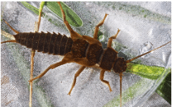
The stonefly order, Plecoptera, is Greek for “folded or pleated winged” referring to the adults’ wing arrangement. Stoneflies are the least pollution tolerant of the EPT group and are found in cold, fast-moving, highly oxygenated streams and rivers, usually in leaf packs or under stones, hence their namesake. While stonefly nymphs can be confused with mayfly nymphs, stonefly nymphs do not have the plate-like abdominal gills, only have 2 caudal filaments, and exhibit two tarsal claws versus one tarsal claw for mayflies. The representative “P” featured in this post below is from the Pteronarcyidae family (the giant or salmonfly stoneflies) in the genus Pteronarcys. These giant stoneflies are sprawlers and clingers found in both lotic-depositional and lotic-erosional habitats and feed mostly as shredders of living and decaying organic matter. They are also known to be a part of the scraper/grazer and engulfer/predator feeding guilds.
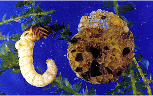
The caddisfly order, Trichoptera, is Greek for “hair wings” in reference to the hairs covering the wings of adults. Caddisflies inhabit a wide range of habitats such as streams, rivers, lakes and ponds. Many caddisfly larvae are known for their ability to make cases out of sand, pebbles, or plant matter using sticky homespun silk. Others are free-living or use miniature silken seine nets or tubes to help capture food. The representative “T” featured in this post below is from the family Helicopsychidae (snail casemakers) within the only genus, Helicopsyche. Historically these caddisflies were originally described as snails that were able to glue sand grains to cover and strengthen their whirls. Larvae of Helicopsyche are typically found in running water but also are found in littoral zone of lakes. They are scraper/grazers primarily feeding on diatoms and detritus.
The Ephemeroptera, Plecoptera, and Trichoptera (EPT) group is an extremely diverse group with which it is very fun to work. As becoming familiar with this group is very important if one wants to perform water quality assessment of streams, it is recommended that one take as many workshops as possible to further understanding of these benthic macroinvertebrates. Be on the lookout for additional posts on these creatures in the future.

Sources Used

Larvae of the North American Caddisfly Genera (Trichoptera), 2nd edition. Wiggins, Glenn B. 1996. University of Toronto Press, Toronto, Ontario, Canada.

Larvae of the Southeastern USA: Mayfly, Stonefly, and Caddisfly Species (Ephemeroptera, Plecoptera, and Trichoptera). Morse, John C., et. al. 2017. Clemson University Public Service Publishing, Clemson, South Carolina.

Macroinvertebrates.org

Nymphs of North American Stonefly Genera (Plecoptera), 2nd edition. Stewart, Kenneth W. and Bill P. Stark. 2002. The Caddis Press, Columbus, Ohio.

March 14, 2024, National Pi Day (or is it PIE?)

Archimedes (287-212 BC) was one of the greatest mathematicians and was the first person to calculate the value of π (pi), which is the ratio of the circumference of a circle to its diameter (C=2πr). The national holiday, yes, national holiday, was declared on March 12, 2009, by the U.S. Congress, and is celebrated on 3/14, which are the first three numbers of the never-ending irrational value of π. (Another fun fact is that Albert Einstein was born on March 14th, which is another good reason to celebrate the day.) Pi day is now celebrated by math geeks all around the circumference of the world with deals at some participating restaurants. Of course, it is also a great excuse to eat all the pie you can on this special day.

However, to wetland delineators, the word pi also congers up the acronym PIE, or the first three letters of the stream classification: Perennial, Intermittent, and Ephemeral. These three terms apply to streams and were defined in 1982 by two gentlemen that go by the names of Hedman and Osterkamp. Most recently, in 2020, President Trump, for the Waters of the U.S. (WOTUS) rules, further defined these terms for classification of “waters” that are jurisdictional by lawyers’ terms.

What is the technical definition of these three terms, you ask?

Technically, the word perennial is an adjective that means lasting or existing for a long or infinite time, and that endures or is continually recurring. As such, these streams are flowing continually throughout the major portion of the year, sometimes even in drought conditions. A perennial stream is a “stream that has flowing water year-round during a typical year. The water table is located above the streambed for most of the year. Groundwater is the primary source of water for stream flow. Runoff from precipitation is a supplemental source of water for stream flow.” (http://www.virginiaplaces.org/watersheds/perennial.html)

The term intermittent is also an adjective that means coming and going at intervals: not continuous. An intermittent stream, as compared to a perennial stream, is a “stream that has flowing water during certain times of the year, when groundwater provides water for stream flow. During dry periods, intermittent streams may not have flowing water. Runoff from precipitation is a supplemental source of water for stream flow.” (http://www.virginiaplaces.org/watersheds/perennial.html)

Ephemeral, on the other hand, means lasting for a short time. An ephemeral stream is a stream that “has flowing water only during or for a short duration after precipitation events in a typical year. In many states, this term refers to streambeds that are located above the water table year-round and streams where groundwater is not a source of water for the stream.” (http://www.virginiaplaces.org/watersheds/perennial.html)

As mentioned above, the WOTUS (Waters of the U.S.) rules defined PIE streams as either jurisdictional or non-jurisdictional. The current WOTUS rules do not mention PIE, only “relatively permanent” waters. Of course, this leads us to question, which of these streams are “relatively” permanent. What is the term relative to? That is a question for another article.

Regardless, wishing you a HAPPY PI (PIE) DAY! Celebrate by having a piece of pie!

Celebrating Nature’s Palette: A Deep Dive into Three Exquisite Wildflowers

In the vast tapestry of the natural world, wildflowers stand as vibrant testaments to the beauty and resilience of flora. Among the myriad of species that grace landscapes worldwide, three particularly captivating varieties capture the hearts of nature enthusiasts and botanists alike: the Cardinal Flower (Lobelia cardinalis), Oswego Tea (Monarda didyma), and Mountain Mint (Pycnanthemum virginianum). These botanical treasures, each with its unique charm and ecological significance, offer a glimpse into the intricate web of life that sustains our planet.

The Cardinal Flower: A Splash of Fiery Red

The Cardinal Flower, scientifically known as Lobelia cardinalis, is a perennial herbaceous plant that belongs to the bellflower family. Its striking red flowers, which resemble the vivid robes of Roman Catholic cardinals, are not just a feast for the eyes; they play a crucial role in the ecosystem. The plant thrives in wet environments along streams, rivers, and swamps across North America.

One of the most remarkable features of the Cardinal Flower is its pollination strategy. The plant’s nectar-rich flowers attract hummingbirds, which are among the few creatures capable of navigating their deep, tubular blossoms. This mutualistic relationship underscores the intricate connections within ecosystems, where each organism plays a role in sustaining others.

The Cardinal Flower’s ecological value extends beyond its beauty and role in pollination. It serves as an indicator species for healthy wetland habitats, which are vital for water filtration and flood mitigation. Preserving these areas is crucial for maintaining biodiversity and ecological balance.

Oswego Tea: A Historical and Aromatic Marvel

Oswego Tea, or Monarda didyma, is another gem of the wildflower world. This perennial, belonging to the mint family, is distinguished by its vibrant red flowers and aromatic leaves. Native to North America, it thrives in moist, rich soils in woodlands and along stream banks. The plant’s common name pays homage to the Oswego Native Americans, who introduced it to European settlers as a medicinal and culinary herb.

Beyond its striking appearance, Oswego Tea has a rich historical significance. It was used as a substitute for tea after the Boston Tea Party, during a time when American colonists boycotted British tea. Its leaves, rich in thymol, have antiseptic properties and were used medicinally by Native Americans to treat a variety of ailments.

Today, Oswego Tea continues to be valued for its beauty and aromatic qualities. It attracts bees, butterflies, and hummingbirds, playing a pivotal role in pollination. Its presence in a garden not only adds a splash of color but also supports local wildlife and promotes biodiversity.

Mountain Mint: The Unsung Hero of the Wildflower World

Pycnanthemum virginianum, commonly known as Mountain Mint, might not boast the bold colors of the Cardinal Flower or Oswego Tea, but its understated elegance and ecological importance are undeniable. This perennial herb, native to North America, flourishes in prairies, woodlands, and along stream banks. Its leaves and stems are covered in a fine, white pubescence, giving the plant a frosty appearance.

Mountain Mint is a powerhouse of ecological benefits. Its tiny, white or pale purple flowers are a magnet for a wide variety of pollinators, including bees, butterflies, and wasps. The plant’s ability to attract such a diverse range of insects makes it a keystone species in its habitat, supporting not only pollinators but also the birds and mammals that feed on them.

Moreover, Mountain Mint is prized for its medicinal properties and aromatic qualities. Its leaves contain pulegone, a natural insect repellent, making it a valuable plant for natural pest control in gardens and agricultural fields.

Conservation and Appreciation: The Way Forward

As we delve into the wonders of the Cardinal Flower, Oswego Tea, and Mountain Mint, it becomes clear that wildflowers are more than just decorative elements in our landscapes. They are vital components of ecosystems, providing essential services from pollination to pest control, and supporting a diverse array of wildlife.

Conservation efforts are crucial to protect these and other wildflower species from threats such as habitat destruction, pollution, and climate change. By preserving natural habitats and practicing sustainable gardening and landscaping, we can help ensure that these botanical treasures continue to thrive for generations to come.

Wildflowers, with their beauty and ecological significance, remind us of the intricate connections that sustain life on Earth. By appreciating and protecting them, we celebrate the richness of biodiversity and the resilience of nature. Let the Cardinal Flower, Oswego Tea, and Mountain Mint inspire us to cherish and safeguard the natural world, recognizing that in its health and vitality lies our own.

The Great Dismal Swamp: A Land Rich in Natural and Cultural Resources

Photo courtesy of Only in Your State

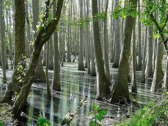
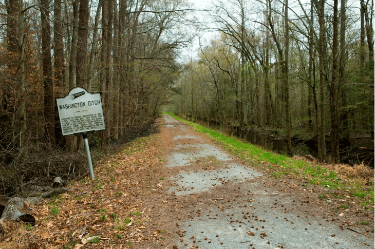
Today, the Great Dismal Swamp, located across southeastern Virginia and northeastern North Carolina, is a national wildlife refuge encompassing about 112,000 acres. Having once covered over a million acres of the coastal plain, this sprawling system of wetlands is home to black bears, red-cockaded woodpeckers, southern plains bumblebees, Dismal Swamp short-tailed shrews, cricket frogs, pawpaw trees, and many other species of wildlife. A biodiversity hotspot with botanical species from both northern and southern climates, biologists with the U.S. Department of Fish and Wildlife and the National Wildlife Refuge system are hard at work making sure it remains a viable habitat. This involves working with the U.S Army Corps of Engineers to manage the swamp’s hydrology. The natural flow of ground and surface waters within the wetlands was heavily disrupted by the construction of drainage ditches, one of which was commissioned by George Washington, who recognized the economic potential of harvesting timber from within the swamp. That little nugget of knowledge provides us with our first clue that there is more than a rich natural history in the Great Dismal Swamp: there is a rich cultural history as well.

Photo courtesy of Allison Shelley and Smithsonian Magazine

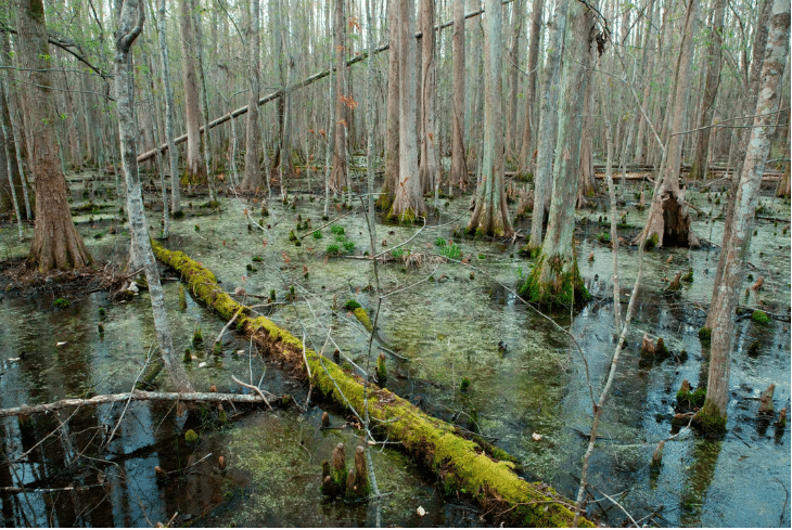
Almost impossible to navigate by canoe or by horseback, the dense quagmire was home to indigenous groups as far back as 6,000 years ago. When European colonists arrived, the surrounding region was turned into farmland and worked by enslaved Africans, enslaved indigenous people, and indentured servants. Those wanting to escape slavery would often head for the swamp, where they were willing to risk running into venomous snakes, mosquito hordes, and the boot-sucking peat muck to secure their freedom. Thus, the Great Dismal Swamp became a stop along the Underground Railroad, where runaway slaves could hide and receive aid from allies on their way to northern states and Canada. The swamp became notorious as a hideout for runaways, and the North Carolina State Assembly even passed the Act to Provide for the Apprehension of Runaway Slaves in the Great Dismal Swamp and for other purposes in 1847. Not everyone who escaped into the swamp chose to leave it behind, though; many formerly enslaved people chose to permanently remain deep within the belly of the swamp. Living on islands, they learned subsistence farming techniques from the dwindling indigenous population. Hunting, fishing, and foraging supplemented the crops they grew, and, according to archaeologist Dan Sayers, they would re-use ancient stone tools that they found in the muck. These communities became known as maroons, and they were often completely isolated from the outside world. References to maroons within the swamp can be found in historical resources dating back to the early 1700s.

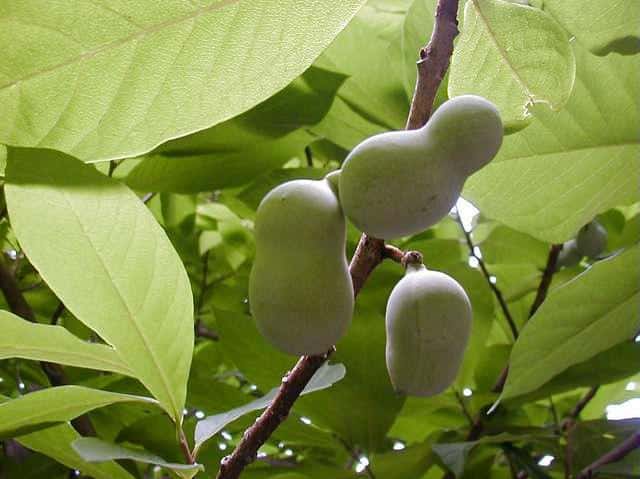
Pawpaw tree and fruit, courtesy of Butterfly Gardens to Go

Sayers has become the world’s foremost expert on maroon communities in the Great Dismal Swamp, and one of the ways he and his team located potential cultural sites was by examining maps of the vegetation. Tree species that need higher, drier ground to thrive revealed the locations of “at least 200 habitable islands” within the wetlands, which may have been home to hundreds of maroons. The interpretation of different vegetative communities within the wildlife refuge’s borders provided Sayers with a way to identify habitable tracts of land. This illustrates the point that our natural and cultural resources are intricately linked, and to only focus on the preservation and interpretation of one without the other does us a disservice. More and more, an interdisciplinary approach is required to gain a fuller picture of our past. Written records of maroon life are scarce, which explains why the fields of history and archaeology traditionally overlooked this portion of history. Sayers, though, recognized how archaeology could reveal the swamp’s secrets, and that botanical surveys could point him to the places most likely to have secrets to reveal. Members of the maroon communities would have, undoubtedly, recognized the plant life that signaled higher, drier ground: pawpaw trees require well-drained soil, so they would have only been able to grow on the islands. Producing a large, tropical-like fruit, pawpaws would have been an important seasonal source of food for maroons. So, the next time you visit the Great Dismal Swamp, or any of the other beautiful natural parks and wildlife refuge systems in the country, try to think about how humans of the past interacted with the environment, and how nature impacted them in return. Our parks and wildlife refuge systems still have a lot to reveal about our nation’s cultural heritage.

Photo courtesy of Allison Shelley and Smithsonian Magazine

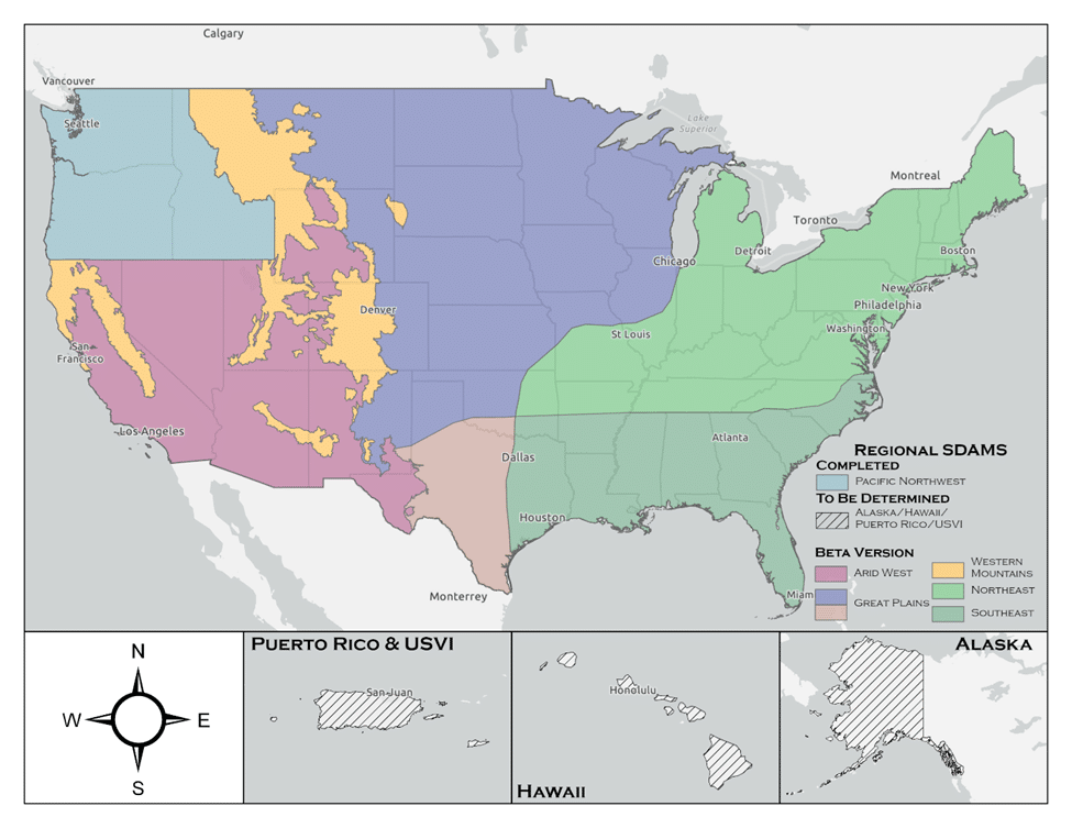
Enhancing Nationwide Wetland Permitting: Integrating the Stream Duration Assessment Model (SDAM) with State-Specific Approaches Across the U.S

The U.S. Army Corps of Engineers (USACE) has developed the Stream Duration Assessment Model (SDAM), a groundbreaking tool that significantly enhances the regulatory oversight and protection of the nation’s water resources. This model plays a critical role in managing and safeguarding streams and wetlands, crucial for maintaining biodiversity, water quality, and flood mitigation. The SDAM is designed to classify streams based on their flow characteristics—perennial, intermittent, or ephemeral—crucial for determining the jurisdictional status of water bodies under the Clean Water Act (CWA). This article explores the integration of state-established models with the SDAM for regulatory purposes and highlights its nationwide applicability for wetland permits.

The SDAM employs a science-based approach, integrating hydrological data, GIS analyses, and field observations to assess stream flow characteristics accurately. This standardized method is vital for delineating the scope of regulatory oversight, ensuring environmental impacts are thoroughly evaluated and mitigated, particularly in the context of Section 404 of the CWA, which governs the discharge of dredged or fill material into waters of the United States.

State-established models of stream flow complement the SDAM by providing detailed insights into the flow regimes of streams within specific geographic areas. These models, developed based on localized data, enhance the precision of the SDAM by incorporating nuanced understandings of stream behavior, reflecting the unique ecological conditions of different regions. Integrating these models involves aligning methodological approaches, standardizing stream type definitions, and harmonizing data analysis techniques to ensure consistency across jurisdictions.

The combined use of the SDAM and state models offers a more nuanced assessment of streams for regulatory purposes. It facilitates more informed decisions regarding wetland permits by identifying streams with significant ecological functions or those critical to maintaining watershed health. This approach supports a more adaptive and responsive regulatory framework, allowing for updates with new data as environmental conditions change, ensuring the relevance and effectiveness of stream assessments.

Nationwide, the applicability of the SDAM, enhanced by state-specific models, encourages collaboration among federal, state, and local agencies. This collaborative approach improves the regulatory process’s efficiency and fosters a shared commitment to protecting water resources. It exemplifies the balance between economic development and environmental stewardship, promoting the sustainable management of aquatic ecosystems.

Furthermore, the integration of state models with the SDAM highlights the USACE’s commitment to using science and technology to improve environmental regulation. It reflects a shift towards data-driven decision-making, setting a precedent for future innovations in water resource management. As the model is refined and updated, its utility for regulatory purposes will continue to improve, ensuring that development and infrastructure projects proceed in an environmentally responsible manner.

The integration of the Stream Duration Assessment Model (SDAM) with state-specific methods, such as the North Carolina (NC) method for assessing stream flows, exemplifies a tailored approach to environmental regulation and water resource management. North Carolina has developed its own methodologies for classifying streams and assessing their ecological significance, which can complement the broader framework of the SDAM.

Example: North Carolina’s Stream Identification Method

North Carolina’s method for stream identification and classification is designed to meet the unique ecological and hydrological conditions of the state, which range from the Appalachian Mountains in the west to the coastal plains in the east. This method involves detailed field assessments, including the examination of physical, chemical, and biological indicators to determine stream types and their jurisdictional status under state and federal regulations.

Key aspects of the NC method include:

  1. Physical Indicators: These include the presence of a well-defined channel, bed and banks, and evidence of flow (e.g., water marks, sediment sorting) to distinguish between perennial, intermittent, and ephemeral streams.
  2. Biological Indicators: The presence of aquatic life, such as fish and macroinvertebrates, which are indicative of perennial or intermittent streams capable of supporting diverse biological communities.
  3. Hydrological Data: Use of historical precipitation, stream gauge data, and other hydrological models to predict flow durations and patterns throughout the state’s diverse landscapes.

Integrating the NC method with the SDAM allows for a comprehensive assessment that leverages local expertise and data while aligning with national standards for water resource management. This integration enhances the precision of stream classifications and the effectiveness of regulatory processes, including permitting for activities that impact water resources.

For example, when a developer proposes a project in North Carolina that may affect waterways, the combined use of the NC method and the SDAM ensures a thorough evaluation of potential impacts on stream flow and aquatic habitats. This dual approach facilitates informed decision-making regarding permit issuance, mitigation measures, and conservation efforts, balancing development needs with environmental protection.

Nationwide Implications

The example of North Carolina illustrates how state-specific methods can enhance the effectiveness of the SDAM in managing water resources across the U.S. By integrating localized approaches with the broader framework of the SDAM, states can ensure that regulatory processes are adapted to their unique environmental conditions, promoting sustainable water resource management and protection at both the state and national levels. This collaborative approach underscores the importance of tailored strategies in addressing the complex challenges of environmental stewardship and water resource regulation.

Restoring the Penobscot River

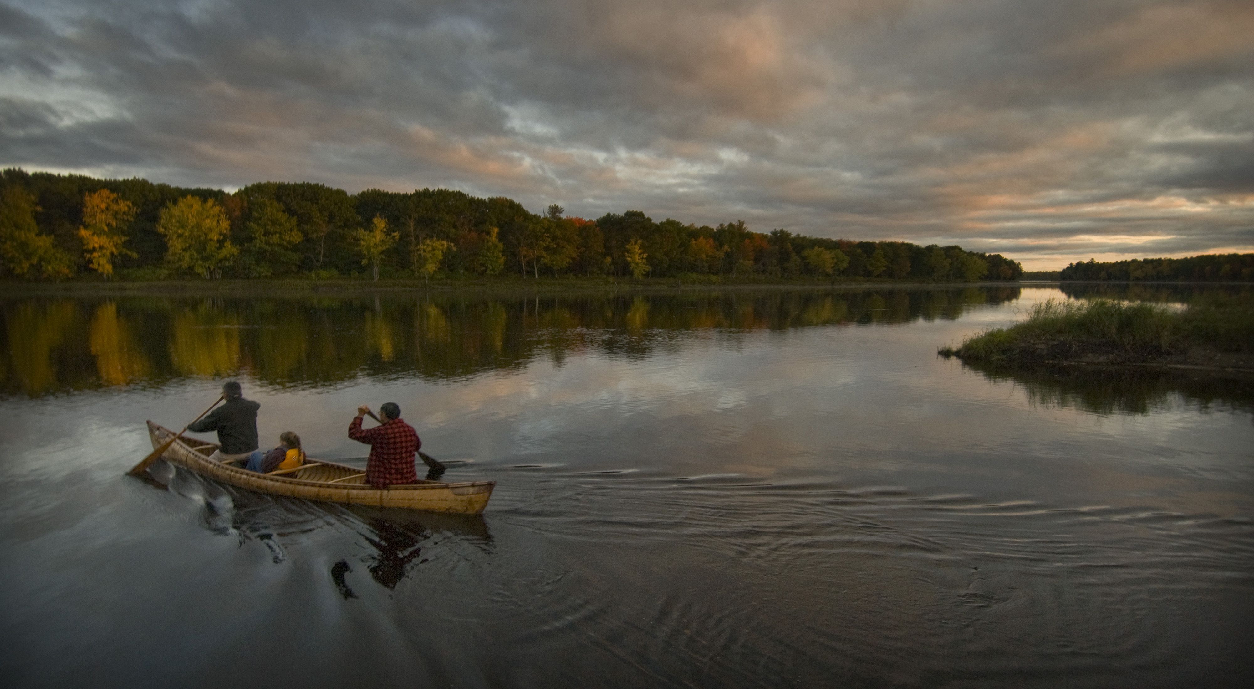
A family paddles across the Penobscot River in a birch canoe at sunset.

Article courtesy of The Nature Conservancy

An Unprecedented Project

The restoration of the Penobscot River is an unprecedented and innovative effort to remove two dams and build a state-of-the-art fish bypass around a third. As a result, thousands of miles of habitat along the Penobscot and its tributaries have been re-opened for 12 native species of sea-run fish. Because of this tremendous project, a multitude of benefits are being realized by biological and human communities in and along the river including skyrocketing fish runs, renewed historic recreational opportunities, and restored connections throughout the watershed.

The seeds of the project were sown in 1999 when PPL-Maine (formerly Pennsylvania Power and Light) purchased a series of dams in Maine. PPL approached the Penobscot Indian Nation who brought in several conservation organizations in hopes of creating a more cooperative and creative model for the dam relicensing process. Discussions with those groups led to a remarkable announcement four years later calling for removal of the Penobscot’s lowermost dams while maintaining hydropower production by increasing power generation at other dams elsewhere.

Partners for Restoration

The 2004 agreement outlining the dam removal process was signed by an unprecedented array of partners that came together to form The Penobscot River Restoration Trust, a nonprofit organization that worked with a variety of state and federal agencies to implement the restoration project. This partnership includes the Penobscot Indian Nation, American Rivers, Atlantic Salmon Federation, Maine Audubon, Natural Resources Council of Maine, Trout Unlimited, the Department of Interior, the State of Maine, and PPL-Maine. The Nature Conservancy joined as a full partner in 2006.

An Ambitious Path

In the first phase of the project, the Penobscot River Restoration Trust purchased the Veazie, Great Works, and Howland dams in December 2010. With support from NOAA and funds from the American Recovery and Reinvestment Act of 2009, and about half in private funds, phase 2 started in June 2012 with the removal of the Great Works Dam. Removal of Veazie Dam was completed in 2013 and a natural river channel that bypasses the Howland Dam was opened in late 2015. These efforts, along with a new fish lift installed by Brookfield Energy at the Milford Dam, thousands of miles of spawning habitat re-connected the main stem of the river to native fish for the first time in nearly 200 years.

The Fish Are Coming Back

Before the dams were removed, river herring counted as they travelled upstream to spawn hovered between a few hundred and few thousand a year. In 2023, more than 6 million of these important fish were counted in the Penobscot watershed during the spring migration!

Monitoring the Results

Researchers and conservationists around the world consider this project a prototype for other river restoration efforts, so it is important to fully understand and study the impacts of dam removal and bypass on life in and around the river including the people whose lives revolve around it. That’s why Conservancy staff are taking the lead as the Trust’s science team, charged with organizing and conducting research and monitoring efforts for the project to better understand the ecological impacts of this work.

A Model for Others to Follow

The Penobscot River Restoration Project resolved longstanding disagreements over how best to restore native sea-run fish and their habitat while balancing the need for hydropower production. It stands as a model of cooperation, innovation, and hard work for the benefit of nature and people.

We’re Not Done Yet

Work continues in the headwaters, removing barriers where roads meet tributary rivers and streams while improving those crossings so they better stand up to increasing flooding from big storms. Thanks to partners and supporters, more habitat is opening to fish and more people are seeing the benefits.

https://www.youtube.com/embed/0nu0v8oyLqA?rel=0&start=0&modestbranding=1&showinfo=0&enablejsapi=1 Butch Phillips (3:45) On restoring the Penobscot River

The Nature Conservancy logo

The Nature Conservancy is a nonprofit, tax-exempt charitable organization (tax identification number 53-0242652) under Section 501(c)(3) of the U.S. Internal Revenue Code. Donations are tax-deductible as allowed by law. Global sites represent either regional branches of The Nature Conservancy or local affiliates of The Nature Conservancy that are separate entities. This site is protected by reCAPTCHA and the Google Privacy Policy and Terms of Service apply.

© 2024 The Nature Conservancy Terms of Use | Privacy Statement | Charitable Solicitation Disclosures | Mobile Terms & Conditions | Notice of Nondiscrimination

Wetlands at the Water’s Edge

Navigating the Confluence of WOTUS, SDAM, and OHWM in Ecosystem Assessment

The integration of the Waters of the United States (WOTUS), the Stream Duration Assessment Model (SDAM), and the Ordinary High Water Mark (OHWM) in wetland assessment provides a holistic approach to identifying and protecting these ecologically significant areas. However, this integration is not without its challenges, which stem from the complexity of wetland ecosystems, the nuances of environmental regulation, and the need for precise scientific data. Expanding on these challenges and opportunities reveals the intricacies involved in effective wetland management.

Data Precision and Availability

One of the foremost challenges in integrating WOTUS, SDAM, and OHWM is the need for high-quality, precise data. Wetland assessment requires detailed information on hydrology, soil types, vegetation, and other ecological indicators. The accuracy of this data directly impacts the determination of WOTUS boundaries, the application of SDAM, and the identification of the OHWM. However, obtaining such data can be resource-intensive, requiring extensive field surveys, remote sensing technology, and hydrological modeling. Moreover, the dynamic nature of wetlands, which may change seasonally or due to climate impacts, adds to the complexity of maintaining up-to-date and relevant data.

Interagency Coordination

Effective integration of these assessment tools also depends on robust interagency coordination. The regulatory landscape of wetland protection in the United States involves multiple federal agencies, including the Environmental Protection Agency (EPA), the U.S. Army Corps of Engineers, the U.S. Fish and Wildlife Service, and state and local entities. Each agency may have different mandates, priorities, and methodologies, which can lead to challenges in achieving a unified approach to wetland assessment and protection. Streamlining communication, data sharing, and regulatory processes among these entities is crucial for the effective implementation of WOTUS, SDAM, and OHWM standards.

Dynamic Nature of Wetland Ecosystems

Wetlands are dynamic systems that respond to a variety of environmental factors, including precipitation patterns, river flow regimes, and human activities. The transient nature of these ecosystems poses a significant challenge to the static frameworks used for their assessment and regulation. For instance, the OHWM might shift due to natural sedimentation processes or human-induced changes in water flow, requiring constant monitoring and adjustment of regulatory boundaries. Similarly, the flow characteristics used in SDAM assessments may vary, affecting the classification of water bodies connected to wetlands. Adapting regulatory approaches to account for these dynamic changes is essential for the long-term protection and management of wetland resources.

Legal and Policy Frameworks

The legal and policy frameworks governing wetland protection, particularly the definition and application of WOTUS, have been subject to significant legal challenges and policy shifts over the years. These changes can lead to uncertainty and inconsistency in wetland assessment and protection efforts. For practitioners and stakeholders, staying informed about current regulations and understanding how they apply to different wetland types and situations is a continual challenge. Ensuring that legal frameworks are both scientifically grounded and flexible enough to adapt to new environmental insights is crucial for effective wetland management.

Conclusion

Integrating WOTUS, SDAM, and OHWM in wetland assessment requires navigating complex environmental, regulatory, and technical landscapes. Addressing the challenges of data precision, interagency coordination, the dynamic nature of wetlands, and evolving legal frameworks is essential for creating a coherent and effective approach to wetland protection. Embracing adaptive management strategies, fostering collaboration among stakeholders, and investing in research and monitoring are key steps toward ensuring that wetlands continue to provide their invaluable ecological services for generations to come.

Exciting Relocation Announcement: The Swamp School Finds a New Home in Apex, NC

We are moving!

We are delighted to share some thrilling news with all our Swamp School supporters and enthusiasts! After many years of growth and dedication to wetlands education and environmental stewardship, the Swamp School is on the move. We’re proud to announce our new location at 315 S Salem, Suite 310, Apex, NC 27502. This relocation marks a significant milestone in our journey, and we can’t wait to embark on this new chapter with all of you.

The Swamp School has always been deeply committed to offering top-quality education and training in the field of wetlands and natural resource management. We believe that understanding and conserving wetlands is crucial for the well-being of our environment and communities. With our move to Apex, we are taking a giant leap towards achieving this mission even more effectively.

Why Apex, NC?

Apex is a vibrant and thriving community located in the heart of North Carolina’s Research Triangle region. This area is known for its commitment to education, innovation, and environmental conservation, making it the perfect home for the Swamp School. Apex’s strategic location provides easy access for students and enthusiasts from various parts of North Carolina and beyond.

Our new location offers a spacious and modern environment that will enhance the learning experience for our students. We are dedicated to maintaining the high standard of education and training that the Swamp School is known for, and our new facility will play a crucial role in achieving this goal.

Our Commitment to Wetlands Education

At the Swamp School, our passion lies in promoting a deeper understanding of wetlands and their vital role in the ecosystem. We believe that by educating individuals and communities about wetlands, we can empower them to become stewards of these unique and precious environments.

Our relocation to Apex allows us to expand our reach and impact. We are excited to continue offering a wide range of courses, workshops, and resources that cater to various levels of expertise, from beginners to seasoned professionals. Whether you’re interested in wetland delineation, plant identification, or habitat restoration, we have something for everyone.

Open House Event – Save the Date!

To celebrate our new home in Apex and to express our gratitude for your unwavering support, we are planning an Open House event that you won’t want to miss! This event will provide an opportunity for you to:

  1. Explore Our New Facilities: Get an exclusive first look at our state-of-the-art classrooms, laboratories, and resources that will enhance your learning experience.
  2. Meet Our Expert Instructors: Interact with our team of passionate and knowledgeable instructors who are at the forefront of wetlands education.
  3. Learn About Our Programs: Discover the diverse range of educational programs, certifications, and training opportunities that we offer.
  4. Connect with Like-Minded Individuals: Network with fellow wetlands enthusiasts, environmentalists, and professionals who share your passion for conservation.
  5. Participate in Engaging Activities: Enjoy hands-on activities, demonstrations, and presentations that showcase the fascinating world of wetlands.

This Open House event will be a fantastic opportunity to get a taste of what the Swamp School has to offer and how our relocation to Apex will benefit you and the community. We encourage you to invite friends, family, and colleagues who might be interested in wetlands education and conservation.

Stay Updated with Us

To ensure you don’t miss any updates regarding the Open House event and other exciting developments at the Swamp School, make sure to follow us on our website and social media channels. We’ll be sharing more details about the event date and registration soon.

The Swamp School is grateful for the support and trust you’ve shown us throughout the years. We are committed to continuing our mission of promoting wetlands education and conservation, and we look forward to welcoming you to our new home in Apex, NC.

Thank you for being a part of our journey, and we can’t wait to see you at our Open House event in our brand-new location! Together, we’ll make a positive impact on wetlands and the environment. 🌱💚

#SwampSchool #NewLocation #OpenHouse #WetlandsEducation #ApexNC #EnvironmentalConservation #CommunityEvent


Subscribe to our Free Newsletter to keep up with current events and happenings at the Swamp School.

Scout Motors is Filling In a Lot of Wetlands

COLUMBIA, S.C. — Environmental advocates are closely monitoring the developments at the site of the massive electric vehicle plant slated for Blythewood in Richland County, with growing concerns about its impact on the delicate wetlands in the area.

Construction crews are back to work after receiving a permit from the U.S. Army Corps of Engineers, allowing them to resume work that had initially been halted due to worries about wetlands damage.

This project has garnered significant attention, particularly after a report by WIS 10 news suggested that the Scout site could potentially impact a staggering 70,000 acres of wetlands, nearly 40,000 acres of ponds, and approximately 35,000 linear feet of tributaries. However, it’s important to note that this report is highly inaccurate and continues to be the top result in Google news searches related to the project.

While the correct figures are somewhat lower, they are still concerning. The USACOE’s permit will authorize the filling or disturbance of 74 acres of wetlands, 38 acres of ponds, and 7 miles of creek.

The new Scout Plant is situated off Interstate 77 in the northern part of Richland County, but questions and apprehensions loom large regarding its potential environmental impact, and the community is eagerly awaiting answers.

Blythewood Mayor Sloan Griffin shared his thoughts, saying, “It’s scary. Change is always accompanied by uncertainty. There are two sides to every coin – heads and tails. Some are excited, looking forward to the promise of 4,000 jobs and increased business opportunities in Blythewood, thanks to Scout.”

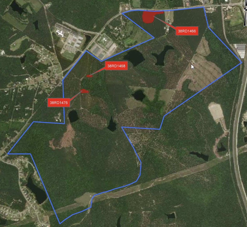
Construction will soon resume on the vast 1,600-acre site in Blythewood, where the Scout Motors manufacturing plant is set to be located.

Last September, Scout had to pause its work following concerns raised by the Environmental Protection Agency (EPA), which had identified evidence of wetlands damage even before the permit was issued.

Additionally, there’s a noteworthy finding indicating that one of the archeological sites, known as 38RD1468, is recommended for inclusion in the National Register of Historic Places (NRHP) under Criterion D. It holds potential for yielding significant insights into the area’s prehistory. However, it’s important to mention that there was not enough data collected during the Phase II investigations to determine its eligibility under other criteria (Criteria A, B, and C).

The Scout Motors project is undeniably intriguing. They are embarking on the production of electric trucks, a technology yet untested in the transportation of goods. This raises questions about the necessity of destroying 75 acres of wetlands for an unproven technology that may or may not compete effectively with traditional trucking methods. While the transition away from fossil fuels is commendable, it’s crucial to ponder whether it should come at the significant cost of our natural environment. Surely, alternative locations with less environmental impact could have been considered for this venture.

Part 2: Tackling the Invasive Menace in Florida’s Everglades

The Battle Against Invasive Species: Florida’s Frontline Strategies

Florida’s picturesque Everglades, a mosaic of wetlands and wildlife, is under siege. The culprits? Invasive species. In Part 1, we explored the nature of these intruders and their impact on this unique ecosystem. Now, let’s delve into the strategies and initiatives in place to combat this ecological threat.

1. Policy Initiatives: Stricter Regulations and Enforcement

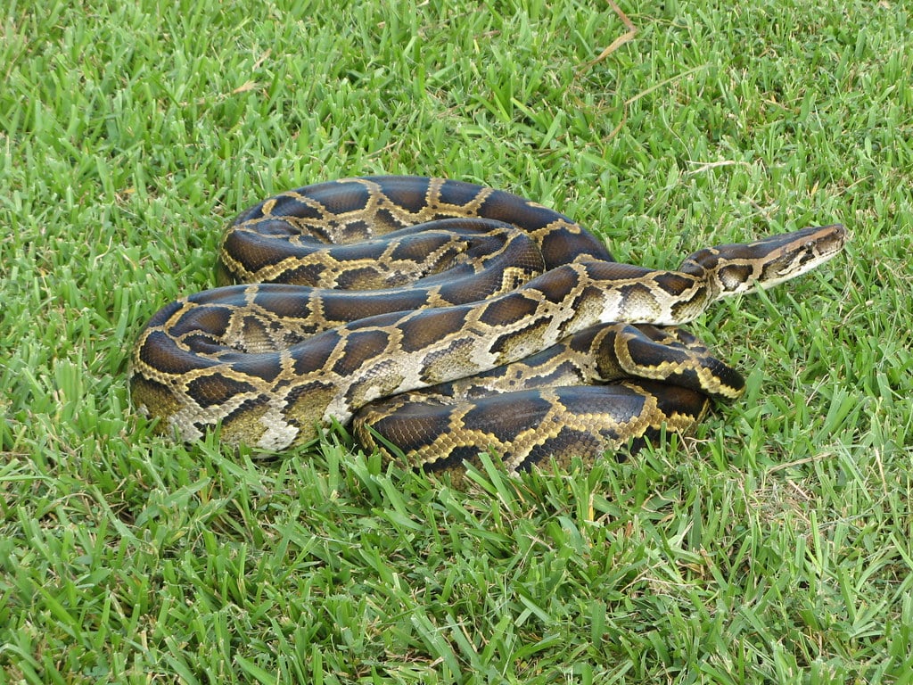
One of the key approaches to combating invasive species is through policy. Stricter regulations on pet trading are essential in curbing the introduction of non-native species into Florida’s ecosystems. The state has implemented more rigorous laws and enforcement measures to monitor and control the exotic pet trade. These efforts aim to reduce the chances of animals like Burmese pythons or lionfish being released or escaping into the wild.

The lionfish is a species native to the Indo-Pacific region, but populations of this fish have exploded in the Gulf of Mexico, the Southeast coast of the U.S., and the Carribean ocean. These fish have few predators, and researchers suspect lionfish kept as pets were released into the wild by their owners in the 1980s, resulting in the large invasive population present today. Photo courtesy of Alabama.com

2. Innovative Land Management Techniques

Effective land management is crucial in the fight against invasive species. Early Detection and Rapid Response (EDRR) systems are in place to identify invasive species quickly and control them before they can reproduce and spread. The Nature Conservancy (TNC) and other organizations employ cutting-edge technologies and methodologies for monitoring and managing these species. This includes using drones for surveillance and employing biological control methods where natural predators of invasive species are introduced in a controlled manner.

3. Community Engagement and Education

Raising awareness and engaging the community is another critical component. Programs like TNC’s Python Patrol and Everglades CISMA’s IveGot1 encourage public participation in spotting and reporting invasive species. Educational campaigns focus on responsible pet ownership to prevent the release of exotic pets into the wild. The Swamp School and other educational institutions offer courses and workshops to educate residents and visitors about the importance of preserving native species and habitats.

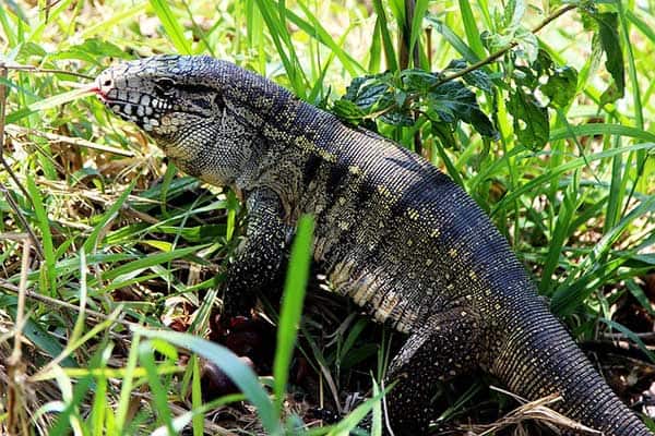
The Argentine black and white tegu is a species common in the pet trade. Pets were released into the wild and now the invasive population is growing, threatening native bird and reptile species. Photo courtesy of Reptile Jam.

4. Research and Collaboration

Ongoing research is pivotal in understanding the behavior and impact of invasive species. Collaborations between universities, conservation organizations, and government agencies are central to developing effective management strategies. Studies focus on the ecological impact of these species and explore new ways to control their populations.

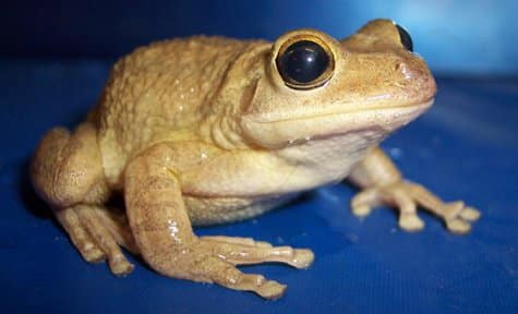
A large, invasive amphibian that will eat whatever it can fit in its mouth is not good news for native species, and unfortunately, wildlife researchers in the U.S. now have to contend with such a species: the Cuban tree frog. The invasive population in Florida is growing, and these large frogs, which consume native amphibians as part of their diet, have been found as far away as Vermont. Photo courtesy of Denise Gregoire of the U.S. Geological Survey.

5. Harnessing Technology and Innovation

Technology plays a significant role in this battle. From advanced tracking systems to genetic studies, scientists and conservationists are leveraging technology to better understand and control invasive populations. Innovations in this field are continually evolving, offering new hope in the fight against these ecological invaders.

The Road Ahead

The battle against invasive species in Florida’s Everglades is ongoing and complex. It requires a multifaceted approach, combining policy, management, education, research, and technology. The commitment of government agencies, conservation groups, scientists, and the public is crucial in preserving this unique ecosystem for future generations.

Stay tuned for more updates on this pressing environmental issue, and don’t forget to join the conversation online. Your awareness and action can make a difference in protecting the Florida Everglades from invasive threats. Let’s work together to safeguard this natural treasure.