Final WOTUS definition to be revised

Press Release:

The Environmental Protection Agency and the U.S. Department of the Army (agencies) are in receipt of the U.S. Supreme Court’s May 25, 2023, decision in the case of Sackett v. Environmental Protection Agency. In light of this decision, the agencies are interpreting “waters of the United States” consistent with the Supreme Court’s decision in Sackett. The agencies are developing a rule to amend the final “Revised Definition of ‘Waters of the United States'” rule, published in the Federal Register on January 18, 2023, consistent with the U.S. Supreme Court’s May 25, 2023 decision in the case of Sackett v. Environmental Protection Agency. The agencies intend to issue a final rule by September 1, 2023.

EPA Press Office, June 26, 2023

The Agencies have announced their intent to revise their draft definition of Waters of the United States to be consistent with SCOTUS’ decision on the Sackett v EPA case. According to their press release, they have not indicated that they will be issuing a draft rule to be published for public comment. It is likely that they will follow an exemption made within the Administrative Procedures Act (APA) that states “when the agency has “good cause” to find the usual proposed rulemaking notice and comment process would be “impracticable, unnecessary, or contrary to the public interest,” the agency may skip this step and proceed to issue a final rule”.

With this exemption in place, the EPA and USACE’s final definition of Waters of the United States will be published in the federal register by September 1, 2023.

Resources

January Definition of Waters of the US

Sackett v EPA Decision

Congressional Letter to Agencies

How Wetlands Protect Louisiana From Powerful Storms

Louisiana’s wetlands represent about 40% of the continental United States’ wetlands. They extend as much as 80 miles inland and along the coast for about 180 miles. Despite the abundance of wetlands in the state, Louisiana represents about 80% of the wetland losses in the United States.

Although not all wetlands are receding, when it comes to Louisiana, it is highly likely for this area to lose these vital habitats in about 200 years. Reducing the losses has proved to be challenging and costly. Some organizations are putting appreciable efforts to protect the wetlands and to understand how to control wetland evolution.

Barrier Islands

The U.S. Geological Survey (USGS), in collaboration with U.S. Fish and Wildlife Service and university partners from Louisiana State University, conducted a joint field investigation and cooperative study to research the Louisiana coast and gather and interpret baseline information.

The Louisiana Barrier Island Erosion Study started in 1988 and focused on the processes that cause barrier island erosion. Scientists collected data sets on variables, including storm effects, water movement and dispersal of fine-grained sediments, soil development, marsh disintegration, and effects of land subsidence and sea-level rise. After synthesizing and comparing data sets, the data collected from representative sediment-starved and sediment-rich basins in Louisiana enhanced scientific knowledge of wetland functions. The goal is to improve scientific knowledge and thus improve the processes responsible for the creation, maintenance, and deterioration of coastal wetlands.  

The Mississippi River Delta and its associated wetlands and barrier shorelines continuously change due to water movement, unconsolidated sands, and mud accumulation. Rivers deltas are the primary source of sediment erosion in a channel. As the river withdraws from the delta, they erode and deposit loose sediment into the river channel. Additionally, marine processes erode and rework the seaward margins of river deltas, which form sandy headlands and barrier beaches. Over time, segmented low-relief barrier islands form and are gradually separated from the mainland by shallow bays and lagoons.   

The barrier islands of the Mississippi River Delta act as natural buffers by reducing the effect of ocean waves and currents on associated estuaries and wetlands. However, the environmental consequences of coastal erosion in Louisiana are notable and are at a rate of up to 60 feet per year. The USGS estimates that several barrier islands could disappear by the end of this century. Without a designated buffer, the wetlands along Louisiana’s delta plains would be exposed to the full force and the effects of the ocean, such as wave action, salinity intrusion, and storm surge.

Solutions

There are various solutions to address the gradual loss of barrier islands and wetlands along the Louisiana coast. Soft engineering methods such as barrier island re-nourishment have proven effective. However, these engineering methods can affect small communities, agriculture, and local industry. Hard engineering solutions can include the creation of new navigation channels, constructed sea walls, and breakwaters. A system of seawalls, levees, pumps, and other flood controls can help prevent catastrophic outcomes. However, natural barriers and wetlands act as “speed bumps,” which significantly decrease the impact of storms. 

New NC Bill Will Limit Wetland Protection

This bill has since been approved by the NC General Assembly and presented to Governor Roy Cooper last Friday (6/13).

Reprinted from CoastalReview.org

Thousands of acres of wetlands in North Carolina stand to lose state protections under a new farm bill that would restrict how the state’s wetlands are defined.

The N.C. Farm Act of 2023 proposes to limit the definition of “wetlands to waters of the United States,” a rule that is currently being challenged in the nation’s highest court.

Environmentalists say the bill, if enacted, would strip the state’s ability to fill in gaps to protect federally non-jurisdictional wetlands, including isolated wetlands, which are those not directly connected to any body of water, but are hydrologically and ecologically valuable.

Concerns are also being raised about a provision in the bill that would change a rule requiring gases captured from hog waste lagoons be used to produce renewable energy.

Isolated Wetlands Now At Risk

The North Carolina General Assembly in 2015 passed a law regulating impacts to isolated wetlands, and the state Environmental Management Commission has adopted a temporary permitting rule for wetlands the state has identified as federally non-jurisdictional.

Those protections would be eliminated if the new farm bill passes, said Julie Youngman, a senior attorney with the Southern Environmental Law Center.

“Wetlands act like a sponge in that they can absorb a lot of water,” she said. “When you have big storms and protected wetlands that are healthy and functioning as they should be functioning upstream, they’re absorbing water and keeping massive amounts of water from moving downstream and flooding downstream communities. To the extent you protect fewer wetlands you’re reducing that capacity.”

Julie Youngman, Southern Environmental Law Center

Isolated wetlands recharge groundwater and can store a lot of water, a function particularly important during coastal storms.

A U.S. Environmental Protection Agency-funded study several years ago assessed isolated wetlands in an eight-county area of southeastern North Carolina and northeastern South Carolina. The study concluded that there are about 50,000 isolated wetlands in the study area, including about 30,000 in the North Carolina portion, each averaging about two-thirds of an acre.

“The General Assembly passed a law setting aside tens of millions of dollars to help local governments prepare for flooding and recover from flooding and it just seems irresponsible and kind of wasteful of government resources and our taxpayers dollars to, on the one hand, pass a law designed to react and prevent and prepare and recover from flooding and then within a year and a half or two years, pass a law that will inevitably increase flooding or reduce the state’s ability to prepare for flooding,”

Julie Youngman, Southern Environmental Law Center

NC Wetlands and WOTUS

Earlier this year, the Biden administration released its final rule defining “waters of the United States”, or WOTUS.

The rule reinstates federal protections for millions of acres of wetlands in North Carolina, putting back into place longstanding clean water protections for streams, lakes, ponds and upstream wetlands that significantly affect what are considered traditional navigable waters. Those include waterways that are used for commercial recreational use, territorial seas and interstate waters.

Both the U.S. House and Senate voted to overturn the Biden WOTUS rule, but efforts to halt the rule fell short last week when the House failed to clear the two-thirds mark needed to override Biden’s April 6 veto.

The final rule will ultimately be determined in the courts.

Solely relying on the WOTUS rule to classify wetlands would leave states at the mercy of a change in the federal landscape.

Grady McCallie, policy analyst with the N.C. Conservation Network, said the provision in the farm bill would hook the state to a contested question of the limit of federal authority under the U.S. Constitution.

That should not decide state policy, he said.

“What should decide our policy is what do we need to protect North Carolina communities and residents,” McCallie said. “In this case, it’s really clear we need to protect wetlands because they hold water and they prevent flooding downstream. That’s the chief reason this provision is a bad idea. We need to protect our wetlands for our own reasons. It doesn’t matter what the federal government does.”

Grady McCallie, N.C. Conservation Network

Agricultural Waste

Will Hendrick, the network’s environmental justice director, explained that the proposed bill would allow digesters, which are used to capture methane gas produced by hog waste, to be permitted, but not used.

“We’re particularly concerned that it could allow constant flaring of that gas,” he said.

North Carolina Pork Council Director of Government Affairs and Sustainability Angie Maier told WRAL that farmers are not going to invest hundreds of thousands of dollars to install digesters and not sell the gas.

The farm bill would require a new 25-foot buffer between farms and trout streams and raise the penalty for spilling animal waste along state roads.

Sources

Talton, T. (2023). NC farm bill would restrict how state defines wetlands. Coastal Online Review. Retrieved from https://coastalreview.org/2023/04/nc-farm-bill-would-restrict-how-state-defines-wetlands/

The Kissimmee River Restoration Project

Only about one-half of Florida’s original wetlands remain, but Florida still has more wetlands than any of the other forty-seven conterminous States. On top of that, over the last few decades, the State of Florida has been diligently restoring some of the lost wetlands.

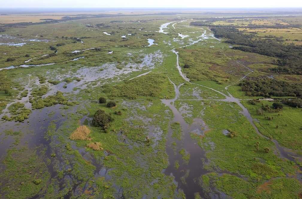
The Kissimmee River once meandered for 103 miles through central Florida. Its floodplain, reaching up to three miles wide, was inundated for extended periods by heavy seasonal rains. Native wetland plants, wading birds and fish thrived there. The Kissimmee Basin encompasses more than two dozen lakes in the Kissimmee Chain of Lakes (KCOL), their tributary streams and associated marshes and the Kissimmee River and floodplain. The basin forms the headwaters of Lake Okeechobee and the Everglades; together they comprise the Kissimmee-Okeechobee-Everglades (KOE) system, but prolonged flooding in 1947 prompted a public outcry for federal assistance to reduce flood damage to property. In 1948, the U.S. Congress authorized the U.S. Army Corps of Engineers to construct the Central and South Florida Project.

Site History

In the 1960s, the Central and Southern Florida Flood Control (C&SF) Project modified the native KOE system extensively throughout South Florida, including construction of canals and water control structures to achieve flood control in the Upper and Lower Kissimmee basins. The Kissimmee River was channelized by cutting and dredging a 30-feet-deep straightaway through the river’s meanders creating the C-38 canal.

After the river channel was straightened, 40,000 acres of floodplain below Lake Kissimmee dried out, reducing the quality of waterfowl habitat by ninety percent, and the number of herons, egrets and wood storks by two-thirds. Catches of largemouth bass in the river were consistently worse after the channelization. While the Kissimmee was not a significant source of pollution for Lake Okeechobee before channelization, in the 1970s and later the river contributed about 25% of the nitrogen and 20% of the phosphorus flowing into the lake.

While the project delivered on the promise of flood protection, it also destroyed much of a floodplain-dependent ecosystem that nurtured threatened and endangered species, as well as hundreds of other native fish and wetland-dependent animals.

Efforts to restore the Kissimmee River to its original flow were approved by Congress in 1992 and began with modification to the headwater lakes in 1997. The United States Army Corps of Engineers had initially hoped to complete the project in 2015. In 2006, the South Florida Water Management District had acquired enough land along the river and in the upper chain of lakes to complete restoration. In all, forty-three miles (69 km) of the Kissimmee River will be restored.

Project Goals

Major initiatives in the Kissimmee Basin include the Kissimmee River Restoration Project, the Kissimmee River Restoration Evaluation Program and the Kissimmee Chain of Lakes and Kissimmee Upper Basin Monitoring and Assessment. Several activities are associated with these projects, including ecosystem restoration, evaluation of restoration efforts, aquatic plant management, land management, water quality improvement and water supply planning.

The Kissimmee River Restoration Project will restore more than forty square miles of the river floodplain ecosystem, 20,000 acres of wetlands, and forty-four miles of the historic river channel. This major restoration effort is a 50-50 partnership between the USACE and the SFWMD. Over the past 22 years, the USACE and SFWMD worked together to:

  • Complete backfilling of 22-miles of the C-38 canal between Lakes Kissimmee and Okeechobee.
  • Reconstruct remnant river channels across the backfilled canal to reconnect and restore flow in remnant river channels.
  • Remove two water control structures.
  • Add two gates to the S-65 water control structure.
  • Acquire more than 100,000 acres of land to restore the river and floodplain.

Restoration Progress

Already, wildlife is returning to the restored sections of the river. When flooding began again, muck and smothering aquatic weeds were flushed out. Sandbars reemerged. Encroaching dry land trees began dying back. Once-dormant plants began to reestablish themselves. The species included pink-tipped smartweed, horsetail, sedges, rushes, arrowhead, duck potato and pickerel weed. Flooding and continuous flow increased levels of dissolved oxygen in the water, creating near perfect conditions for aquatic invertebrates such as insects, mollusks, works, crayfish, and freshwater shrimp. This, in turn, boosted fish populations and it led to a rise in bird and alligator populations. The entire food chain benefited. The Kissimmee River restoration is one of the largest ecosystem restoration projects in the world.

The decades-long project to restore the historic Kissimmee River is now nearing completion. There’s two phases to complete Kissimmee River restoration,” said Lawrence Glenn, director of the SFWMD’s water resources division. “The first step, construction, is now complete. Next is what Glenn calls “the restoration of hydrology.” 

Standing from the bow of an airboat, Glenn pointed to the meandering grassy waters behind him. In the exact spot where the C-38 Canal once flowed, there was now an abundance of birds flying overhead. “The next step is managing the quantity, timing and distribution of the river’s water, to ensure the ecology thrives,” he said. 

Sources

Chesnes, M. (2021). ‘A fantastic day’: Kissimmee River restoration project complete after 22 years. TCPalm. Retrieved from https://www.tcpalm.com/story/news/local/indian-river-lagoon/2021/07/29/army-corps-kissimmee-river-restoration-project-complete-22-years-lake-okeechobee-releases-discharges/5399944001/

Koebel Jr., J. W. (1995). An historical perspective on the Kissimmee River restoration project. Restoration Ecology, 3(3), Pages 149-159. Retrieved from https://doi.org/10.1111/j.1526-100X.1995.tb00167.x

South Florida Management District. (n.d.). Kissimmee River. Retrieved from https://www.sfwmd.gov/our-work/kissimmee-river

How To Get Hired in Wetlands

With recent graduates entering the professional world, I thought it might be helpful to offer some advice on entering the wetland job market. Several of our subscribers either work in a related wetland science field or are interested in wetland studies. If you know any recent graduates looking to start their wetland career, please pass this post on!

First, I want to congratulate you on your hard work. You are probably now wondering “What can I do to get a job?”

The answer is simple; you need “real world” training. No matter your field, you need to look at the required skill sets for a prospective job and get them now. This applies to all industries, not just wetland science.

I am sure the last thing you want to hear is that you need more schooling. Four years of college should be enough to get started. However, no matter what job you are looking at, your employer will require that you either get on-the-job training or attend a training workshop. More often than not, a college degree opens the door to a job, but it does not give you all of the required skills.

A simple example is found at your local supermarket. Generally, supermarkets have at least one week of employee training before they face the public. You could have an MBA but not know how to run the register or which aisle you can find peanut butter. Supermarkets have a treasure hunt for groceries as part of their training to learn the store layout. Add in the inventory reporting, human resource compliance, how to deal with U-scan, etc., and it can be quite a lot. None of which you are going to learn in college. Each new employee needs to undergo the training process, which takes time.

How does this translate to wetland science?

Right now, we are at the beginning of wetland delineation season. Employers need to increase their work crews for the busy season and hire new recruits for projects that have already started.

So, what can you do?

Get trained now! Enroll in an introductory wetland delineation class. Having a wetland delineation training certificate on your resume puts you ahead of other job seekers.

Why?

You can start working on billable work almost immediately. In addition, you have saved the company the tuition, any class-related travel expenses, and the most expensive aspect of training, non-billable hours. This can represent thousands of dollars the company does not have to spend. By going into the job interview with this training, you are the most cost-effective hire they will consider, and you can start making them money right away.

We at the Swamp School obviously have a stake in this, but we want to help you get a job. As part of our training program, we provide you with many job resources and are happy to discuss any job-seeking advice we can offer. Give us a call or start a chat if you need any help.

New Update: Sackett v. EPA 2023

On May 25, 2023 the Supreme Court of the US (SCOTUS) issued its unanimous decision on the Sackett v. EPA case. The Courts 9-0 opinion was focused on whether the USEPA could claim Water of the US (WOTUS) jurisdiction on the Sackett’s land using the 2006, Kennedy Significant Nexus (SN) test. The Kennedy SN test arose from a precarious SCOTUS case where the Court was not able to arrive at a majority decision. The fractured 4-1-1 plurality resulted in a US Army Corps of Engineers (USACE) SN guidance that has been in use since 2007.

The Sackett SCOTUS ruling limits the extent of federal jurisdiction to navigable waters and wetlands that are directly connected to these same waters. The wetlands should be “indistinguishable” from the navigable waters. The majority (5) of the Justices supported this reason for restricting EPA.

However, while all nine Justices agreed on the extent of jurisdiction, four of the Justices disagreed with the rational as to why the significant nexus test was inappropriate. These Justices were concerned with the Court being at the center of national environmental policy. This, in their opinion, should be left to Congress.

WOTUS has a long history of debate. At issue is the extent of federal jurisdiction over inland waters that extend beyond riverbanks of navigable waters. The Clean Water Act does not define what a WOTUS is, and it has been the practice of over 40 years to leave that definition to the USEPA and the USACE. This has taken the form of nearly a dozen different WOTUS definitions and guidance that changes with each Presidential Administration. This year the Biden Administration has released a WOTUS rule that uses both the SN test as well as the physical connection test. The latter is now rejected.

The USACE has conveniently issued a new Ordinary High Water Mark (OHWM) manual this year. This manual’s purpose is to define the extent of OHWM in the absence of wetlands. It is in an interim phase which means that it should be used to support an OHWM delineation in addition to the 2005 OHWM definition. Going forward it is easy to see that the OHWM establishment and the extent of wetlands are now legally connected. The wetlands extent must be “indistinguishable” from the OHWM indicators. Perhaps in writing the new manual the USACE had some hint of what the SCOTUS was likely to do. The USACE also lost their WOTUS battle in the 2001 SWACC case with almost the same legal nexus issue as Sackett.

The Justices have called out Congress again asking for a national environmental policy and a clear definition of what the extent of federal jurisdiction should be. This was asked for in 2006 and thus far Congress has been silent on the issue.

Farmers are one of the largest groups to push for WOTUS reform. While the Sackett decision may appear to be a win for the farmers, it really is not. Wetlands are specifically protected by the US Department of Agriculture (USDA) by means of farm subsidy contracts. Simply put, when a farmer agrees to receive federal farm subsidies, the farmer has also agreed to not impact wetlands. This provision of the farm subsidy contract has been in force since the Swamp Buster provisions were revoked in 1990. The USDA does not distinguish between jurisdictional and non-jurisdictional wetlands. USDA wetlands are defined by the Food Security Act Manual which includes and expands on the USACE definition of wetlands. The only relief the farms may receive from the Sackett Decision is that they may not be prosecuted by EPA for isolated wetland impacts. However, they will have to refund their farm subsidies which can run into the millions if they impact a USDA wetland.

One last point regarding some of the rhetoric that is already churning in the media. None of the WOTUS definitions have anything to do with making the water cleaner. It is simply a defines the extent of federal jurisdiction. The assumption is that if the water is regulated it will be cleaner. History seems to work against this precept. The USACE is tasked with developing a permit program to fill in WOTUS. This does not make anything cleaner. The USEPA’s role seems to be unclear. Environmental protection is their mandate, but the tools to nationalize this are limited. Most if not all of the wetland protections come from state laws and rules. It was always the intent of Congress to leave the water quality issues to the state. Perhaps we should look to our local elected officials for leadership in the Waters of the State debate.

Going forward it is unclear if the EPA and USACE will issue new regulations. Regulations are usually issued as an interpretation of a Congressional Act. The SCOTUS ruling seems fairly clear and may not necessitate the need for further regulations. Even if it does, it would be close to a year before a regulation could be authorized due to the nature of the process.

Several Justices were concerned that the federal government’s rules should not require experts to interpret. Their decision should be clear enough that anyone should be able to implement it. However, the process of identifying a wetland is still a technical one that does require an expert. Furthermore, it could be argued that if the Justice’s concerns were realized then we would also have no need for accountants, CPAs, or even attorneys. To that end, our jobs as wetland professionals are safe.

Reliable and Strategic Habitat Conservation

What Is Habitat Conservation?

The most common definition for habitat conservation is a management practice that creates plans for preserving, protecting, and restoring habitats and is responsible for preventing species extinction, fragmentation, or reduction in range.

History of Habitat Conservation

For centuries, nature was viewed as a resource for economic gain and controlled by government rules and regulations. The 18th and 19th centuries marked the beginning of the conservationist ideology. The ideology included three core principles: 

  • Identifying human activities that impact the environment
  • Ensuring environmental preservation for future generations
  • Conducting conservation efforts responsibly

The first regulatory application of conservation principles was established in the forests of British India. Sir James Ranald Martin was a pre-eminent British military surgeon in India. He encouraged the notion that there are links between human and environmental health. He published medico-topographical reports demonstrating damage from large-scale deforestation and desiccation. Martin used his research to lobby for forest conservation activities in British India.

In 1842 the Madras Board of Revenue, led by botanist Alexander Gibson, started local conservation efforts in British India. This forest conservation program was adopted based on scientific principles, making it the first case of state conservation management of forests. In 1855, Governor-General Lord Dalhousie introduced the first permanent and large-scale forest conservation program in the United States and other colonies. This program promoted the inception of the world’s first national park in 1872: Yellowstone National Park.

By the mid-20th century, people began to appreciate the value of nature itself rather than focusing on the economic benefits. Various movements and activist groups raised awareness to protect natural capital. Several countries, including the United States, Canada, and Britain, enacted legislation to protect the most fragile environments and ecosystems.

The Importance of Habitat Conservation

Today, governments and non-governmental organizations worldwide are creating policies focused on protecting habitats and preserving biodiversity. The commitment and daily actions of volunteer associations in local communities make an enormous difference in ensuring that future generations understand the importance of natural resource conservation.

Habitats serve a multitude of organisms, and therefore it is of utmost importance to preserve them. Several reports have documented habitat loss in fragile ecosystems, such as coastal and inland wetlands, coastal sage scrub, oak woodlands, vernal pools, and free-flowing rivers. Moreover, many endangered species are found in these habitats. Degraded or reduced habitat area leads to species extinction. The fundamental relationship between habitat and species requires habitat protection to conserve biological diversity.

Strategic Habitat Conservation (SHC)

U.S. Fish and Wildlife Service (USFWS) created the SHC approach to establish self-sustaining wildlife populations with landscape and system sustainability. This adaptive management framework informs decisions to expand resources for wildlife species or species groups in priority landscapes with biological importance. The SHC identifies and selects areas or regions and decides where and how to deliver conservation effectively and achieve predicted outcomes, which are crucial in sustaining endangered species, fish, and wildlife populations.

The strategic conservation of habitats is an ongoing process that includes biological planning with measurable outcomes. The objectives of the SHC design include different management practices and ecological functions for various species. Additionally, monitoring, research, and evaluation are the basis of every decision, grounded in the best science available.      

Partnerships with the U.S. Geological Survey, State and Tribal wildlife agencies, conservation organizations, landowners, and other individuals and organizations with extensive knowledge of the issues allow SHC to assess the risk better and provide effective solutions for landscapes that need conservation.

Strategic Conservation Framework

Through strategic habitat conservation, the USFWS takes strategic, accountable, and adaptive action toward conserving ecosystems. The consistent use of this framework enables the workforce to create a solid plan and creative design and deliver strategically planned conservation actions. Moreover, shared outcomes help members to operate in a more coordinated and collaborative way. The science-driven conservation framework enables project transparency and an extensive, detailed decision-making process.

Strategic habitat conservation focuses on large-scale projects in wildlife and natural resource conservation. Some of the program goals with the SHC include land conversion efforts; improving environmental conditions that impact wildlife; providing reports for the increased public demand for transparency and interagency collaboration; sustaining species, populations, communities, and systems instead of the management of separate resources components; implementation of science-intensive approaches.

Sources

Arcata Fish and Wildlife Office. (n.d.). Strategic Habitat Conservation. U.S. Fish and Wildlife Service. Retrieved from: https://www.fws.gov/office/arcata-fish-and-wildlife/strategic-habitat-conservation

Wetlands Proven to Withstand Hurricanes

As hurricane season draws near, studies show that coastal wetlands can mitigate property damage from flooding and storms, saving taxpayers millions of dollars annually in averted losses.

The study, jointly conducted by researchers from the University of California Santa Cruz and scientists from private insurance, conservation, and engineering groups, assessed the value of the ecosystem services provided by wetlands to mitigate flood damage in the northeastern United States caused by Hurricane Sandy in 2012. The researchers estimated that $625 million of property damage was prevented by coastal wetlands. From Maine to North Carolina, the study found an average 22% reduction of damages for each of the areas assessed.

Their findings established a clear, positive correlation between wetlands and the value of nearby properties. They also found a positive correlation between wetland areas and averted losses due to flooding. This correlation was consistent in heavily urbanized coastal areas that had lost most of their wetlands, such as New York, where wetlands cover only 2% of the land yet still saved the state $140 million.

Wetlands as a buffer

Wetlands can serve as a buffer between the ocean and inland properties. As the storm surge produced by a hurricane moves onto the land, wetland vegetation significantly reduces the wave energy and height, with some wetlands attenuating surge action by up to seventy centimeters per kilometer.

Despite the profound ecosystem service value, only about 3% of private and public investments in coastal infrastructure go toward wetland restoration. The remaining 97% goes toward “grey” infrastructure, such as concrete seawalls that can be expensive to maintain and often only redirect flood water to other areas, potentially exacerbating the damages to life and property.

Aside from damages caused exclusively by hurricanes, the researchers also measured the annual flood mitigating benefits derived from salt marshes in Barnegat Bay in Ocean County, New Jersey. They found that properties buffered by wetlands experienced an average of 16% fewer losses than those not buffered from the ocean by wetlands, suggesting that wetland restoration is a sound investment even if few hurricanes make landfall in the region.

How can we plan ahead?

An affiliated report by Lloyd’s Tercentenary Research Foundation assessed strategies for funding wetlands restoration initiatives. The restoration strategies included investing in flood-mitigating wetland restoration and conservation before a catastrophic weather event, which would reduce the price of insurance premiums and securities, allowing the resulting savings to pay for the initial costs of restoration. Then, after a natural disaster does occur, a portion of the public and private recovery and rebuilding funds would be allocated towards further wetland restoration efforts, making the coasts even more resilient and reducing flood insurance premiums further.

By quantifying the monetary value of the ecosystem services provided by wetlands, wetland conservation is legible to politicians, investors, and laypeople. This understanding will lead to an increase in wetland management for the benefit of humans and ecosystems alike.

Sources:

Siddarth, N., et al. (2017). The Value of Coastal Wetland for Flood Reduction in the Northeastern USA. Scientific Reports, 7 (9463). Retrieved from https://www.nature.com/articles/s41598-017-09269-z

Stephens, T. (2017). Coastal wetlands dramatically reduce property losses during hurricanes. University of California Santa Cruz Newscenter. Retrieved from https://news.ucsc.edu/2017/08/coastal-wetlands.html

New Executive Order: Environmental Justice For All

Getty Images

Reprinted from Environmental Law and Policy Monitor.

Executive Order 14095

On April 21, President Biden signed Executive Order No. 14096 (EO), titled “Revitalizing Our Nation’s Commitment to Environmental Justice For All.” The EO builds on prior executive orders by President Biden related to environmental justice, racial equity, and climate change, as well as on the original executive order on environmental justice issued in 1994 by President Clinton (Executive Order No. 12898). Overall, the EO establishes a stronger framework with specific milestones for implementing environmental justice across federal agencies. Below is a summary of the EO’s key provisions.

The EO reaffirms the whole-of-government approach to environmental justice (EJ). Several aspects of the new order stand out. First, it stresses the enforcement of environmental and civil rights laws as important tools to achieve EJ. Second, the order provides a new, broader definition of EJ, which expands the protected categories to include Indigenous populations and individuals with disability, and it includes affordable housing as an element of achieving EJ. Third, the order shifts the standard for EJ from preventing disproportionate and significant/high adverse human health and environmental effects to disproportionate and adverse effects. Fourth, the EO explicitly identifies climate change and cumulative impacts as effects that must be addressed.

How Are Federal Agencies Impacted?

Reporting requirements are established by the EO for EPA and DOJ. EPA is required to report annually to the Council on Environmental Quality (CEQ) and the White House Environmental Justice Interagency Council on its reviews of state air permitting actions. DOJ is required to assess agency efforts to ensure compliance with civil rights laws and report annually to CEQ regarding pending or closed litigation.

The EO requires each federal agency to develop an EJ Strategic Plan within 18 months, and such plans must be posted online. EJ Strategic Plans are to establish agency goals, vision, and priority action items, and outline how regulations, policies, or permits could be used to improve accountability. The EJ Strategic Plans should consider requiring public reporting by regulated entities, expanding the use of pollution measurement tools (e.g., fence line monitoring), and removing exemptions and waivers that may undermine EJ goals. After submitting their EJ Strategic Plans, agencies will be required to submit an EJ Assessment to CEQ evaluating the effectiveness of the plans.

Executive Office of Environmental Justice

The EO establishes the White House Office of Environmental Justice within CEQ. This office will be led by a Federal Chief Environmental Justice Officer to be appointed by President Biden. This office is in addition to the already existing White House Environmental Justice Advisory Council.

The EO also establishes an EJ subcommittee of the National Science and Technology Council, which is an advisory agency within the White House. The EJ subcommittee will focus on research and data sharing and will prepare an annual EJ Science, Data, and Research Plan. The purpose of the plan is to analyze gaps in the science, identify opportunities, and provide recommendations to agencies. The EO also adds extra members to the existing White House Environmental Justice Interagency Council and requires it to create a public, internet-based clearinghouse containing EJ materials.

Within six months, CEQ must issue interim guidance for agencies regarding implementation of the EO.

Sources

De Las Casas, V., Wortzel, A., & Noble, C. (2023). President Biden Signs Executive Order on Environmental Justice. Environmental Law and Policy Monitor. Retrieved from https://www.environmentallawandpolicy.com/2023/05/president-biden-signs-executive-order-on-environmental-justice/#more-5497

Duck Stamps and Wetland Protection

2022 Federal Duck Stamp Contest Winner Artist: Joseph Hautman; Species: Tundra Swans.

The Migratory Bird Hunting and Conservation Stamp Act, commonly known as the Duck Stamp Act, is a conservation revenue program within the U.S. Fish and Wildlife Service (USFWS) that’s been in effect since 1934. Duck Stamps are licenses required for any waterfowl hunters in the U.S. The funds from Duck Stamp sales are directed toward wetland restoration and conservation efforts throughout the USFWS’ national wildlife refuges. Over the program’s lifetime, Duck Stamps have raised over $1.1 billion in sales. On average, the program generates over $40 million each year.

Duck Stamp Art Contest

While the Duck Stamp primarily acts as a hunting license, the stamps have become a beloved collector’s item for wildlife conservationists and artists. The USFWS holds an annual art contest for wildlife artists to design the Duck Stamp. There are over forty species of waterfowl eligible for the Duck Stamp. Contestants can choose from five species selected by the USFWS to depict in their design. The 2023 contest is open and accepting submissions through August 15, 2023.

For the 2023 contest, the eligible species include:

  • Snow Goose
  •  American Black Duck
  •  Northern Pintail
  •  Ring-necked Duck
  •  Harlequin Duck

Wetland Conservation

Last week, the USFWS stated they would receive over $146 million in funding from the Migratory Bird Conservation Commission to conserve and restore 242,000 acres of wetlands. Over $20 million of the available funds is attributed to Duck Stamp sales.

These funds will be used to purchase waterfowl habitat at the following national wildlife refuges:  

  • Cat Island National Wildlife Refuge in Louisiana – $1,466,000 to acquire 548 acres.
  • Clarks River National Wildlife Refuge in Kentucky – $6,621,000 to acquire 2,482 acres. 
  • Green River National Wildlife Refuge in Kentucky – $11,372,000 to acquire 1,335 acres.
  • Silvio O. Conte National Fish and Wildlife Refuge in New Hampshire – $1,066,450 to acquire 797 acres.
  • Willapa National Wildlife Refuge in Washington – $1,255,248 to acquire 239 acres.

Sources

Kauffman, V. (2023). Interior Department Announces More Than $146 Million for Wetland Conservation Projects and National Wildlife Refuges. US Fish and Wildlife Service. Retrieved from https://www.fws.gov/press-release/2023-04/more-146-million-wetland-conservation-projects-and-national-wildlife-refuges

US Fish and Wildlife Service. (n.d.). 2023 Federal Duck Stamp Art Contest. Retrieved from https://www.fws.gov/sites/default/files/documents/2023%20Federal%20Duck%20Stamp%20Art%20Contest%20regulations%20v2.pdf