Mastering Soil Analysis: How to Use the Munsell Soil Color Chart

Image showing woman using the Munsel Soil Chart.

Soil color is more than just an aesthetic attribute; it offers significant insights into the soil’s composition, fertility, and health. Professionals in agriculture, environmental science, and geology rely on precise tools to determine soil characteristics, and one of the most effective tools is the Munsell Soil Color Chart. In this post, we will explore how to use this chart to accurately identify soil color, providing a practical guide for anyone needing to conduct detailed soil analyses.

Understanding the Munsell Soil Color Chart

The Munsell Soil Color Chart is a standardized tool used to determine the color of soil. It is structured around three color attributes: hue (the type of color), value (lightness or darkness), and chroma (color intensity). The chart consists of a series of color chips with coded notations that represent these three attributes, allowing users to match soil samples with high precision.

Equipment Needed

  • Munsell Soil Color Chart
  • Clean white paper
  • A spade or soil auger
  • Water (optional, for moistening the soil)
  • Natural light conditions (preferably on a cloudy day or in shaded area)

Steps to Identify Soil Color

1. Collecting the Soil Sample

Begin by collecting a fresh soil sample from about 10-20 cm below the surface to avoid weathered or altered topsoil. Use a spade or an auger to extract the soil and place a representative pinch of it on a clean white paper.

Soil auger with a core sample.

2. Preparing the Soil Sample

Crumble the soil gently to remove any clumps and debris. For the most accurate color reading, the soil should be free of organic material like leaves and roots. You can choose to analyze the soil color when it’s dry or after moistening it with a bit of water. Moist soil tends to show the truest color.

3. Using the Munsell Soil Color Chart

Open your Munsell Soil Color Chart and begin comparing your soil sample to the color chips. Start by matching the hue, then adjust for the value, and finally, match the chroma. It’s important to conduct this comparison in natural light, as artificial lighting can distort the color perception.

4. Recording the Color Match

Once you find the closest match, record the notation from the Munsell Chart. This notation consists of the hue (expressed as a fraction or a number), followed by the value and chroma (e.g., 10YR 6/4, where “10YR” is the hue, “6” is the value, and “4” is the chroma). This notation allows you to communicate the soil color accurately in reports or analysis documents.

5. Interpreting the Results

The color of the soil can tell you a lot about its composition. For example, red or orange soil often indicates the presence of iron oxides, while gray soil may suggest organic content or water saturation. Understanding these nuances can help in assessing soil conditions for agricultural purposes, environmental assessments, and more.

Tips for Accurate Soil Color Identification

  • Consistent Lighting: Always use natural light for color matching, as artificial sources can alter how colors appear.
  • Moist vs. Dry Soil: Note that soil colors can vary significantly between their dry and moist states. It’s useful to assess both conditions if possible.
  • Regular Practice: The more you use the Munsell Soil Color Chart, the more proficient you will become in quickly and accurately matching soil colors.

Soil game

Conclusion

The Munsell Soil Color Chart is an invaluable tool for anyone involved in soil analysis. By following these steps, you can accurately determine the color of the soil, leading to better understanding and management of the land. Whether you’re a farmer assessing soil health, an environmental scientist monitoring restoration projects, or a geologist mapping out a site, mastering the use of this chart enhances your ability to make informed decisions based on the ground beneath your feet.

Regulatory Changes and the Future of Wetland Protection in Virginia

The following blog post is a summary of the article State Rolling Back Regulations for Wetland Delineators under Youngkin Directive by Charlie Paullin, published in the Virginia Mercury on April 29, 2024. You can read the original article here.

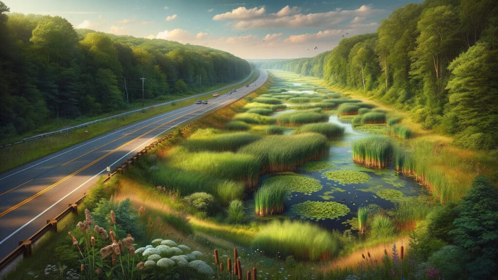
Image of a wetland alongside a Virginia roadway.

Wetlands along highways and properties, often mistaken for mere puddles or swamps, are significant natural resources that offer a myriad of environmental benefits, such as wildlife habitat and flood protection. These areas are assessed and categorized by professional wetland delineators, specialists who have undergone rigorous training and acquired years of experience to gain certification. However, recent legislative actions in Virginia have sparked concern regarding the potential dilution of these stringent certification standards. Virginia’s legislative body recently amended some requirements for professional wetland delineators, triggering concerns among current professionals about the potential degradation of certification quality. These professionals worry that the changes could undermine efforts to preserve these crucial natural environments, already at risk from various threats. Eli Wright, a notable environmental scientist, emphasized that the existing stringent requirements were essential to ensure high-quality, accurate delineations crucial for maintaining the integrity of wetland boundaries and for regulatory compliance.

Governor Glenn Youngkin has initiated these regulatory changes under Executive Order 19, aiming for a 25% reduction in state regulations. This broader initiative has affected various sectors, including cosmetology licensing and housing and community development standards. The administration argues that these reductions are part of a strategy to streamline regulations, claiming that a thorough economic analysis will precede any regulatory change to ensure the benefits outweigh the costs while maintaining essential public protections. However, these proposed changes have not been universally welcomed. Critics like Mary-Carson Stiff, head of the environmental non-profit Wetlands Watch, argue that reducing certification standards risks the quality of wetland delineations, potentially jeopardizing the environment and regulatory compliance. The legislative adjustments include reducing the required years of experience and educational prerequisites for delineators, a move opposed by many professionals who believe that extensive experience is crucial for accurate wetland identification and navigating the complex regulatory landscape.

Thaddeus J. Kraska, an environmental services director, noted that the variety of wetlands in Virginia, from coastal plains to mountainous terrains, presents unique challenges that require in-depth knowledge and experience to manage effectively. He highlighted that reducing educational and experience requirements could lead to poorer quality delineations, adversely affecting wetland conservation efforts and compliance with environmental regulations. In addition to professional concerns, the regulatory changes have practical implications for the development sector. Following a recent U.S. Supreme Court decision, Virginia’s Department of Environmental Quality has implemented a policy that prioritizes applications accompanied by delineations from certified professionals, emphasizing the importance of maintaining high standards in professional certification to expedite regulatory processes.

Despite some resistance, the Virginia Board of Professional Soil, Wetland Delineators, and Geologists is considering further regulatory reductions. These include modifying the requirements for references in certification applications, which some argue could weaken the mentorship and training aspects essential for high-quality professional development. The stakes are high, as wetlands are not only critical for environmental stability but also for regulatory and development processes. As the climate changes and sea levels rise, the accurate delineation of wetlands becomes increasingly vital. Wetlands are dynamic ecosystems, and their preservation is crucial not just for environmental health but also for reducing legal and financial risks associated with development. The ongoing regulatory changes in Virginia concerning professional wetland delineators are at the center of a significant debate. These changes could potentially lower the barriers to certification, risking the quality of wetland delineation, with far-reaching consequences for environmental protection, regulatory compliance, and development within the state.

Microplastics in the Environment

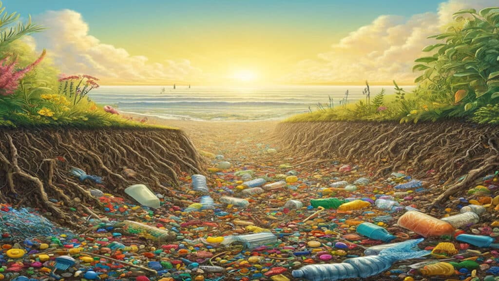
Microplastics, tiny fragments of plastic less than 5 millimeters (about 0.2 in) in size, have become a growing topic of conversation in recent years. Since 1950, about 8 million tons of plastic have been produced, but only about 10% of that has been reused and recycled. The rest of that plastic has found its way to landfills, the ocean, and roadsides, to name a few. Primary microplastics are plastic materials designed to be small in order to perform a specific function. Think about the exfoliating beads you see in face cleansers, or the grittiness you can sometimes feel in your toothpaste. Secondary microplastics come from the breakdown of larger plastic materials: water bottles and storage tubs are good examples. Through wear and tear, the effects of the sun, wind, and water, larger plastic items break down into tiny pieces. Most plastics that have been produced take thousands of years to fully decompose; so in the meantime, those tiny plastic pieces end up in the air we breathe, the water we drink, the food we eat, and the soil beneath our feet.

Most microplastic studies have focused on the ocean. How do microplastics affect marine life, and in turn, how would that consequence affect us? Research has shown that microplastics are often absorbed and ingested by sea creatures, and if they survive having the plastic inside of them, and do not become ill or die from the toxins that might have come along with the plastic pieces, then those toxins and fragments stay within the animal. When that animal is eaten, the plastic moves up a notch in the food chain; the amounts of microplastic present within a creature’s tissues increase the further up the food chain you go. Microplastics have been found in people, and studies have found microplastics in our food, honey, and sugar. They are everywhere, and a recent study published in the Science of the Total Environment journal in January of this year revealed that microplastics had been found in soil samples collected more than seven meters (23 feet) below the surface. The samples had originally been collected as part of an archaeological excavation in the 1980s, and, until now, the samples were thought to be from stratigraphic layers untouched by human activity.

The authors of the study caution that their research is in the early stages, but for archaeologists, this development might result in seismic changes to the field. Preserving prehistoric and historic resources in situ, that is, in their original state, as opposed to digging them up or moving them elsewhere saves time and resources. The idea is that being encased deep within the earth will preserve the resource for a long time, but this research presents the distressing notion that microplastics have been contaminating archaeological sites for decades. Why are microplastics a problem in soils? Not only are they ingested by soil-dwelling animals and absorbed by vegetation, but the presence of microplastics can alter the chemical and physical composition of the soils and sediments themselves. As a result, sites, features, artifacts, and remains buried underground may deteriorate more rapidly, and the chemicals released from the microplastics as they decay could potentially compromise radiocarbon dating and trace element analyses.

The researchers emphasize that soil is often not studied holistically as a complex ecosystem. Archaeology as a field tends to view soils and sediments solely as the casings surrounding the good stuff, and not as an entity that acts on and is acted upon by the artifacts and ecofacts humans leave behind. In order to fully understand how the presence of microplastics will affect preservation, more research must be performed on soil as an ecosystem, taking into account its physical, chemical, and biological components together. Soils are unique in that they can change from one kind to another, if the environmental factors change. Studies on microplastics in our oceans, our air, and our food are important, and should continue. The consequences of microplastics in our soils, while still relatively unknown, are consequences all the same. More attention should be focused on figuring out exactly what effect those consequences will have.

North Carolina’s Weird & Wonderful: Flying Squirrels

Artistic image of the Northern Flying Squirrel and the Southern Flying Squirrel in a forest

North Carolina is covered in squirrels. Everywhere you look, there is a good chance you will see the Eastern Gray Squirrel, Sciurus carolinensis, one of the most familiar mammals in our state. If you are in or around Brevard, North Carolina, you might see the white variant of the gray squirrel. These all-white or mostly all-white individuals are not albinos, but that does not stop the citizens of Brevard from celebrating White Squirrel Weekend every year. Approximately one-third of the gray squirrel population in their city consists of the white variant, and Brevard is a designated squirrel sanctuary. If you are in the far western tip of the state, the sandhills, or the southeastern coastal plain, you probably will not find white gray squirrels, but you will find Fox Squirrels, Sciurus niger, which are the largest tree squirrels in North America. In the mountains of our state, you may happen upon the Red Squirrel, Tamiasciurus hudsonicus, though there are reports of an isolated population of red squirrels in the Winston-Salem and Greensboro area. Those three species are the squirrels that people see every day, but there are two more species of squirrel in our state that many people never see: the Southern Flying Squirrel and the Northern Flying Squirrel.

Southern Flying Squirrel, Glaucomys volans. Photo courtesy of Riverwatch and the Tennessee Aquarium.

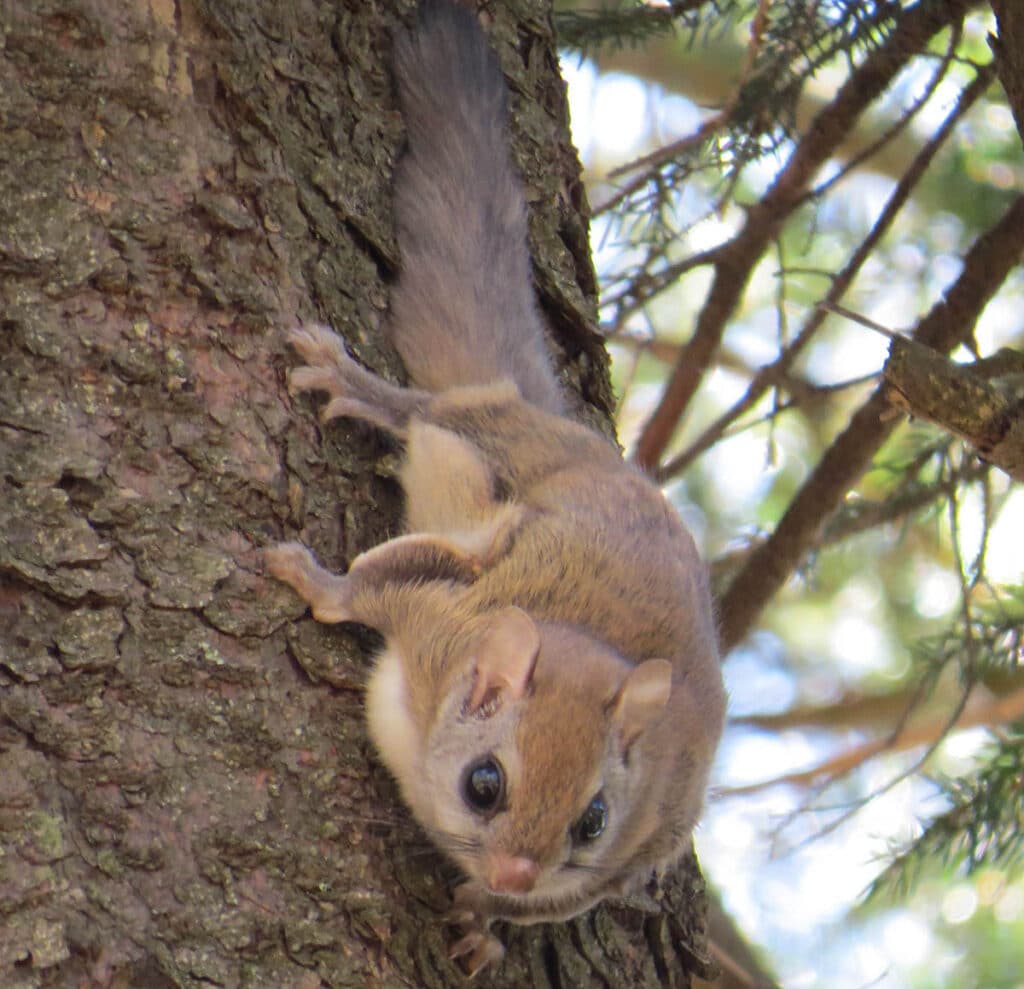
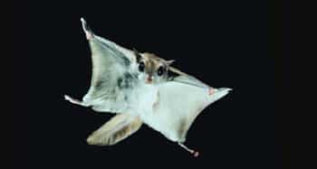
The Southern Flying Squirrel, Glaucomys volans, is the smallest squirrel in our state, weighing up to 100 grams (about 3.53 oz). They are found throughout the Carolinas, except on coastal barrier islands, but, as they are nocturnal, most people never see them. Southern Flying Squirrels do not actually fly like bats or birds: rather, they glide using membranes formed from loose, furred skin extending from their wrists to their ankles. When their arms and legs are fully outstretched, the membranes form a winglike apparatus that is great for gliding from tree to tree. How is that for weird and wonderful? Southern Flying Squirrels use their tails as rudders, and they glide from positions higher in a tree to points further down. They can run, hop, and leap like the other squirrel species, and the best time to see them is by the light of a full moon during a warm summer night. These animals nest in tree cavities, often competing for nesting sites with woodpecker species. This can be a problem for the red-cockaded woodpecker, an endangered bird within our state. Southern Flying Squirrels occupy the same natural spaces as gray and fox squirrels, and, due to their abundance and more aggressive behavior, may be outcompeting the Northern Flying Squirrel.

Carolina Northern Flying Squirrel, Glaucomys sabrinus coloratus. Photo courtesy of Clifton Avery and the NC Wildlife Resources Commission

Northern Flying Squirrels, Glaucomys sabrinus, are larger in size and more richly colored than the southern species. Northern Flying Squirrels tend to have darker brown colored fur on their backs and belly hairs that are gray at the base, not all-white like the belly hairs of the Southern Flying Squirrels. This species is far less common, occurring along the peaks of the Appalachian Mountains, in the Bald Knob area near Mount Mitchell, and in a few locales in the Great Smoky Mountains. In actuality, the Northern Flying Squirrels that we have in North Carolina are a very rare subspecies: Glaucomys sabrinus coloratus, the Carolina Northern Flying Squirrel. A federally listed endangered species, these animals also have a membrane of loose, furred skin that is used as a gliding mechanism. Due to their rarity, far less is known about the Carolina Northern Flying Squirrel, but their natural history appears to be quite similar to that of the Southern Flying Squirrel. They nest in tree cavities and consume many of the same foods, though they have a penchant for lichens and fungi, and do not rely on seeds as much as the southern species. Nocturnal, they are most active just after dusk and right before dawn.

Southern Flying Squirrel mid-glide. Photo courtesy of Dave Maslowski, NC Wildlife Resources Commission, and NCPedia.org

Witnessing a flying squirrel glide through a forest is a sight to behold, and we are fortunate in North Carolina to have two species. Habitat loss is the main threat to their survival, especially for the Carolina Northern Flying Squirrel. This is unfortunate, because without the flying squirrels, these wooded areas might not have ever existed in the first place. Through foraging for and caching away seeds, nuts, and fungi, flying squirrels end up spreading those species around. This becomes vital when tree growth and health is examined more closely. Tree roots form a symbiotic relationship with fungi, where the fungi get sugars from the tree, and the tree is able to better absorb nutrients in the soil with help from the fungi. Without the fungi, the trees would not grow and thrive, so without the aid of flying squirrels, our forests would look a lot different. Even if you never get to see one in the wild, these weird, wonderful, and quite frankly adorable squirrels are notable members of the ecosystem and will hopefully be frolicking and gliding in North Carolina well into the future.

North Carolina Wetlands at Risk

NC Wetlands at Risk

The following blog is a shorter version of the article Analysis: Millions of acres of NC wetlands can be developed due to SCOTUS, NC law by Adam Wagner, published in the Raleigh News & Observer on April 1, 2024. To read the full article, click here.

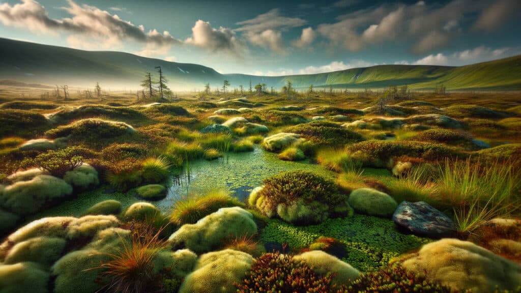
A large portion of North Carolina’s wetlands could lose protections due to the dual impact of a Supreme Court decision and a state law. When North Carolina lawmakers passed a provision in last year’s Farm Act that prevented development only in wetlands protected by the federal government, they couldn’t answer a key question: How many acres of wetlands here would lose protection? For North Carolina, the answers range from bad to worse, with the analysis determining that anywhere between 14% and 100% of the state’s non-coastal wetlands could be open to development. Those wetlands cover 490,000 to 3.6 million acres, many of them in the low-lying coastal plain. The wide range of risk in the analysis is due to ongoing litigation about what constitutes a federally protected wetland, said Adam Gold, an EDF manager for climate resilient coasts and wetlands in North Carolina and Virginia “The Supreme Court used really unclear language and this leaves the door wide open for potential interpretations.”

The timing of the North Carolina bill’s passage was just weeks after the U.S. Supreme Court’s 2023 Sackett V. EPA decision, a rollback of federal wetlands protections. The decision narrowed which wetlands the federal Clean Water Act protects to those continuously “adjoining” streams, oceans, rivers and lakes in the U.S. The N.C. Home Builders Association was a key force behind last year’s rule change in North Carolina, arguing that the change was introduced to prevent state environmental officials from regulating some isolated wetlands no longer protected by federal rules. North Carolina has other state and local rules that will protect many wetlands that could lose federal protections, Chris Millis, the Home Builders Association’s director of regulatory affairs, told The News & Observer. He pointed to riparian buffer rules, vegetated areas near streams; watershed protection overlays that limit development and require stormwater controls in areas that are important to drinking water supplies; and floodplain protections that curb development in flood-prone areas. Millis also pointed to a March 2024 memo from Assistant Secretary of the Army Michael Connor to the U.S. Army Corps of Engineers directing the agency to continue including wetlands that are no longer federally protected due to the Court’s decision in Corps mitigation projects. That means that even though a wetland might no longer be federally protected from development, the Corps could restrict development there. Citing reduced protections for some North Carolina wetlands, Gov. Roy Cooper vetoed the 2023 Farm Act, but legislators overrode Cooper’s veto.

Wetlands are a key point of regulatory conflict, with businesses and developers arguing that protections are applied too broadly, stymieing building projects that should move forward with ease. Environmental groups say wetlands are key to a clean environment because they filter pollutants out of water and protect against flooding. An acre of wetlands can hold between a million and 1.5 million gallons of water, according to the EPA. That’s particularly important in isolated wetlands found in the Piedmont or North Carolina mountains, Gold said. By retaining water, he said, those wetlands reduce the amount of floodwater flowing downstream, helping everyone in the stream or river basin below. “The wetlands that are most at risk after this decision are the ones that are most critical for flood storage because they are towards the headwaters of watersheds,” Gold said.

Another concern environmental lawyers have about the Farm Act is that it goes further to roll back protections than previous rollbacks, which were primarily focused on permitting the filling in of certain wetlands for development activity. Those wetlands are now no longer protected by state rules limiting the discharge of pollutants into water. With the new information in hand, environmental advocates hope to start making the case for additional wetlands protections when lawmakers return for the short session next month. David Kelly, EDF’s North Carolina president, wrote in an email that lawmakers either have to find a way to convince developers to avoid the losses of wetlands or significantly ramp up funding for wetlands conservation and restoration. “We believe it’s important that science helps inform the policy discussion on wetland conservation in North Carolina and beyond, with the consequences of the Sackett decision providing a clear example of the kind broad ambiguity and uncertainty that can result when policy making is not rooted firmly in science,” Kelly wrote. “We stand ready; if there are any areas of environmental concern that are affected, we’re open-minded and we’re not trying to develop in areas that are truly wetlands,” Millis said.

Exploring the Marvels and Challenges of Louisiana’s Coastal Restoration

The following blog post is a summary of the Saving the Wetlands article by Shenti Menon that appeared in the Environmental Defense Fund’s Volume 55, Number 1 Winter 2024 edition of Solutions magazine.

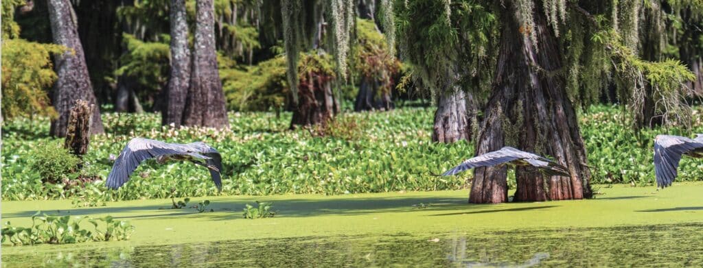
Photo courtesy of Getty Images

Louisiana’s coastline is a marvel, a dynamic landscape shaped by the mighty Mississippi River, but it’s also one of the fastest-disappearing places on Earth. Over the years, human interventions like levees and dams have disrupted the natural flow of sediment, causing the wetlands that act as a buffer against storms and floods to erode at an alarming rate. Since the 1930s, an area equivalent to the size of Delaware has vanished from Louisiana’s wetlands, leaving communities vulnerable to the increasing threats of climate change. Enter the ambitious project championed by the Environmental Defense Fund (EDF) and partners: the restoration of Louisiana’s coastal wetlands using the power of the Mississippi River itself. This groundbreaking endeavor, part of Louisiana’s $50 billion plan to bolster coastal resilience, seeks to counteract land loss by allowing the river to flow freely and replenish the disappearing wetlands.

The Mississippi River, flowing over 2,000 miles through the heart of America, carries with it rich sediment that has historically nourished Louisiana’s coastal ecosystems. However, human efforts to control the river’s course have disrupted this natural process, leading to the rapid disappearance of land. Levees and other structures built by the U.S. Army Corps of Engineers to manage navigation and flood protection have inadvertently starved the wetlands of sediment, exacerbating the effects of subsidence and sea-level rise.

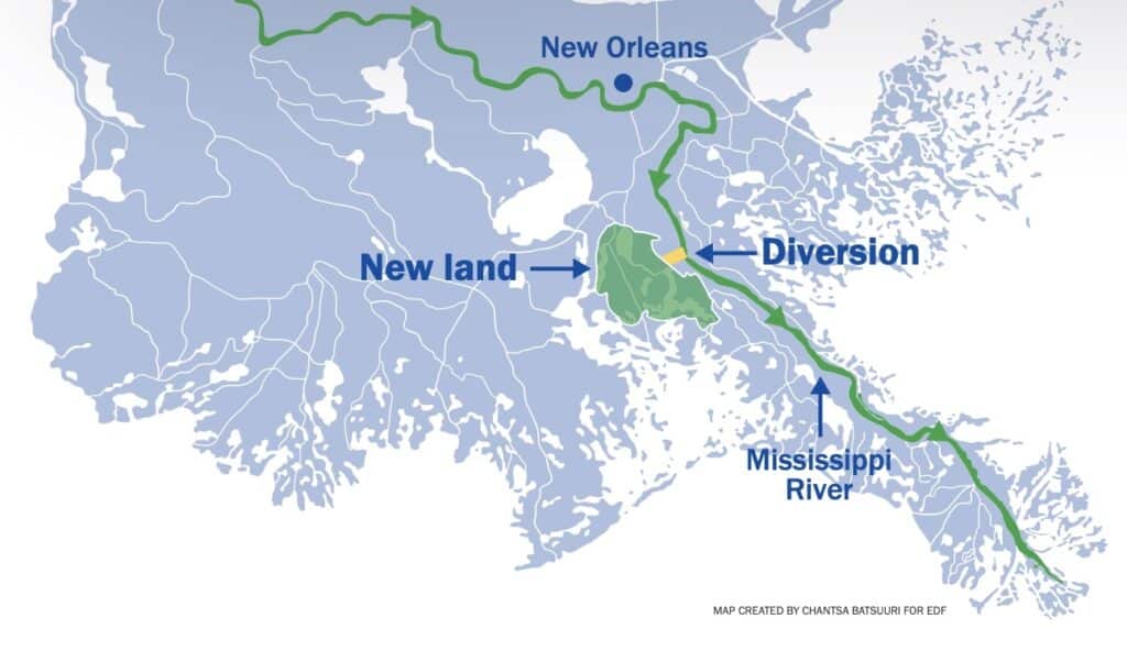
Represented in yellow, the Mid-Barataria sediment diversion will replenish the dying wetlands.

The Mid-Barataria Sediment Diversion project represents a paradigm shift in how we approach coastal restoration. Instead of fighting against the river’s natural processes, Louisiana is embracing them. Engineers will create a 2-mile-long channel to reconnect the river with the vanishing wetlands of Barataria Bay, allowing sediment-rich water to flow in and rebuild land. This approach mimics the natural diversions that occur when the Mississippi finds weak spots in its banks, carving new paths to the sea and depositing sediment along the way. Already, natural diversions like Neptune Pass in Plaquemines Parish have demonstrated the potential of sediment to create new land. Satellite images show muddy sediment flowing into coastal waters, where it accumulates and forms the foundation for new wetlands. With the Mid-Barataria Sediment Diversion, this process will be accelerated, restoring 20–40 square miles of wetlands over the next 50 years.

But the project isn’t without its challenges and controversies. Some stakeholders, particularly in the fishing industry, are concerned about the potential impact on their livelihoods. The diversion of freshwater into saltwater habitats could disrupt ecosystems and alter the distribution of fish and shellfish. However, proponents argue that the long-term benefits of coastal restoration far outweigh these concerns. By protecting and enhancing the natural environment, the project aims to safeguard not only vulnerable communities but also the rich biodiversity of Louisiana’s coast. Moreover, the project is not just about restoring land; it’s also about supporting the communities that rely on these ecosystems for their survival. Louisiana has allocated significant funds to mitigate the impact of the diversion on fisheries and other industries. Investments in new gear, oyster cultivation, and flood mitigation measures demonstrate a commitment to balancing environmental restoration with economic prosperity.

In addition to large-scale infrastructure projects, innovative initiatives are emerging to address the interconnected challenges of climate change and agriculture. Programs like the Regenerative Agriculture Financing Program, developed by EDF and Farmers Business Network, reward farmers for adopting climate-smart practices that reduce emissions and build soil health. By incentivizing sustainable farming methods, these programs not only mitigate climate change but also improve the resilience of agricultural systems. Louisiana’s coastal restoration efforts serve as a model for proactive adaptation to environmental challenges. By harnessing the power of nature and investing in community resilience, we can protect our precious coastal landscapes for generations to come. The challenges ahead are immense, but with collaboration and innovation, we can ensure a brighter future for Louisiana’s coast and its people.

#CoastalRestoration #MississippiRiver #Wetlands #Sustainability #Community Resilience #EnvironmentalStewardship #Innovation

Navigating New Waters: The U.S. Army Corps of Engineers’ Strategic Response to the Sackett Decision and the Future of Wetland Protections

wetland impacts

In the aftermath of the pivotal Supreme Court ruling in Sackett v. EPA, a seismic shift has occurred in the legal framework governing the protections of the United States’ waters and wetlands under the Clean Water Act (CWA). The U.S. Army Corps of Engineers, tasked with a significant portion of the Act’s implementation through its permitting program, has issued a detailed memorandum dated March 22, 2024, outlining a nuanced and multifaceted strategy to adapt to and mitigate the implications of this landmark decision.

The crux of the Sackett ruling lies in its narrow reinterpretation of the “Waters of the United States” (WOTUS), a critical term under the CWA that delineates the extent of federal jurisdiction over the nation’s aquatic resources. Historically, the scope of WOTUS has been subject to regulatory definitions since the 1970s, with the latest iteration promulgated on September 8, 2023. The Supreme Court’s decision, however, significantly contracted the ambit of federally protected wetlands, specifically those without a continuous surface connection to larger bodies of water, thereby excluding them from the protections afforded by the Act.

This memo from the Army Corps of Engineers charts a forward-looking course, underscoring the imperative to leverage existing legal authorities and resources to safeguard and enhance the resilience of these now more vulnerable aquatic ecosystems. It articulates a comprehensive strategy encompassing Civil Works Actions and Regulatory Program Actions, each with specific initiatives designed to address the challenges posed by the Sackett decision.

Civil Works Actions

The memo delineates several key actions within the Corps’ Civil Works mission to bolster aquatic ecosystem restoration, technical assistance, and the integration of nature-based solutions. These efforts are premised on a nuanced understanding of the ecosystem services rendered by waters and wetlands, emphasizing their critical role in flood mitigation, water quality enhancement, and habitat provision.

  1. Aquatic Ecosystem Restoration: The directive prioritizes projects that restore hydrologic connectivity and improve the physical and biological integrity of ecosystems impacted by the Sackett decision. This includes an emphasis on Section 206 of the Continuing Authorities Program (CAP), highlighting the strategic allocation of resources towards projects that align with the watershed-based needs elucidated by the ruling.
  2. Technical Assistance Programs: Recognizing the pivotal role of state, local, and tribal entities in aquatic resource management, the memo underscores the Corps’ commitment to providing expert guidance and planning assistance. This is particularly relevant for entities navigating the altered regulatory landscape post-Sackett, with a focus on fostering resilience in ecosystems stripped of federal protection under the narrowed WOTUS definition.
  3. Nature-Based Solutions: The memo advocates for the broader adoption of nature-based solutions in Civil Works projects, aligning with ongoing research and development initiatives. This approach is posited as a means to enhance project sustainability and ecological benefits, especially in light of the reduced jurisdictional scope for wetland protections.

Regulatory Program Actions

In addressing the regulatory implications of the Sackett decision, the memo places a strong emphasis on transparency and compensatory mitigation:

  1. Approved Jurisdictional Determinations: It mandates the continuation of transparent processes in issuing jurisdictional determinations, vital for providing stakeholders with clarity on the jurisdictional status of aquatic resources post-Sackett. This transparency is instrumental in enabling informed decision-making and strategic planning by affected parties.
  2. Compensatory Mitigation: Crucially, the memo reiterates that the jurisdictional status of waters and wetlands, as delineated by the WOTUS definition, does not preclude their eligibility for serving as compensatory mitigation under Corps permits. This policy stance is particularly significant, underscoring the Corps’ commitment to a functional and ecological assessment of aquatic resources for mitigation purposes, beyond the binary jurisdictional categorizations constrained by the Sackett ruling.

The memorandum issued by the U.S. Army Corps of Engineers post-Sackett decision is a testament to the agency’s commitment to navigating the complex interplay between environmental protection and legal mandates. Through a meticulous articulation of strategic actions, the Corps aims to fortify the resilience and ecological integrity of the nation’s waters and wetlands, navigating the nuanced legal terrain sculpted by the Supreme Court’s decision. This document not only outlines a path forward in the wake of reduced federal oversight but also reinforces the enduring value of aquatic ecosystems to the nation’s environmental, economic, and social well-being.

Balancing Growth and Green: The Urgent Need for Sustainable Development Amidst Wetland Decline

In a groundbreaking new report by the U.S. Fish and Wildlife Service (USFWS), the alarming trend of wetland decline across the United States has been meticulously documented, shedding light on an environmental crisis that has far-reaching implications not only for biodiversity but for human well-being as well. This comprehensive analysis reveals a worrying acceleration in the loss of these critical habitats, underscoring the urgent need for concerted conservation efforts. Wetlands serve as the lifeblood of our planet’s ecological framework. They are not merely waterlogged spaces but vibrant ecosystems that play a pivotal role in water purification, flood control, carbon sequestration, and as biodiversity hotspots. Despite their undeniable importance, wetlands have been vanishing at an alarming rate due to urban expansion, agriculture, climate change, and pollution.

The USFWS report highlights several key factors contributing to the decline. Among them, urban development stands out as a significant culprit. As cities expand, the conversion of land for housing, infrastructure, and commerce often comes at the expense of wetland areas. Additionally, agricultural practices, including the drainage of wetlands for crop production, have led to substantial losses. The impacts of climate change, such as rising sea levels and increased frequency of extreme weather events, exacerbate the situation, further threatening these fragile ecosystems.

The consequences of wetland degradation are profound and far-reaching. Wetlands are among the most productive environments on earth, providing essential services that benefit humanity and the natural world. They act as natural water filters, removing pollutants and sediment from waterways, and they are crucial for water storage, helping to mitigate the impacts of floods and droughts. Moreover, wetlands are vital for carbon storage, playing a significant role in the fight against climate change. Biodiversity loss is another grave consequence of wetland decline. These ecosystems are home to a rich variety of species, many of which are specially adapted to the unique conditions wetlands provide. As wetlands disappear, so too do the species that rely on them, leading to reduced biodiversity and the loss of species critical to ecosystem health.

The USFWS report serves as a clarion call to action, emphasizing the need for robust conservation strategies to halt and reverse the decline of wetlands. Protecting what remains is paramount, and this requires a multi-faceted approach involving government, communities, and individual action. Policy measures such as stronger environmental regulations, incentives for wetland conservation, and the implementation of sustainable land-use practices are critical steps in the right direction. Restoration efforts also play a key role in the recovery of wetland ecosystems. Projects that focus on re-establishing wetland hydrology, replanting native vegetation, and removing invasive species can help restore these areas’ ecological functions and biodiversity. Such efforts, however, require significant investment, expertise, and community involvement to be successful.

Public awareness and education are essential components of wetland conservation. Many people are unaware of the critical role wetlands play in our environment and everyday lives. Increasing public understanding of these ecosystems’ value and the threats they face can foster greater support for conservation initiatives. The USFWS report is a stark reminder of the challenges wetlands face, but it also presents an opportunity to galvanize action. By documenting the continued decline of these vital ecosystems, the report provides a scientific basis for the urgent need for conservation. It is a call to all stakeholders—governments, conservation organizations, communities, and individuals—to come together in a concerted effort to protect and restore wetlands.

The decline of wetlands is a pressing environmental issue with significant implications for biodiversity, climate change mitigation, and human well-being. The latest USFWS report sheds light on this critical issue, providing valuable data that can inform and inspire action. Through a combination of policy measures, restoration projects, and public engagement, it is possible to halt the loss of wetlands and ensure these invaluable ecosystems continue to thrive for generations to come. The time to act is now; the future of our planet’s wetlands—and all the life they support—hangs in the balance.

#WetlandConservation #SustainableDevelopment #EnvironmentalAwareness #HabitatProtection #ClimateAction #Biodiversity #EcoFriendlyLiving #GreenInfrastructure #ConservationEfforts #ProtectOurWetlands

North Carolina’s Weird & Wonderful: Carnivorous Plants

North Carolina is home to many unique species, including 36 species of carnivorous plants. These plants consume small, unsuspecting invertebrates that fall into their traps. Now, you might be wondering, why do these plants eat meat? Don’t they get their food from sunlight through photosynthesis? Well, yes, these plants do photosynthesize, and are able to produce sugars from that process. However, these species live in wet areas with nutrient-deficient soils, thus they have adaptations that allow them to get nutrients from insects, arachnids, and aquatic prey items. There are five groups of carnivorous plants in North Carolina: butterworts, sundews, bladderworts, pitcher plants, and, of course, the Venus flytrap.

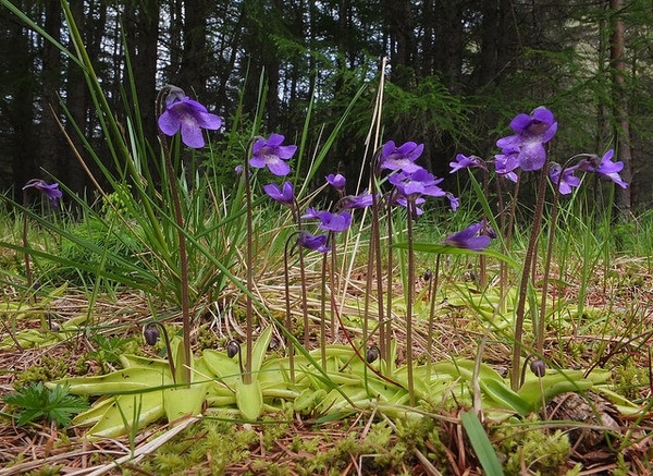
Common Butterwort, Pinguicula vulgaris, photo courtesy of Stuart Anthony and the North Carolina Extension Gardener Plant Toolbox

Butterwort species are in the genus Pinguicula, and these plants, found throughout the southeastern United States in very sunny, wet locations, have small leaves with sticky hairs. Often appearing greasy in texture, the leaves form the trap, and insects get stuck in the residue. The struggling of the insect triggers the butterwort to release more of the sticky fluid; once the residue has fully encased the food item, special cells in the leaves will begin releasing digestive enzymes. Believe it or not, this process gets even cooler! Butterworts also release a strong chemical that kills bacteria. This prevents the dead insect from rotting while it is slowly being digested.

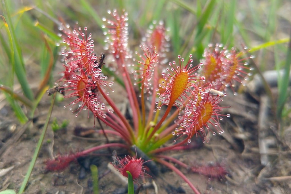
A sundew species, photo courtesy of Phil Champion and the North Carolina Extension Gardener Plant Toolbox

Sundews, which are in the genus Drosera, are one of the largest groups of carnivorous plants. In addition to species native to North Carolina, there are sundews found all over the world, found in bogs, fens, and marshes ranging from tropical climates to colder climates. Sundews are similar to butterworts in that their leaves, which are pad-like, are covered in sticky hairs. More struggling results in the fluid stickiness increasing; but instead of fully encasing the insect in a residue, the leaf pads will slowly curl up around the insect before digestion begins. Due to their small size, sundews’ prey items are very tiny, often small gnats and ants.

Swollen Bladderwort, Utricularia inflata, photo courtesy of Robby Deans and the North Carolina Extension Gardener Plant Toolbox

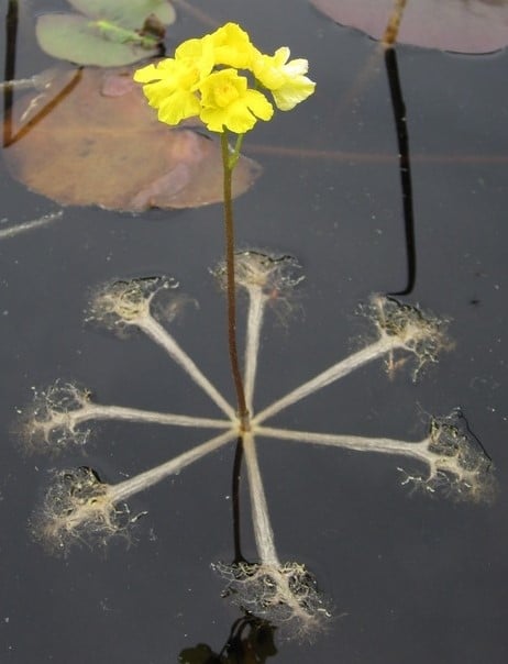
The genus Utricularia contains the bladderworts, and it is the largest genus of carnivorous plants. Aquatic species of bladderworts grow fully submerged, except for the stem and blossom, and they may float freely in the water or attach themselves to a surface. Other bladderwort species that are more tropical are epiphytic, and still other species grow in very wet soil. The bladderworts are unlike any other carnivorous plant in that they have a unique bladder system. These bladders have a trap door covered in tiny hairs. When a prey item touches the hairs, it triggers the trap door to open in a millisecond and the bladder sucks in the prey, closing in about 2.5 milliseconds! So, in about 3.5 milliseconds, the bladderwort has caught its food. How weird and wonderful is that?

Purple Pitcher Plant, Sarracenia purpurea, photo courtesy of David Midgley and the North Carolina Extension Gardener Plant Toolbox

Now pitcher plants, in the genus Sarracenia, are probably some of the more recognizable carnivorous plants in the world. In North Carolina we have the purpurea species, so named because of the color of the flowers and the pitchers themselves. This species is often found in marshes and bogs but is also right at home in wet forest floors and pinelands. The purple pitcher plant’s leaves form pitchers that are open to the sky and collect rainwater. Insects are attracted to little droplets of nectar that are produced along the rim of the pitcher, and as they crawl inward, they encounter tiny hairs that point downwards. This results in a surface that is very easy to climb down, but impossible to climb up! Eventually the insects fall into the pool of water, which also contains digestive enzymes that the plant has produced. What is really cool about the purple pitcher plant is that it is pollinated by a member if the pitcher plant fly genus, Fletcherimyia. The larvae of these flies live in the fluid inside of the pitchers, feeding on some of the insects that have gotten trapped!

The Venus Flytrap, Dionaea muscipula, photo courtesy of Lucy Bradley and the North Carolina Extension Gardener Plant Toolbox

There is only one more carnivorous plant to discuss: North Carolina’s official state carnivorous plant, the Venus flytrap. Venus flytraps, Dionaea muscipula, are mainly found in southeastern North Carolina, though some small populations have been found in northeastern South Carolina. This plant has specialized, folded leaves covered in large and small hairs. When an insect touches those hairs, it triggers the two halves of the leaf to close around the insect, trapping it. Like the butterwort, special cells on the leaves release digestive enzymes, and in about two weeks, the leaf will reopen and be ready to catch another insect. We North Carolinians love Venus flytraps so much that, not only has it been declared the state carnivorous plant, but there is also a house bill to authorize the Venus Flytrap Specialty License Plate! If House Bill 734 passes, some of the proceeds from each license plate renewal will go towards the Friends of Plant Conservation and the North Carolina Botanical Garden Foundation, which will use the money to fund plant conservation education and research.

The Venus flytrap, and many of the other carnivorous plant species, are endangered. Habitat destruction and overharvesting are the two major threats facing these plants today. These species require specific habitat conditions in which to grow and thrive, and if even one of those conditions is thrown off, the plants will start to decline. Gardening and houseplant fever unfortunately results in wild plants of all kinds, not just carnivorous ones, being poached in order to meet the demand. If you have to have a carnivorous plant, purchase one from a reputable nursery. There are many other amazing plants that share the same habitat needs as the meat-eaters, so consider creating a small bog or marsh garden in your backyard. In North Carolina, nurseries such as Carolina Habitats and Plant Delights can be excellent resources for learning how to recreate plant communities in a garden setting. State cooperative extension offices and their Master Gardeners programs would be a good resource for region-specific knowledge. Finally, if you want to see carnivorous plants in action, plan a trip to Carolina Beach State Park, south of Wilmington, North Carolina. These weird and wonderful plants are sure to make a lasting impression.

Special thanks to the North Carolina Extension Gardener Plant Toolbox and all of their amazing photographers for the photographs in this blog and for being a source of great information on the many carnivorous plant species in the state. https://plants.ces.ncsu.edu/

Benthic Macroinvertebrates and the EPT Index

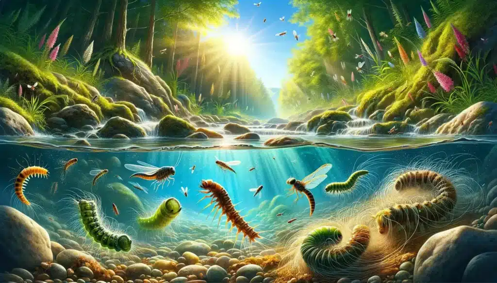
Benthic macroinvertebrates (BMI; no, not body mass index) are aquatic animals without backbones that are large enough to see without a microscope. They include worms, crustaceans, and immature forms of aquatic insects such as mayfly and stonefly nymphs and caddisfly larvae. BMI can be important indicators of water quality. Unlike fish, these organisms are not very mobile and are therefore less able to escape the effects of pollution and sedimentation. Many species of mayfly nymphs, stonefly nymphs, and caddisfly larvae are not very tolerant of pollution and can only survive in swift, cool, well-oxygenated water. Their presence is generally interpreted as a sign of good water quality.

One important index often used for water quality rating of perennial streams is the EPT index. This acronym stands for Ephemeroptera, Plecoptera, and Trichoptera, insect taxonomic orders for mayflies, stoneflies, and caddisflies, respectively. The abundance and richness of EPTs are very useful in determining water quality classification.

The mayfly order, Ephemeroptera, is Greek for “short-lived winged” referring to the short-lived adult lifespan, usually less than 24 hours for some species. The nymphs are characterized by having well-developed abdominal plate-like gill filaments and usually 3 but sometimes 2 well-developed caudal filaments (cerci). The representative “E” featured in this post below is from the Baetiscidae family within the only genus, Baetisca. This genus is widespread east of the Rockies and somewhat pollution intolerant in the Southeastern United States. Up to 10 different species have been identified in the Southeastern U.S. These “armored” mayflies are sprawlers and clingers found in lotic-depositional habitat and feed by collecting or scraping live organic matter. Note the armored head and thoracic sections with spines that aid in burrowing and protection in depositional areas.

The stonefly order, Plecoptera, is Greek for “folded or pleated winged” referring to the adults’ wing arrangement. Stoneflies are the least pollution tolerant of the EPT group and are found in cold, fast-moving, highly oxygenated streams and rivers, usually in leaf packs or under stones, hence their namesake. While stonefly nymphs can be confused with mayfly nymphs, stonefly nymphs do not have the plate-like abdominal gills, only have 2 caudal filaments, and exhibit two tarsal claws versus one tarsal claw for mayflies. The representative “P” featured in this post below is from the Pteronarcyidae family (the giant or salmonfly stoneflies) in the genus Pteronarcys. These giant stoneflies are sprawlers and clingers found in both lotic-depositional and lotic-erosional habitats and feed mostly as shredders of living and decaying organic matter. They are also known to be a part of the scraper/grazer and engulfer/predator feeding guilds.

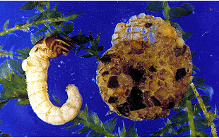
The caddisfly order, Trichoptera, is Greek for “hair wings” in reference to the hairs covering the wings of adults. Caddisflies inhabit a wide range of habitats such as streams, rivers, lakes and ponds. Many caddisfly larvae are known for their ability to make cases out of sand, pebbles, or plant matter using sticky homespun silk. Others are free-living or use miniature silken seine nets or tubes to help capture food. The representative “T” featured in this post below is from the family Helicopsychidae (snail casemakers) within the only genus, Helicopsyche. Historically these caddisflies were originally described as snails that were able to glue sand grains to cover and strengthen their whirls. Larvae of Helicopsyche are typically found in running water but also are found in littoral zone of lakes. They are scraper/grazers primarily feeding on diatoms and detritus.

The Ephemeroptera, Plecoptera, and Trichoptera (EPT) group is an extremely diverse group with which it is very fun to work. As becoming familiar with this group is very important if one wants to perform water quality assessment of streams, it is recommended that one take as many workshops as possible to further understanding of these benthic macroinvertebrates. Be on the lookout for additional posts on these creatures in the future.

Sources Used

Larvae of the North American Caddisfly Genera (Trichoptera), 2nd edition. Wiggins, Glenn B. 1996. University of Toronto Press, Toronto, Ontario, Canada.

Larvae of the Southeastern USA: Mayfly, Stonefly, and Caddisfly Species (Ephemeroptera, Plecoptera, and Trichoptera). Morse, John C., et. al. 2017. Clemson University Public Service Publishing, Clemson, South Carolina.

Macroinvertebrates.org

Nymphs of North American Stonefly Genera (Plecoptera), 2nd edition. Stewart, Kenneth W. and Bill P. Stark. 2002. The Caddis Press, Columbus, Ohio.