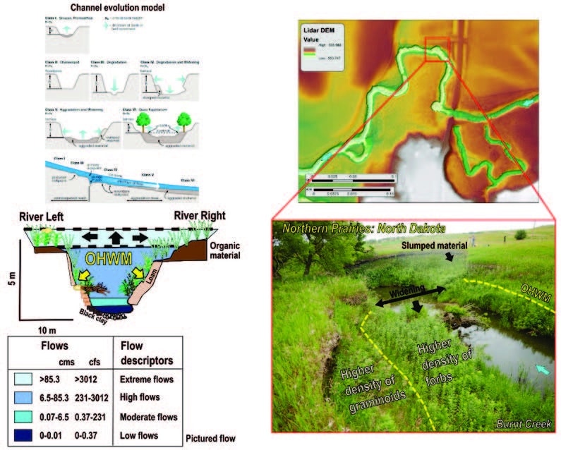
The U.S. EPA and the U.S. Army Corps of Engineers have issued an interim manual for delineation the National Ordinary High Watermark for rivers and streams. The ordinary high water mark (OHWM) defines the lateral extent of non-tidal aquatic features in the absence of adjacent wetlands in the United States. The Interim Draft of the National OHWM Manual provides draft technical guidance for identifying aquatic resources that may be subject to regulatory jurisdiction under Section 404 of the Clean Water Act (CWA) and/or Sections 9 and 10 of the Rivers and Harbors Act of 1899 (RHA), by providing a standard process, uniform datasheets, and unified field procedures to identify and delineate the OHWM of rivers and streams.
This is the first manual to present a methodology for nationwide identification and delineation of the OHWM. The manual provides a process for identifying the OHWM using stream characteristics observed in the field; it also provides information on how to use other lines of evidence to support field delineations. A data sheet and field procedure are included to guide users through the step-by-step process of identifying the OHWM. It also describes regional differences and challenges in identifying the OHWM at sites disturbed by human-induced or natural changes and illustrates how to use remote data to structure field inquiries and interpret field evidence using the principles of fluvial science. The manual demonstrates that, in many landscape settings, the OHWM may be located near the bankfull elevation.
The public and practitioners are encouraged to test and provide comments on their experience using the Interim Draft National OHWM Manual. Comments on the Interim Draft National OHWM Manual should be submitted by email to usace.ohwm@usace.army.mil. Written comments may also be provided by mail to Mr. Matt Wilson, U.S. Army Corps of Engineers, Attn: CECW-CO-R, 441 G Street NW, Washington, DC 20314-1000. The one-year comment period ends on December 1, 2023.
Links for the Manual and Data Forms:
INTERIM DRAFT RAPID ORDINARY HIGH WATER MARK (OHWM) FIELD IDENTIFICATION DATA SHEET (defense.gov)
Sources
U.S. Army Corps of Engineers & U.S. Environmental Protection Agency. (2022). Notice of Availability of the Interim Draft of the National Ordinary High Water Mark Field Delineation Manual for Rivers and Streams. https://usace.contentdm.oclc.org/utils/getfile/collection/p16021coll15/id/756
