The Chevron Overturn: A New Era for Environmental Law and Consulting

Chevron Blog

The recent decision by the U.S. Supreme Court to overturn the Chevron doctrine marks a significant shift in administrative law, with profound implications for environmental regulation. This landmark ruling will notably impact the workload of environmental consultants, who will find themselves at the forefront of navigating the new legal landscape.

Background on the Chevron Doctrine

The Chevron doctrine, established in the 1984 case Chevron U.S.A., Inc. v. Natural Resources Defense Council, Inc., has been a foundational principle in administrative law. It mandated that courts defer to federal agencies’ interpretations of ambiguous statutes within their regulatory domain, provided those interpretations were reasonable. This deference allowed agencies like the Environmental Protection Agency (EPA) considerable leeway in enforcing complex regulations such as those under the Clean Water Act, including the contentious Waters of the United States (WOTUS) rule​ (Home | Holland & Knight)​​ (Politico)​.

Increased Litigation and Regulatory Challenges

With the Chevron doctrine overturned, courts will no longer defer to agency interpretations of ambiguous statutes. Instead, they will exercise independent judgment. This shift is expected to trigger a wave of legal challenges against existing and new environmental regulations. Environmental consultants will play a crucial role in these legal battles, providing expert testimony, preparing detailed environmental impact assessments, and supporting legal teams in understanding and contesting regulatory interpretations​ (SCOTUSblog)​​ (Politico)​.

The legal uncertainty following the end of Chevron deference means that many regulations previously upheld under this doctrine are now open to re-evaluation. This scenario will likely lead to an increased demand for consultants to help navigate the evolving legal landscape and ensure compliance with regulatory requirements.

Need for Detailed Compliance Analysis

Without Chevron deference, the clarity on what constitutes compliance with environmental statutes will diminish. Companies and developers will require more comprehensive and rigorous analyses to ensure they meet the new standards set by independent judicial interpretations. Environmental consultants will need to conduct detailed investigations and provide robust documentation to demonstrate compliance with environmental laws, particularly those related to water quality and land use​ (Politico)​.

For instance, WOTUS regulations, which define the scope of waters protected under the Clean Water Act, could see significant reinterpretations. Environmental consultants will need to stay abreast of these changes and provide accurate assessments to help clients navigate compliance issues.

Policy Interpretation and Guidance

Environmental consultants will be essential in interpreting new court rulings and understanding their implications for existing regulations. The overturning of Chevron deference means that regulatory guidance from agencies may no longer carry the same weight, placing greater responsibility on consultants to interpret legal requirements and advise clients accordingly​ (SCOTUSblog)​.

This role will involve staying updated on the latest legal developments and providing clients with clear, actionable insights on how changes in the law affect their operations. Consultants will need to be adept at translating complex legal decisions into practical compliance strategies for their clients.

Updating Environmental Management Practices

Organizations will need to update their environmental management practices to align with the new legal landscape. This process involves revising standard operating procedures, training staff on new compliance requirements, and ensuring all practices meet the latest interpretations of environmental laws. Environmental consultants will be instrumental in guiding organizations through these updates, ensuring that all aspects of their operations are compliant with the new regulatory environment​ (Home | Holland & Knight)​​ (Politico)​.

The Supreme Court’s decision may lead to more stringent judicial scrutiny of agency regulations, requiring consultants to provide more detailed and scientifically robust analyses to support compliance efforts. This increased scrutiny will necessitate higher standards of environmental documentation and reporting.

Permitting and Project Delays

The process for obtaining environmental permits is likely to become more complex and time-consuming. Without the deference previously afforded under Chevron, agencies may face more challenges in implementing and defending their regulatory decisions. This complexity will extend to the permitting process, where more rigorous and detailed applications will be required. Environmental consultants will be essential in navigating these processes, ensuring that all necessary documentation and environmental impact analyses are thorough and meet the new legal standards​ (Home | Holland & Knight)​​ (Politico)​.

In summary, the Supreme Court’s decision to overturn the Chevron doctrine represents a significant shift in administrative law that will substantially increase the workload for environmental consultants. They will be required to provide more detailed compliance analysis, interpret new legal standards, update environmental management practices, and navigate a more complex permitting process. As the legal landscape evolves, the expertise and guidance of environmental consultants will be more critical than ever in ensuring that organizations remain compliant with environmental regulations.

Unveiling WOTUS: How NOHWM and SDAM Define Our Nation’s Waterways

Stream Site

Establishing Jurisdictional Waters of the United States (WOTUS) Using the US Army Corps of Engineers National Ordinary High Water Mark Manual (NOHWM) and Stream Duration Assessment Method (SDAM)

For environmental scientists, the determination of whether a wetland or waterway qualifies as a jurisdictional Water of the United States (WOTUS) is not just a regulatory necessity but a vital step in preserving our nation’s aquatic ecosystems. At the heart of this process are two pivotal tools provided by the US Army Corps of Engineers (USACE): the National Ordinary High Water Mark (NOHWM) Manual and the Stream Duration Assessment Method (SDAM). Together, these methodologies offer a comprehensive, scientific approach to delineating WOTUS, ensuring that critical water resources are effectively protected.

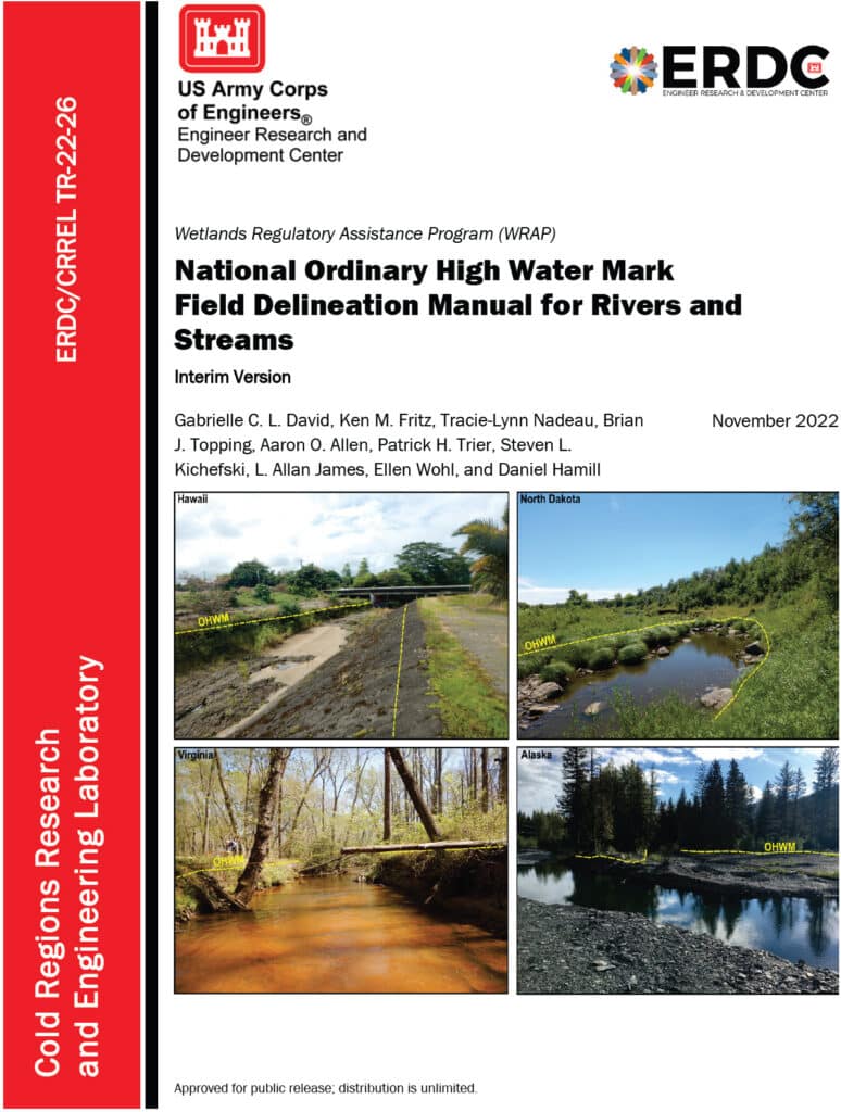
An image of the cover of the National Ordinary High Water Mark Field Delineation Manual for Rivers and Streams.

Diving into the National Ordinary High Water Mark (NOHWM) Manual

The National Ordinary High Water Mark (NOHWM) Manual serves as a detailed guide for environmental professionals to accurately identify the Ordinary High Water Mark (OHWM) in various landscapes. The OHWM represents the boundary between jurisdictional waters and upland areas, making it a crucial concept for environmental assessments.

Key Components of NOHWM:

  1. Physical Characteristics: The manual outlines physical indicators that signify the presence of an OHWM. These include:
  • Clear Natural Line: Look for a visible line on the bank formed by the regular presence of water.
  • Soil Changes: Notice differences in soil color, texture, or composition that indicate historical water presence.
  • Vegetation Patterns: Identify areas where terrestrial vegetation is absent or altered due to frequent inundation.
  • Litter and Debris: Examine the accumulation of organic and inorganic materials deposited by water flow.
  1. Regional Adaptations: The NOHWM Manual acknowledges the diversity of the US landscape, providing region-specific guidelines to account for varying hydrological and geomorphological conditions.
  2. Field Procedures: The manual details systematic field procedures, ensuring consistency and accuracy across assessments. This includes standardized data collection techniques, field forms, and documentation practices.

The Weight of Evidence Approach in NOHWM

A critical concept in the NOHWM approach is the “weight of evidence” (WOE) methodology. This approach ensures that multiple lines of evidence are considered when determining the OHWM, providing a more robust and defensible delineation.

Weight of Evidence Approach:

  1. Multiple Indicators: Instead of relying on a single indicator, the WOE approach integrates various physical, hydrological, and biological indicators. This multi-faceted analysis helps in cross-verifying the presence and extent of OHWM.
  2. Corroborative Evidence: Indicators such as changes in soil, vegetation patterns, and physical markings on the bank are examined together. Consistency among these indicators strengthens the determination of OHWM.
  3. Contextual Analysis: The WOE approach considers the broader landscape and hydrological context, including historical data and regional characteristics, ensuring that the delineation is not only accurate but also contextually relevant.
  4. Documentation and Transparency: Detailed documentation of all evidence and indicators used in the assessment is crucial. This transparency enhances the defensibility of the OHWM determination.
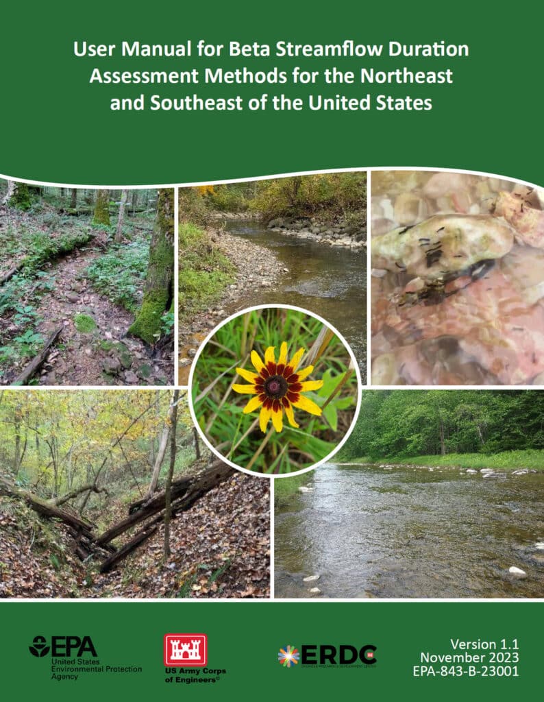
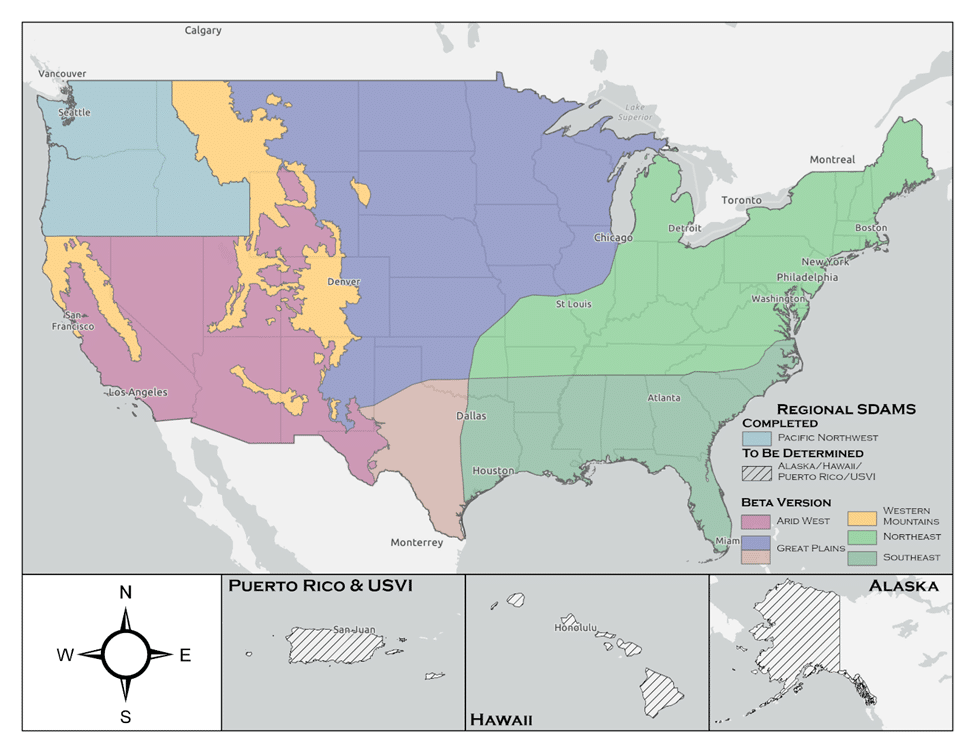
An image of the cover of the User Manual for Beta Streamflow Duration Assessment Methods for the Northeast and Southeast of the United States

Stream Duration Assessment Method (SDAM): A Closer Look

For scientists engaged in stream assessments, the Stream Duration Assessment Method (SDAM) is a game-changer. It allows for precise classification of streams based on their flow duration, which is essential for determining their jurisdictional status.

Stream Classifications:

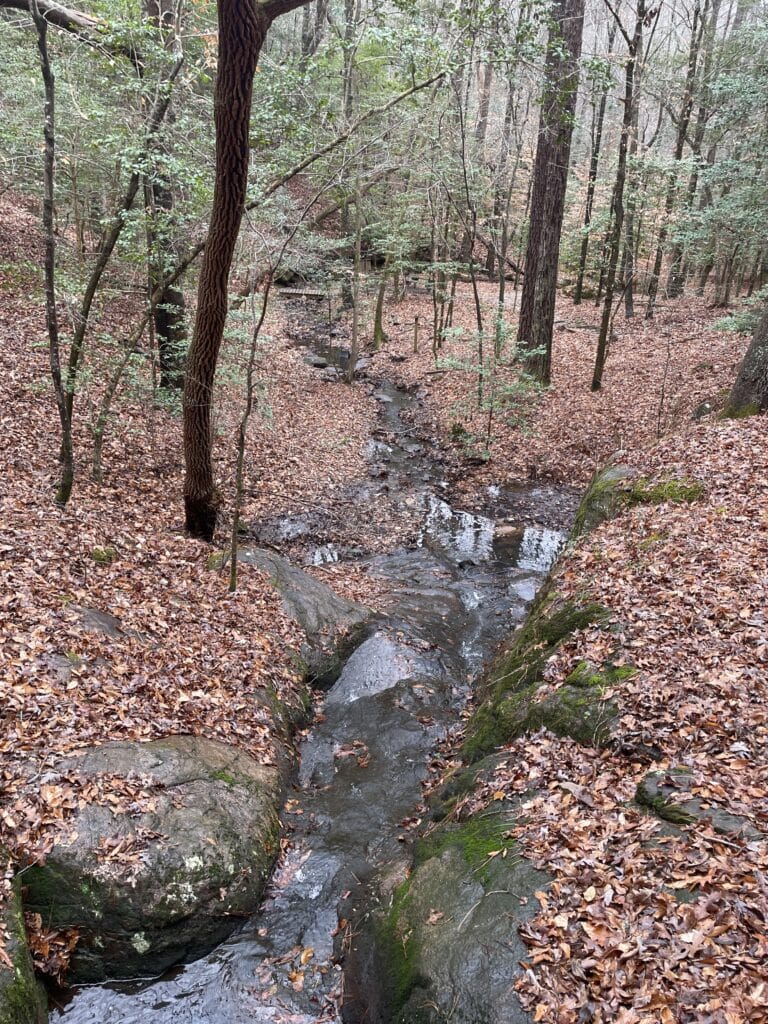
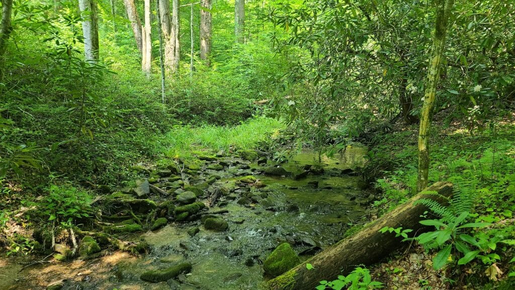
  1. Ephemeral Streams: These streams flow only during and immediately after precipitation events. As a scientist, identifying ephemeral streams involves recognizing temporary water flow patterns and minimal biological activity.
  2. Intermittent Streams: These streams flow during certain times of the year, such as the wet season, but not continuously. Intermittent streams show clear signs of seasonal aquatic life and sediment patterns.
  3. Perennial Streams: Perennial streams flow year-round and are typically considered jurisdictional. These streams support continuous aquatic habitats and show persistent hydrological and biological indicators.

SDAM Assessment Process:

  1. Field Observations: Conduct site visits to observe physical characteristics like bed and bank features, sediment deposits, and biological indicators such as the presence of aquatic organisms and specific plant species.
  2. Hydrological Data Review: Examine historical flow records, precipitation data, and stream gauge information to understand the stream’s flow regime over time.
  3. Biological Indicators: Identify the presence of certain aquatic organisms and plant species that thrive in continuous or seasonal water flow, offering insights into the stream’s duration and consistency.

Integrating NOHWM and SDAM for WOTUS Determinations

The integration of the NOHWM and SDAM methodologies provides a robust framework for determining whether a water body qualifies as WOTUS. For environmental scientists, this integration involves a meticulous blend of physical, hydrological, and biological assessments.

Determination Process:

  1. Preliminary Assessment: Begin with a thorough desktop review, using maps, aerial photos, and existing hydrological data to identify potential jurisdictional waters.
  2. Field Verification: Conduct on-site inspections to validate preliminary findings. Observe physical indicators of OHWM and perform SDAM assessments to classify stream types accurately.
  3. Data Integration: Combine field observations with historical and current hydrological data. This comprehensive dataset aids in making well-informed determinations of a water body’s jurisdictional status.
  4. Documentation and Reporting: Prepare detailed reports that document findings, methodologies, and justifications for the jurisdictional status. These reports provide transparency and serve as a basis for regulatory decisions.

The Environmental Significance of NOHWM and SDAM

For environmental scientists, the accurate identification of jurisdictional waters is paramount. Here’s why:

  1. Protecting Ecosystems: Correctly delineating WOTUS ensures the preservation of vital aquatic ecosystems, protecting them from pollution and degradation.
  2. Ensuring Compliance: Clear identification helps landowners, developers, and other stakeholders understand their obligations under the Clean Water Act, preventing unauthorized activities that could harm protected waters.
  3. Resource Management: Informed decision-making for water resource management, conservation planning, and habitat restoration efforts becomes possible, benefiting both the environment and the communities that rely on these resources.

Conclusion

The National Ordinary High Water Mark Manual (NOHWM) and the Stream Duration Assessment Method (SDAM) are indispensable tools for environmental scientists working to delineate jurisdictional Waters of the United States (WOTUS). By applying these methodologies, the US Army Corps of Engineers ensures that water bodies deserving of protection under the Clean Water Act are accurately identified and managed. For environmental professionals, mastering these methods is not just about regulatory compliance—it’s about playing a critical role in safeguarding the health and integrity of our nation’s precious water resources. Through diligent application of NOHWM and SDAM, we can continue to protect and sustain our aquatic ecosystems for future generations.

Understanding the 2023 Revised WOTUS Rule: Aligning Federal Water Regulations with Supreme Court Guidance

A beautifully illustrated waterway

The revised rule defining “Waters of the United States” (WOTUS) under the Clean Water Act was significantly influenced by the Supreme Court’s decision in the case of Sackett v. EPA. This 2023 amendment refines the scope of waters that are federally regulated, emphasizing the necessity for them to have more permanent, physical connections to traditional navigable waters.

Key Elements of the Revised WOTUS Rule:

  1. Narrowed Definition: The new rule focuses on waters that are:
    • Traditionally navigable waters, including oceans and large rivers.
    • Perennial and intermittent tributaries that contribute flow to traditional navigable waters.
    • Certain lakes, ponds, and impoundments of jurisdictional waters.
    • Wetlands adjacent to other jurisdictional waters that meet specific criteria for a direct hydrological surface connection.
  2. Exclusions: The rule specifically excludes:
    • Features that only contain water in response to rainfall.
    • Groundwater.
    • Many ditches, including most roadside and farm ditches.
    • Prior converted cropland.
    • Waste treatment systems.
  3. Implementation Status: As mentioned, the implementation of this rule is currently mixed due to ongoing litigation:
    • In 23 states, plus the District of Columbia and U.S. Territories, the 2023 rule is in effect.
    • In 27 other states, authorities continue to use the pre-2015 regulatory definitions pending further court decisions.
  4. Legal and Regulatory Framework: The rule is designed to align with the Supreme Court’s narrower interpretation which limits federal jurisdiction to those waters with a significant nexus to navigable waters.
  5. Impact on Regulatory Practices: This revision affects how businesses and landowners manage their land and water resources, particularly concerning permits for development and land use changes.

The practical application of these changes means that permit requirements may vary significantly depending on the state and the nature of the water bodies involved. This complexity underscores the need for ongoing legal guidance and compliance strategies for those affected by these regulations.

For complete details on the regulatory definitions and implications, you can view the official documentation and additional resources provided by the EPA on their WOTUS Rule Information Page.

Navigating New Waters: The U.S. Army Corps of Engineers’ Strategic Response to the Sackett Decision and the Future of Wetland Protections

wetland impacts

In the aftermath of the pivotal Supreme Court ruling in Sackett v. EPA, a seismic shift has occurred in the legal framework governing the protections of the United States’ waters and wetlands under the Clean Water Act (CWA). The U.S. Army Corps of Engineers, tasked with a significant portion of the Act’s implementation through its permitting program, has issued a detailed memorandum dated March 22, 2024, outlining a nuanced and multifaceted strategy to adapt to and mitigate the implications of this landmark decision.

The crux of the Sackett ruling lies in its narrow reinterpretation of the “Waters of the United States” (WOTUS), a critical term under the CWA that delineates the extent of federal jurisdiction over the nation’s aquatic resources. Historically, the scope of WOTUS has been subject to regulatory definitions since the 1970s, with the latest iteration promulgated on September 8, 2023. The Supreme Court’s decision, however, significantly contracted the ambit of federally protected wetlands, specifically those without a continuous surface connection to larger bodies of water, thereby excluding them from the protections afforded by the Act.

This memo from the Army Corps of Engineers charts a forward-looking course, underscoring the imperative to leverage existing legal authorities and resources to safeguard and enhance the resilience of these now more vulnerable aquatic ecosystems. It articulates a comprehensive strategy encompassing Civil Works Actions and Regulatory Program Actions, each with specific initiatives designed to address the challenges posed by the Sackett decision.

Civil Works Actions

The memo delineates several key actions within the Corps’ Civil Works mission to bolster aquatic ecosystem restoration, technical assistance, and the integration of nature-based solutions. These efforts are premised on a nuanced understanding of the ecosystem services rendered by waters and wetlands, emphasizing their critical role in flood mitigation, water quality enhancement, and habitat provision.

  1. Aquatic Ecosystem Restoration: The directive prioritizes projects that restore hydrologic connectivity and improve the physical and biological integrity of ecosystems impacted by the Sackett decision. This includes an emphasis on Section 206 of the Continuing Authorities Program (CAP), highlighting the strategic allocation of resources towards projects that align with the watershed-based needs elucidated by the ruling.
  2. Technical Assistance Programs: Recognizing the pivotal role of state, local, and tribal entities in aquatic resource management, the memo underscores the Corps’ commitment to providing expert guidance and planning assistance. This is particularly relevant for entities navigating the altered regulatory landscape post-Sackett, with a focus on fostering resilience in ecosystems stripped of federal protection under the narrowed WOTUS definition.
  3. Nature-Based Solutions: The memo advocates for the broader adoption of nature-based solutions in Civil Works projects, aligning with ongoing research and development initiatives. This approach is posited as a means to enhance project sustainability and ecological benefits, especially in light of the reduced jurisdictional scope for wetland protections.

Regulatory Program Actions

In addressing the regulatory implications of the Sackett decision, the memo places a strong emphasis on transparency and compensatory mitigation:

  1. Approved Jurisdictional Determinations: It mandates the continuation of transparent processes in issuing jurisdictional determinations, vital for providing stakeholders with clarity on the jurisdictional status of aquatic resources post-Sackett. This transparency is instrumental in enabling informed decision-making and strategic planning by affected parties.
  2. Compensatory Mitigation: Crucially, the memo reiterates that the jurisdictional status of waters and wetlands, as delineated by the WOTUS definition, does not preclude their eligibility for serving as compensatory mitigation under Corps permits. This policy stance is particularly significant, underscoring the Corps’ commitment to a functional and ecological assessment of aquatic resources for mitigation purposes, beyond the binary jurisdictional categorizations constrained by the Sackett ruling.

The memorandum issued by the U.S. Army Corps of Engineers post-Sackett decision is a testament to the agency’s commitment to navigating the complex interplay between environmental protection and legal mandates. Through a meticulous articulation of strategic actions, the Corps aims to fortify the resilience and ecological integrity of the nation’s waters and wetlands, navigating the nuanced legal terrain sculpted by the Supreme Court’s decision. This document not only outlines a path forward in the wake of reduced federal oversight but also reinforces the enduring value of aquatic ecosystems to the nation’s environmental, economic, and social well-being.

Enhancing Nationwide Wetland Permitting: Integrating the Stream Duration Assessment Model (SDAM) with State-Specific Approaches Across the U.S

The U.S. Army Corps of Engineers (USACE) has developed the Stream Duration Assessment Model (SDAM), a groundbreaking tool that significantly enhances the regulatory oversight and protection of the nation’s water resources. This model plays a critical role in managing and safeguarding streams and wetlands, crucial for maintaining biodiversity, water quality, and flood mitigation. The SDAM is designed to classify streams based on their flow characteristics—perennial, intermittent, or ephemeral—crucial for determining the jurisdictional status of water bodies under the Clean Water Act (CWA). This article explores the integration of state-established models with the SDAM for regulatory purposes and highlights its nationwide applicability for wetland permits.

The SDAM employs a science-based approach, integrating hydrological data, GIS analyses, and field observations to assess stream flow characteristics accurately. This standardized method is vital for delineating the scope of regulatory oversight, ensuring environmental impacts are thoroughly evaluated and mitigated, particularly in the context of Section 404 of the CWA, which governs the discharge of dredged or fill material into waters of the United States.

State-established models of stream flow complement the SDAM by providing detailed insights into the flow regimes of streams within specific geographic areas. These models, developed based on localized data, enhance the precision of the SDAM by incorporating nuanced understandings of stream behavior, reflecting the unique ecological conditions of different regions. Integrating these models involves aligning methodological approaches, standardizing stream type definitions, and harmonizing data analysis techniques to ensure consistency across jurisdictions.

The combined use of the SDAM and state models offers a more nuanced assessment of streams for regulatory purposes. It facilitates more informed decisions regarding wetland permits by identifying streams with significant ecological functions or those critical to maintaining watershed health. This approach supports a more adaptive and responsive regulatory framework, allowing for updates with new data as environmental conditions change, ensuring the relevance and effectiveness of stream assessments.

Nationwide, the applicability of the SDAM, enhanced by state-specific models, encourages collaboration among federal, state, and local agencies. This collaborative approach improves the regulatory process’s efficiency and fosters a shared commitment to protecting water resources. It exemplifies the balance between economic development and environmental stewardship, promoting the sustainable management of aquatic ecosystems.

Furthermore, the integration of state models with the SDAM highlights the USACE’s commitment to using science and technology to improve environmental regulation. It reflects a shift towards data-driven decision-making, setting a precedent for future innovations in water resource management. As the model is refined and updated, its utility for regulatory purposes will continue to improve, ensuring that development and infrastructure projects proceed in an environmentally responsible manner.

The integration of the Stream Duration Assessment Model (SDAM) with state-specific methods, such as the North Carolina (NC) method for assessing stream flows, exemplifies a tailored approach to environmental regulation and water resource management. North Carolina has developed its own methodologies for classifying streams and assessing their ecological significance, which can complement the broader framework of the SDAM.

Example: North Carolina’s Stream Identification Method

North Carolina’s method for stream identification and classification is designed to meet the unique ecological and hydrological conditions of the state, which range from the Appalachian Mountains in the west to the coastal plains in the east. This method involves detailed field assessments, including the examination of physical, chemical, and biological indicators to determine stream types and their jurisdictional status under state and federal regulations.

Key aspects of the NC method include:

  1. Physical Indicators: These include the presence of a well-defined channel, bed and banks, and evidence of flow (e.g., water marks, sediment sorting) to distinguish between perennial, intermittent, and ephemeral streams.
  2. Biological Indicators: The presence of aquatic life, such as fish and macroinvertebrates, which are indicative of perennial or intermittent streams capable of supporting diverse biological communities.
  3. Hydrological Data: Use of historical precipitation, stream gauge data, and other hydrological models to predict flow durations and patterns throughout the state’s diverse landscapes.

Integrating the NC method with the SDAM allows for a comprehensive assessment that leverages local expertise and data while aligning with national standards for water resource management. This integration enhances the precision of stream classifications and the effectiveness of regulatory processes, including permitting for activities that impact water resources.

For example, when a developer proposes a project in North Carolina that may affect waterways, the combined use of the NC method and the SDAM ensures a thorough evaluation of potential impacts on stream flow and aquatic habitats. This dual approach facilitates informed decision-making regarding permit issuance, mitigation measures, and conservation efforts, balancing development needs with environmental protection.

Nationwide Implications

The example of North Carolina illustrates how state-specific methods can enhance the effectiveness of the SDAM in managing water resources across the U.S. By integrating localized approaches with the broader framework of the SDAM, states can ensure that regulatory processes are adapted to their unique environmental conditions, promoting sustainable water resource management and protection at both the state and national levels. This collaborative approach underscores the importance of tailored strategies in addressing the complex challenges of environmental stewardship and water resource regulation.

Wetland Mitigation Banking

Wetland mitigation banking is an environmental policy tool used to compensate for the loss of wetland functions and values that may occur due to permitted development activities. It represents a market-based approach that allows for the restoration, creation, enhancement, or in some cases, preservation of wetlands to offset impacts from development. Mitigation banks are sites where wetlands and other aquatic resources are restored, created, enhanced, or, in exceptional cases, preserved expressly for the purpose of providing compensatory mitigation in advance of authorized impacts to similar ecosystem types.

History and Regulatory Framework

The concept of wetland mitigation banking emerged in the United States in the 1990s as a response to the loss of wetlands and the requirements of the Clean Water Act (CWA). Section 404 of the CWA establishes a program to regulate the discharge of dredged or fill material into waters of the United States, including wetlands. The U.S. Army Corps of Engineers (USACE) is tasked with permitting such activities, while the Environmental Protection Agency (EPA) provides oversight.

The goal of the CWA is to achieve “no net loss” of wetlands, a policy which has been supported by successive administrations since the late 1980s. Wetland mitigation banking became a practical tool to achieve this goal, providing a way to compensate for wetland losses with the restoration or creation of wetlands elsewhere, ideally leading to equal or greater ecological benefit.

Implementation of Wetland Mitigation Banking

Mitigation banking works on the principle of wetland credits and debits. When wetlands are impacted by development, a debit is incurred, which must then be compensated by purchasing credits from a wetland mitigation bank. These banks are sites where wetlands have been restored or created with the explicit purpose of providing such credits.

The banks themselves are usually operated by private entities, non-profit organizations, or government agencies. They must adhere to strict criteria regarding the ecological restoration and must have a long-term management plan to ensure the persistence of the wetland functions and values over time. Mitigation banks are required to establish financial assurances, such as trusts or letters of credit, to ensure that sufficient funds are available for long-term management.

Benefits of Wetland Mitigation Banking

Mitigation banking offers several advantages over traditional project-by-project mitigation. The scale of mitigation banking often allows for a more comprehensive approach to restoring wetland functions, such as hydrology, water quality, and habitat for wildlife. By consolidating mitigation efforts, banks can potentially restore larger, more ecologically valuable wetlands, rather than piecemeal, often less successful, on-site mitigation efforts.

Moreover, mitigation banking provides a more efficient permitting process for developers. Since the bank sites are pre-approved, developers can purchase credits quickly, allowing for timely project advancement while ensuring that mitigation requirements are met.

Economically, mitigation banking has fostered a new industry, creating jobs and opportunities for environmental restoration and management. It encourages private investment in natural resources and leverages market forces to achieve environmental objectives.

Challenges of Wetland Mitigation Banking

Despite its potential benefits, wetland mitigation banking faces several challenges. The success of a mitigation bank depends on the ecological success of the wetlands restored or created, which can take years or even decades to fully realize. The science of wetland restoration is complex, and outcomes are not guaranteed.

The regulatory framework around wetland mitigation banking can also be complex and variable across different USACE districts, leading to uncertainty for bank developers and customers. There’s also the challenge of ensuring that the mitigation banks provide a level of ecological function equivalent to the wetlands that were lost, known as “functional equivalency.”

Furthermore, there is the issue of “service area,” the geographic limit within which a bank can sell credits. It is essential to ensure that credits are used within an ecologically appropriate distance to maintain landscape-level ecological integrity.

Future Prospects

As recognition of the importance of wetlands to biodiversity, climate regulation, and water quality continues to grow, wetland mitigation banking may become even more prominent in environmental policy and conservation efforts. Innovations in restoration ecology, increased regulatory clarity, and new financing mechanisms could enhance the effectiveness and appeal of wetland mitigation banking.

In the face of climate change, wetlands play a critical role in carbon sequestration and in buffering against extreme weather events, such as storms and floods. Wetland mitigation banks can be strategically located to not only replace lost wetland functions but also to contribute to climate adaptation and resilience.

The use of advanced monitoring technologies, including remote sensing and ecological modeling, can improve the assessment and long-term management of mitigation banks. Additionally, there’s potential for integrating wetland mitigation banking with other market-based conservation tools, like conservation banking for endangered species, which could lead to more comprehensive ecosystem-based management approaches.

Wetland mitigation banking represents an innovative intersection of environmental science, policy, and market economics. It offers a pragmatic solution to the complex problem of wetland loss, aligning economic development with conservation objectives. While it presents challenges, its evolution and refinement could be instrumental in advancing the goal of no net loss of wetlands.

As society moves forward in developing sustainable strategies for land use, mitigation banking will likely continue to play a vital role in reconciling development pressures with the imperative to preserve vital wetland ecosystems. Its success will depend not only on sound science and effective regulation but also on the continued collaboration between developers, conservationists, regulators, and the public. With ongoing attention to these factors, wetland mitigation banking has the potential to serve as a model for balancing human needs with the ecological imperatives of our time.

A day in the life of a wetland scientist

In the field, the wetland scientist engages in a variety of specialized tasks, including soil sampling to identify hydric soils, conducting thorough vegetation surveys, and assessing wetland hydrology through both direct and indirect means. These activities require a keen eye for detail, extensive knowledge of wetland ecosystems, and the ability to work effectively in challenging outdoor conditions. Additionally, the role involves meaningful interactions with local communities, landowners, and regulatory bodies, emphasizing the importance of wetlands in ecological balance and sustainable land use.

The day of a wetland scientist is not just about fieldwork; it also involves critical analysis and documentation back at the office or lab. Here, the scientist delves into data interpretation, report writing, and consultation with environmental experts, ensuring that their findings contribute to broader conservation efforts and comply with environmental regulations. The narrative also emphasizes the importance of continuous learning and professional development in the field of wetland science. This commitment to staying abreast of the latest research, technological advancements, and regulatory changes is vital for effective wetland management and protection.
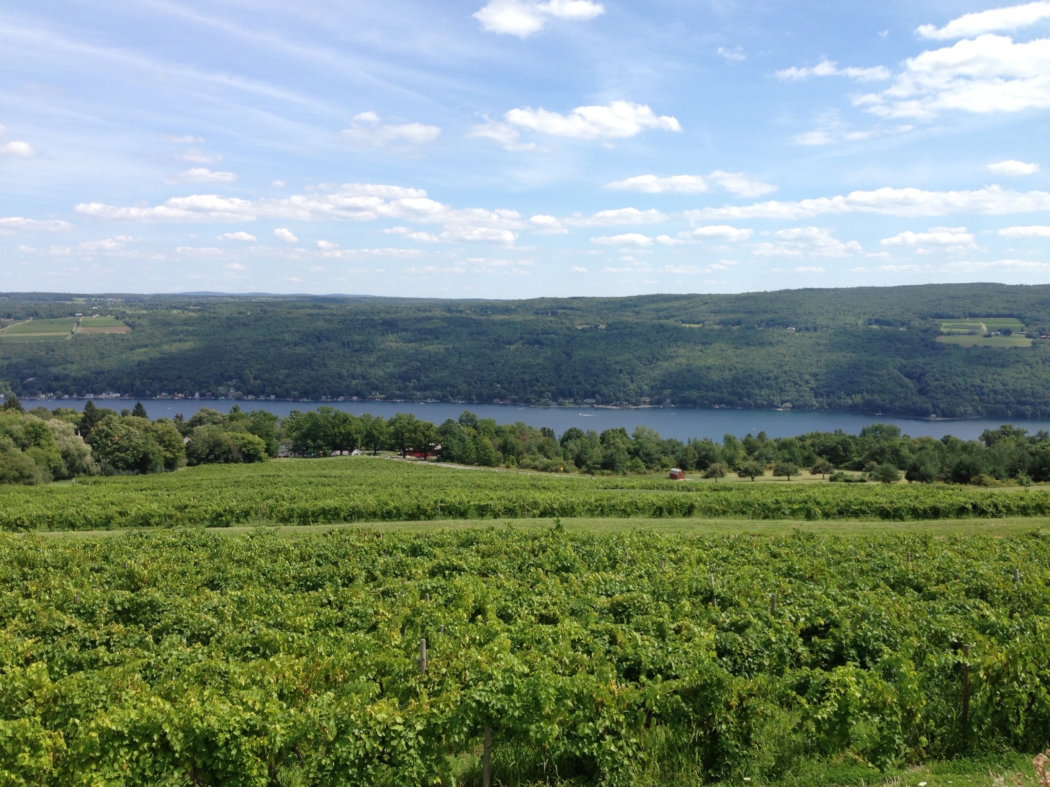
  • Early Morning Research and Preparation: The scientist’s day begins with reviewing satellite images, wetland delineation protocols, and local environmental regulations. They ensure that all their equipment, including soil coring tools and water quality kits, is ready for the day.
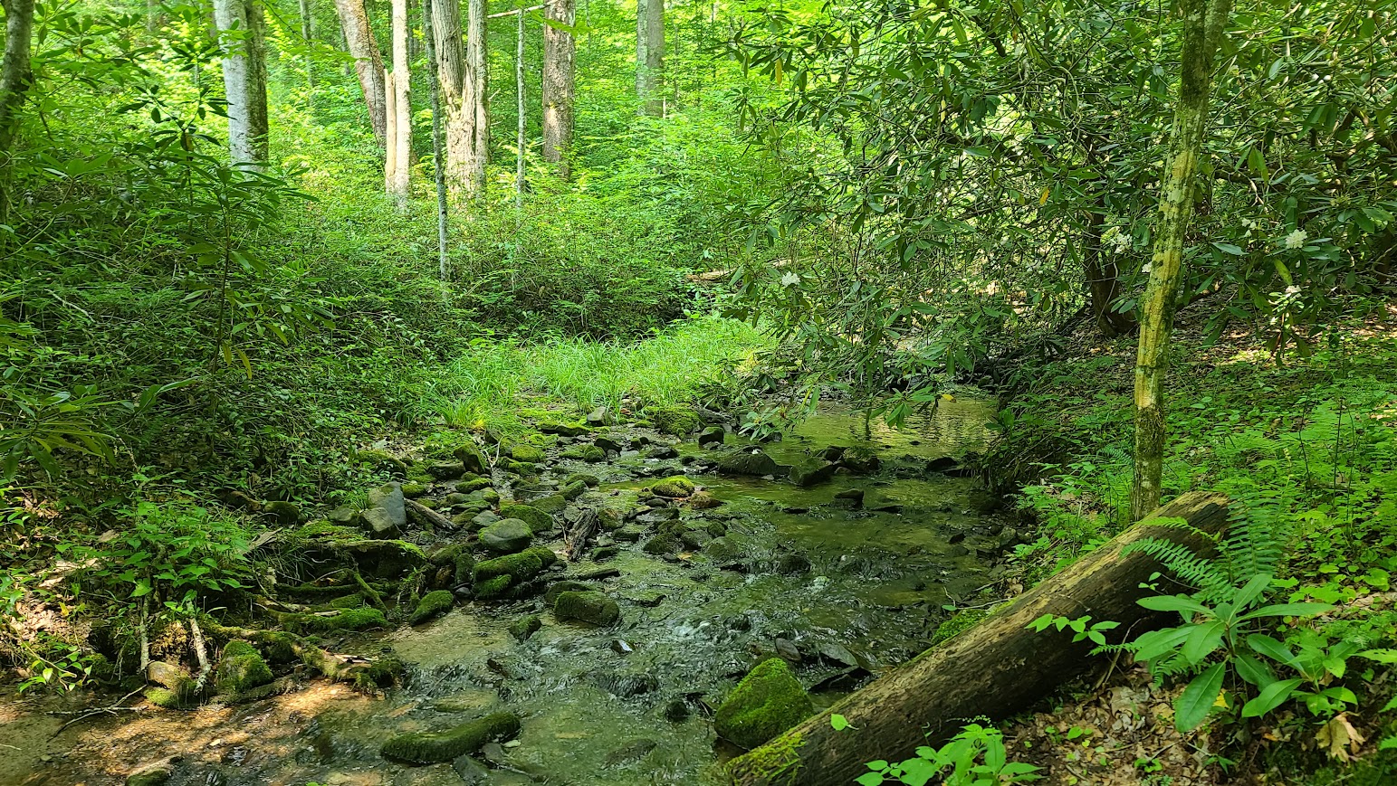
  • Travel to the Wetland Site: The journey to the wetland site might be an adventure, often traversing through less-traveled paths. The scientist plans their route, considering the day’s objectives and the logistics of reaching the site.
  • Initial Site Assessment: Upon arrival at the wetland, the scientist conducts an initial survey, looking for visible indicators of wetland boundaries and making preliminary notes.
  • Detailed Wetland Delineation Work: The morning is spent in intense fieldwork, including soil sampling, vegetation identification, and hydrology assessment, to accurately delineate the wetland boundaries.
  • Fun and Exploratory Lunch Break: By midday, it’s time for a well-deserved break. The scientist often takes this opportunity to explore local eateries, enjoying the chance to discover unique and interesting restaurants in the area. This lunch break becomes a mini-adventure, offering a delightful pause from the fieldwork and a chance to savor the local cuisine.
  • Post-Lunch Delineation and Data Collection: After lunch, the scientist returns to the field, possibly revisiting certain areas for additional verification or moving to new sections for further delineation.
  • Community Interaction and Educational Outreach: The afternoon may also include interactions with local communities, landowners, or educational groups, discussing the day’s findings and the importance of wetland conservation.
  • Return to Base for Analysis and Reporting: Back at their office or lab, the scientist analyzes the collected data, begins processing samples, and starts drafting reports based on the day’s delineation work.
  • Consultations and Collaborations: The scientist might consult with environmental agencies or collaborate with colleagues, ensuring that the delineation aligns with regulatory standards and contributes to broader environmental research.
  • Evening Review, Planning, and Networking: The day concludes with a review of the work done, updating project files, and perhaps participating in professional networking activities, staying connected with the wider scientific community.
  • Continued Learning and Research: The scientist spends time in the evening catching up on the latest research in wetland ecology and planning for future professional development opportunities.
  • Relaxation and Personal Time: Finally, the scientist unwinds, reflecting on the day’s work and the culinary adventure they enjoyed at lunch, recharging for the next day’s challenges.

Streamflow Duration Assessment Methods (SDAMs)

The U.S. Army Corps of Engineers (USACE) has developed the Streamflow Duration Assessment Methods (SDAMs), currently in their interim phase, to enhance the management and protection of water resources. This interim phase, reflecting a period of testing and refinement, is crucial for ensuring the accuracy and effectiveness of these methods.

Understanding the Interim Phase of SDAMs

The interim phase of the SDAMs, is a dynamic period where the methods are being field-tested, evaluated, and improved. This phase allows for the incorporation of feedback from various stakeholders, including environmental scientists, water resource managers, and policy makers.

The Role and Importance of SDAMs

Streamflow Duration Assessment Methods are essential for classifying streams based on the duration and frequency of their flow. This classification is vital for:

  1. Environmental Conservation: Assessing the impact of streamflow on aquatic ecosystems.
  2. Water Resource Management: Informing decisions related to water rights, usage, and allocation.
  3. Land Development: Guiding development projects to minimize adverse effects on water resources.
  4. Regulatory Compliance: Aiding in adherence to environmental regulations, such as the Clean Water Act in the U.S.

Implementation Strategies During the Interim Phase

During this interim phase, USACE employs various strategies:

  • Pilot Studies: Conducting field tests in diverse geographical locations to understand the method’s applicability.
  • Stakeholder Feedback: Actively seeking input from users to refine the methods.
  • Data Collection and Analysis: Gathering and analyzing extensive data to validate and improve the methods.
  • Technological Integration: Incorporating advanced technologies such as remote sensing and hydrological modeling.

Challenges and Future Outlook

The interim phase faces challenges like dealing with the impacts of climate change and the need for robust data. Looking ahead, the focus will likely be on:

  • Refining Models: Enhancing the precision and reliability of the methods.
  • Climate Adaptation: Incorporating climate change projections more comprehensively.
  • Expanding Collaboration: Increasing engagement with a broader range of stakeholders.

The U.S. Army Corps of Engineers’ (USACE) Streamflow Duration Assessment Methods (SDAMs) play a significant role in determinations related to the Waters of the United States (WOTUS). WOTUS is a term used in U.S. federal environmental regulations that defines the bodies of water that fall under the jurisdiction of the Clean Water Act (CWA). Understanding this relationship is crucial for environmental protection, water resource management, and compliance with federal laws.

The Role of SDAMs in WOTUS Determinations

  1. Defining Jurisdictional Waters: SDAMs are instrumental in determining whether a particular stream or water body falls under the category of WOTUS. By assessing the duration and frequency of streamflow, these methods help to classify streams as perennial, intermittent, or ephemeral, which is a key factor in WOTUS determinations.
  2. Environmental Regulation Compliance: The classification of water bodies as WOTUS has significant implications for environmental regulation, particularly in terms of permitting, pollution control, and habitat protection under the CWA.
  3. Impact on Land Use and Development: SDAMs influence decisions on land use and development. Projects near water bodies classified as WOTUS might require additional permits and environmental assessments to ensure compliance with the CWA.
  4. Protection of Aquatic Ecosystems: By aiding in the identification of WOTUS, SDAMs contribute to the protection of aquatic ecosystems, especially those dependent on certain streamflow conditions.

Challenges and Complexities in WOTUS Determinations

  1. Changing Definitions and Regulations: The definition of WOTUS has been subject to changes and legal challenges over the years, affecting how SDAMs are applied in regulatory contexts.
  2. Interagency Collaboration: WOTUS determinations often require collaboration between the USACE, the Environmental Protection Agency (EPA), and other federal and state agencies, necessitating a harmonized approach to streamflow assessment.
  3. Site-Specific Assessments: SDAMs need to be adaptable to various geographical and climatic conditions, as streamflow characteristics can vary significantly across different regions.
  4. Incorporating Climate Change Impacts: With changing climate patterns, the assessment of streamflow duration may become more complex, affecting WOTUS determinations over time.

Conclusion

The USACE’s Streamflow Duration Assessment Methods, in their critical interim phase, represent a significant step forward in sustainable water resource management. As these methods evolve, they will play an increasingly important role in protecting and managing water resources effectively for future generations. The ongoing development and refinement during this interim phase, while challenging, are essential for the creation of reliable and universally applicable streamflow assessment tools.

The Streamflow Duration Assessment Methods are deeply intertwined with the determinations of Waters of the United States. They provide a scientific and systematic approach to classifying water bodies, which is fundamental for regulatory compliance, environmental protection, and informed decision-making in land development. As environmental policies and climate conditions continue to evolve, the role of SDAMs in WOTUS determinations remains a key aspect of sustainable water resource management.

EPA and the Department of the Army issue Amended Final Rule Defining WOTUS

By Rick Savage – Carolina Wetlands Association

On August 29, 2023, the U.S. Environmental Protection Agency (EPA) and the Department of the Army announced a final rule that amends the January 2023 definition of “waters of the United States” (WOTUS). The amendments conform the January 2023 definition to the U.S. Supreme Court’s decision in Sackett and will take effect immediately upon publishing in the Federal Register (likely to happen within two weeks)To read the pre-publication version of the revised final rule, go to Pre-publication Version of the Final Rule – Amendments to the Revised Definition of Waters of the United States (epa.gov)

While exact details are yet to be digested, the gist of the ruling is becoming clear.  First, the significant nexus rule has been eliminated; so isolated wetlands are not jurisdictional wetlands, meaning they are not protected under the Clean Water Act.  Second, the new rule requires visual evidence of a continuous surface flow between a wetland and navigable water.  This part of the rule can get complicated as to what constitutes visual evidence of continuous surface flow.  I am sure that this will cause a lot of confusion and some developers will say there is no continuous surface flow and impact the wetland with a permit. 

Suffice it to say, this puts wetlands in North and South Carolina in jeopardy. The NC Department of Environmental Quality has estimated about 2.5 million acres of wetland have lost protection in North Carolina and I am sure a similar number in South Carolina.  The NC legislature could have continued to protect these wetlands; however, the recently passed Farm Bill eliminated state protection of isolated wetlands.   

We all need to brace ourselves for a lot of wetland loss and they are the very resource we need to protect our communities from flooding.  I think it is reasonable to expect more communities to get flooded, to have less clean water, and to have reduced climate resilience as well as miss the many other benefits that our wetlands provide. 

So go out an explore a wetland (before it gets developed?).

August 2023 Definition of Waters of the United States

On August 29, 2023 the US EPA and the US Army Corps of Engineers released a pre-publication version of the conforming amendment to the 2023 definition a Waters of the US. I cannot recall ever having seen a “conforming amendment” in all my years working with this issue. In fact, I am not sure it has ever been done before in any circumstance. I expect the next round of challenges to this rule will focus on this.

The final version of this rule is the weakest version of the Waters of the US we have ever had. The amount of wetlands no longer covered by Clean Water Act protections is the lowest it has ever been including the Navigable Waters Protection Rule era. It is also important to note that the Supreme Court Decision that prompted this new rule was a unanimous (9-0) one. All nine justices were in agreement despite popular media decrying it was the right side of the bench that dominated the Decision.

This is a final rule and becomes effective on the date it is published in the Federal Register. There is no public comment period. I am still unclear as to why the agencies are in such a hurry to not regulate wetlands.

Much of the new rule discusses why it is proper to issue a conforming amendment without a public comment period. The rule itself is fairly brief, in that it provides the edits to the existing Biden rule. The rule itself does not merge the two rules together into a single document. They leave that up to you. However, we have done this for you and the total new conforming rule follows. We will also be hosting a webinar on this new rule on September 28, 2023. Hope to see you there!

Title 33 —Navigation and Navigable Waters

Chapter II —Corps of Engineers, Department of the Army, Department of Defense

Part 328 —Definition of Waters of the United States

Authority: 33 U.S.C. 1251 et seq.

Source: 51 FR 41250, Nov. 13, 1986, unless otherwise noted.

§ 328.3 Definitions.

For the purpose of this regulation these terms are defined as follows:

(a) Waters of the United States means:

(1) Waters which are:

(i)  Currently used, or were used in the past, or may be susceptible to use in interstate or foreign commerce, including all waters which are subject to the ebb and flow of the tide;

(ii) The territorial seas; or

(iii) Interstate waters,

(2)  Impoundments of waters otherwise defined as waters of the United States under this definition, other than impoundments of waters identified under paragraph (a)(5) of this section;

(3) Tributaries of waters identified in paragraph (a)(1) or (2) of this section that are relatively permanent, standing or continuously flowing bodies of water;

(4) Wetlands adjacent to the following waters:

(i) Waters identified in paragraph (a)(1) of this section; or

(ii) Relatively permanent, standing or continuously flowing bodies of water identified in paragraph (a)(2) or (a)(3) of this section and with a continuous surface connection to those waters.

(5) Intrastate lakes and ponds not identified in paragraphs (a)(1) through (4) of this section that are relatively permanent, standing or continuously flowing bodies of water with a continuous surface connection to the waters identified in paragraph (a)(1) or (a)(3) of this section.

(b)  The following are not “waters of the United States” even where they otherwise meet the terms of paragraphs (a)(2) through (5) of this section:

(1)  Waste treatment systems, including treatment ponds or lagoons, designed to meet the requirements of the Clean Water Act;

(2)  Prior converted cropland designated by the Secretary of Agriculture. The exclusion would cease upon a change of use, which means that the area is no longer available for the production of agricultural commodities. Notwithstanding the determination of an area’s status as prior converted cropland by any other Federal agency, for the purposes of the Clean Water Act, the final authority regarding Clean Water Act jurisdiction remains with EPA;

(3)  Ditches (including roadside ditches) excavated wholly in and draining only dry land and that do not carry a relatively permanent flow of water;

(4) Artificially irrigated areas that would revert to dry land if the irrigation ceased;

(5)  Artificial lakes or ponds created by excavating or diking dry land to collect and retain water and which are used exclusively for such purposes as stock watering, irrigation, settling basins, or rice growing;

(6)  Artificial reflecting or swimming pools or other small ornamental bodies of water created by excavating or diking dry land to retain water for primarily aesthetic reasons;

(7)  Waterfilled depressions created in dry land incidental to construction activity and pits excavated in dry land for the purpose of obtaining fill, sand, or gravel unless and until the construction or excavation operation is abandoned and the resulting body of water meets the definition of waters of the United States; and

(8)  Swales and erosional features (e.g., gullies, small washes) characterized by low volume, infrequent, or short duration flow.

(c) In this section, the following definitions apply:

(1)  Wetlands means those areas that are inundated or saturated by surface or ground water at a frequency and duration sufficient to support, and that under normal circumstances do support, a prevalence of vegetation typically adapted for life in saturated soil conditions. Wetlands generally include swamps, marshes, bogs, and similar areas.

(2)  Adjacent means having a continuous surface connection.

(3)  High tide line means the line of intersection of the land with the water’s surface at the maximum height reached by a rising tide. The high tide line may be determined, in the absence of actual data, by a line of oil or scum along shore objects, a more or less continuous deposit of fine shell or debris on the foreshore or berm, other physical markings or characteristics, vegetation lines, tidal gages, or other suitable means that delineate the general height reached by a rising tide. The line encompasses spring high tides and other high tides that occur with periodic frequency but does not include storm surges in which there is a departure from the normal or predicted reach of the tide due to the piling up of water against a coast by strong winds such as those accompanying a hurricane or other intense storm.

(4)  Ordinary high water mark means that line on the shore established by the fluctuations of water and indicated by physical characteristics such as clear, natural line impressed on the bank, shelving, changes in the character of soil, destruction of terrestrial vegetation, the presence of litter and debris, or other appropriate means that consider the characteristics of the surrounding areas.

(5)  Tidal waters means those waters that rise and fall in a predictable and measurable rhythm or cycle due to the gravitational pulls of the moon and sun. Tidal waters end where the rise and fall of the water surface can no longer be practically measured in a predictable rhythm due to masking by hydrologic, wind, or other effects.