Transforming Wetland Delineation: The Power of AI and Chat Assistants

Wetlands are some of the most ecologically significant and sensitive habitats on Earth. They provide essential services such as water filtration, flood protection, and habitat for countless species. However, their complexity and the dynamic nature of wetland ecosystems pose significant challenges for environmental consultants tasked with delineating and assessing these areas. Traditional methods of wetland delineation, while effective, are often labor-intensive, time-consuming, and subject to human error. Enter artificial intelligence (AI) and chat assistants—technologies that promise to revolutionize wetland delineation by enhancing accuracy, efficiency, and accessibility.

The Role of AI in Environmental Consulting

Artificial intelligence has made significant strides in various fields, and environmental consulting is no exception. AI systems excel at processing vast amounts of data quickly and accurately, identifying patterns, and making predictions that can significantly aid decision-making processes. In the context of wetland delineation, AI can be utilized in several ways:

  1. Data Analysis:
    • AI can process large datasets, such as satellite imagery, soil samples, and hydrological data, to identify wetland boundaries and characteristics with high precision. Machine learning algorithms can be trained to recognize specific features and indicators of wetlands, reducing the time required for manual analysis.
  2. Predictive Modeling:
    • AI models can forecast environmental changes based on historical data, helping consultants anticipate how wetlands might evolve under different scenarios. This capability is particularly useful for understanding the impacts of climate change, land use changes, and water management practices on wetland ecosystems.
  3. Automation:
    • Many of the repetitive and routine tasks involved in wetland delineation, such as data entry and initial assessments, can be automated using AI. This automation not only speeds up the process but also minimizes the risk of human error.

Practical Applications of AI in Wetland Delineation

AI applications in wetland delineation are diverse and powerful. Here are a few examples:

  • Species Identification: Using AI to recognize plant and animal species from images is a game-changer. Models trained on large datasets of labeled images can accurately identify species based on features such as shape, color, and texture. This capability is invaluable for monitoring biodiversity and detecting the presence of rare or endangered species within wetlands.
  • Habitat Suitability Analysis: AI can analyze environmental variables such as soil type, water availability, and temperature to predict suitable habitats for different species. This analysis helps in planning conservation efforts and ensuring that habitats are protected and managed effectively.
  • Climate Impact Modeling: Predicting how climate change will affect wetland ecosystems is critical for developing adaptive management strategies. AI models can integrate various climatic and environmental factors to forecast changes in wetland areas, helping policymakers and conservationists make informed decisions.

Introduction to Chat Assistants in Environmental Consulting

Chat assistants, or chatbots, leverage natural language processing (NLP) to interact with users in a conversational manner. These AI-powered tools can provide quick answers to common questions, assist with data entry, and perform initial analyses, making complex AI models more accessible.

How Chat Assistants Work:

  • Natural Language Processing (NLP): Chat assistants use NLP to understand and respond to human language, allowing users to interact with AI models without needing to know technical details. This interaction simplifies the process of obtaining information and insights from AI systems.
  • User Interaction: By providing a user-friendly interface, chat assistants make it easy for users to input data, ask questions, and receive detailed responses. This ease of use is particularly beneficial for environmental consultants who may not have extensive technical backgrounds.

Applications in Environmental Consulting:

  • Customer Support: Chat assistants can answer frequently asked questions about environmental regulations, project timelines, and data requirements, providing quick and accurate responses to clients and stakeholders.
  • Data Collection: Guiding users through the process of entering environmental data ensures that information is collected correctly and consistently. Chat assistants can standardize data entry, reducing variability and improving data quality.
  • Preliminary Analysis: Performing initial assessments based on user inputs allows chat assistants to provide quick insights and recommendations, helping consultants prioritize tasks and focus on more complex analyses.

The Importance of Prompt Engineering

Prompt engineering is the process of designing prompts to effectively communicate with AI models. In wetland delineation, this involves creating specific instructions or questions that guide the AI to provide relevant and accurate responses.

Key Aspects of Prompt Engineering:

  • Designing Effective Prompts: Prompts must be clear, concise, and contextually relevant to ensure the AI model understands the specific task at hand. For instance, a prompt like “Analyze the soil data and classify the area as wetland or non-wetland” directs the AI to focus on relevant soil characteristics.
  • Contextual Awareness: The AI model must understand the context of wetland delineation, including the specific indicators of wetlands and the regulatory criteria used to classify these areas. This contextual awareness is achieved through training the model on relevant datasets and continuously refining the prompts.
  • Iterative Process: Prompt engineering is an iterative process where prompts are tested and refined based on the AI’s performance. This continuous improvement ensures that the model’s responses become more accurate and relevant over time.

Example Prompts:

  • Data Input: “Based on the following soil sample data, is this area classified as a wetland?”
  • Species Identification: “Identify the plant species in this image and determine if it is a wetland indicator species.”
  • Predictive Modeling: “Predict the impact of a 10% increase in rainfall on the wetland area over the next year.”

Case Study: Everglades Water Management

The Everglades, a vast and complex wetland ecosystem in southern Florida, presents a unique set of challenges for water management. Traditional methods often struggle to predict the complex interactions between hydrology and ecology. To address this, an AI model named was developed to simulate various water management scenarios using historical data on precipitation, water flow, and ecological responses.

How it Works:

  1. Data Collection and Preparation: The Ai gathers data from weather stations, hydrological sensors, and ecological surveys. This data is cleaned and preprocessed to ensure accuracy and consistency.
  2. Machine Learning Algorithms: The Ai employs supervised learning, neural networks, random forests, and support vector machines (SVM) to model complex relationships and make robust predictions.
  3. Training the AI Model: The training process involves splitting the data into training and testing sets, performing feature engineering, and iterating on the model to optimize performance.
  4. Running Simulations: Managers input scenarios such as changes in rainfall patterns or water release schedules, and the Ai simulates the impact on the ecosystem, including predicting water levels, flood risks, and habitat conditions.
  5. Insights and Decision Support: The Ai provides detailed reports on the predicted outcomes, helping managers make informed decisions that balance ecological and human needs.

Results and Insights: The Ai’s simulations have proven invaluable in optimizing water flow, improving habitat conditions for wildlife, and ensuring sustainable water use. By identifying optimal water release schedules and predicting potential flooding or drought conditions, Ai helps manage the delicate balance of the Everglades ecosystem.

Benefits and Challenges of AI in Wetland Delineation

While AI and chat assistants offer numerous benefits, there are also challenges to consider.

Benefits:

  • Increased Efficiency: Automating data analysis and routine tasks saves time and resources.
  • Improved Accuracy: AI models can process large datasets and identify patterns that might be missed by human analysts.
  • Scalability: AI systems can handle large volumes of data, making them suitable for extensive project areas.
  • Enhanced Decision-Making: AI provides data-driven insights that support informed decision-making.

Challenges:

  • Data Quality: The accuracy of AI models depends on the quality and completeness of the data.
  • Complexity: Developing and maintaining AI models requires technical expertise.
  • Cost: Implementing AI solutions can involve significant initial investment.
  • Ethical Considerations: Ensuring that AI systems are transparent and do not reinforce biases is crucial.

Join Our Webinar to Learn More

To delve deeper into these topics and explore how AI and chat assistants can transform wetland delineation, join our webinar on August 29, 2024, at 1 PM ET. This 90-minute session will provide valuable insights, practical applications, and a live demonstration of AI in action. Don’t miss this opportunity to stay ahead in the rapidly evolving field of environmental consulting. Register now to secure your spot.

For more details and/or to register, visit our Webinar Registration Page.

Understanding Jurisdictional Determinations: Pipes and Swales as Continuous Surface Connections

Background

The U.S. Environmental Protection Agency (EPA) and the Office of the Assistant Secretary of the Army for Civil Works (OASACW) recently issued a joint memorandum addressing the jurisdictional determination (JD) for NAP-2023-01223. This memorandum clarifies the criteria for wetlands to be considered “waters of the United States” (WOTUS) under the Clean Water Act (CWA), following the Supreme Court decision in Sackett v. EPA. This decision is pivotal in determining when wetlands are jurisdictional, requiring a continuous surface connection to navigable waters or other recognized WOTUS.

Summary

The joint memorandum returned the draft approved JD to the Philadelphia District for revisions, ensuring alignment with the Supreme Court’s Sackett decision. The Sackett ruling specifies that wetlands must have a continuous surface connection to waters recognized as WOTUS to fall under CWA protection. This blog post will delve into the critical role of pipes and swales in maintaining this continuous surface connection, thus impacting the jurisdictional status of wetlands.

Assessment of Adjacent Wetlands Consistent with Sackett

The Sackett decision mandates that adjacent wetlands must have a continuous surface connection with traditionally navigable waters or other WOTUS. This standard, first established in the Rapanos plurality opinion, does not require the wetlands and waters to be visually indistinguishable but emphasizes a clear, physical connection. It is important to note that the term “indistinguishable” in this context does not imply a visual similarity; instead, it refers to the physical and hydrologic connection that allows the wetland to function as part of the broader aquatic ecosystem.

Pipes as Continuous Surface Connections

Context and Application

Infrastructure Role: Pipes and culverts are essential for maintaining hydrologic connectivity across roadways, preventing flooding and erosion. They ensure a continuous flow of water between aquatic resources on either side of the road.

Jurisdictional Determination: During storm events and high water flow periods, these pipes help maintain a physical connection between wetlands and relatively permanent waters, supporting their jurisdictional status under the CWA.

Case Example: Wetlands Area #6

Location: Camden Wyoming, Delaware.
Connection: Wetlands Area #6 connects to Red House Branch via a 70-foot pipe under Willow Grove Road.
Hydrologic Role: This pipe ensures continuous surface water flow from Wetlands Area #6 to Red House Branch, meeting the criteria for an adjacent wetland.

Swales as Continuous Surface Connections

Context and Application

Natural and Constructed Features: Swales, which can be natural or constructed, convey water from surrounding uplands and wetlands. They often carry low-frequency and low-volume flows, which can be crucial for maintaining jurisdictional connectivity.

Evidence of Flow: Observations of water flow in swales, especially following precipitation events, provide critical evidence of a continuous surface connection between wetlands and relatively permanent waters.

Case Example: Wetlands Area #8

Location: Camden Wyoming, Delaware.
Connection: Wetlands Area #8 connects to Waters Area #2, a relatively permanent impoundment, via a 350-foot swale.
Hydrologic Role: Observations of water flow in the swale after rain events demonstrate the physical connection necessary for jurisdictional status.

Legal and Regulatory Framework

Clean Water Act (CWA) Provisions: Regulations at 33 CFR 328.3(a)(4) and 40 CFR 120.2(a)(4) outline the conditions under which wetlands are considered adjacent and thus jurisdictional.

Supreme Court Decisions: The Sackett and Rapanos rulings provide the judicial framework for the continuous surface connection requirement, emphasizing the importance of physical and hydrologic connectivity.

Factors Considered in Assessments:

  • Physical Indicators of Flow: Evidence such as surface water flow during storm events and physical connections like pipes and swales.
  • Length and Nature of Connection: The physical characteristics of the connection, such as length and whether it is manmade or natural.

Practical Implications

Recognizing pipes and swales as continuous surface connections has several practical implications:

  • Infrastructure Design: Encourages designs that maintain hydrologic connectivity, supporting wetland preservation.
  • Regulatory Compliance: Assists regulatory bodies and stakeholders in making informed jurisdictional determinations consistent with the CWA and Supreme Court rulings.
  • Environmental Protection: Ensures that connected wetlands receive appropriate regulatory protections, contributing to broader water quality and ecosystem health goals.

Conclusion

The joint memorandum provides detailed guidance on when pipes and swales can meet the continuous surface connection requirement for wetlands, emphasizing context-specific assessments. By examining physical connections and hydrologic evidence, regulatory agencies can make informed determinations that align with the legal standards established in Sackett and Rapanos. This approach ensures that wetlands that truly function as part of the broader aquatic ecosystem are appropriately regulated and protected under the CWA.

Keywords: jurisdictional determination, Clean Water Act, wetlands, continuous surface connection, Sackett v. EPA, Rapanos, pipes, swales, hydrologic connectivity, WOTUS, environmental protection, EPA.

The Chevron Overturn: A New Era for Environmental Law and Consulting

Chevron Blog

The recent decision by the U.S. Supreme Court to overturn the Chevron doctrine marks a significant shift in administrative law, with profound implications for environmental regulation. This landmark ruling will notably impact the workload of environmental consultants, who will find themselves at the forefront of navigating the new legal landscape.

Background on the Chevron Doctrine

The Chevron doctrine, established in the 1984 case Chevron U.S.A., Inc. v. Natural Resources Defense Council, Inc., has been a foundational principle in administrative law. It mandated that courts defer to federal agencies’ interpretations of ambiguous statutes within their regulatory domain, provided those interpretations were reasonable. This deference allowed agencies like the Environmental Protection Agency (EPA) considerable leeway in enforcing complex regulations such as those under the Clean Water Act, including the contentious Waters of the United States (WOTUS) rule​ (Home | Holland & Knight)​​ (Politico)​.

Increased Litigation and Regulatory Challenges

With the Chevron doctrine overturned, courts will no longer defer to agency interpretations of ambiguous statutes. Instead, they will exercise independent judgment. This shift is expected to trigger a wave of legal challenges against existing and new environmental regulations. Environmental consultants will play a crucial role in these legal battles, providing expert testimony, preparing detailed environmental impact assessments, and supporting legal teams in understanding and contesting regulatory interpretations​ (SCOTUSblog)​​ (Politico)​.

The legal uncertainty following the end of Chevron deference means that many regulations previously upheld under this doctrine are now open to re-evaluation. This scenario will likely lead to an increased demand for consultants to help navigate the evolving legal landscape and ensure compliance with regulatory requirements.

Need for Detailed Compliance Analysis

Without Chevron deference, the clarity on what constitutes compliance with environmental statutes will diminish. Companies and developers will require more comprehensive and rigorous analyses to ensure they meet the new standards set by independent judicial interpretations. Environmental consultants will need to conduct detailed investigations and provide robust documentation to demonstrate compliance with environmental laws, particularly those related to water quality and land use​ (Politico)​.

For instance, WOTUS regulations, which define the scope of waters protected under the Clean Water Act, could see significant reinterpretations. Environmental consultants will need to stay abreast of these changes and provide accurate assessments to help clients navigate compliance issues.

Policy Interpretation and Guidance

Environmental consultants will be essential in interpreting new court rulings and understanding their implications for existing regulations. The overturning of Chevron deference means that regulatory guidance from agencies may no longer carry the same weight, placing greater responsibility on consultants to interpret legal requirements and advise clients accordingly​ (SCOTUSblog)​.

This role will involve staying updated on the latest legal developments and providing clients with clear, actionable insights on how changes in the law affect their operations. Consultants will need to be adept at translating complex legal decisions into practical compliance strategies for their clients.

Updating Environmental Management Practices

Organizations will need to update their environmental management practices to align with the new legal landscape. This process involves revising standard operating procedures, training staff on new compliance requirements, and ensuring all practices meet the latest interpretations of environmental laws. Environmental consultants will be instrumental in guiding organizations through these updates, ensuring that all aspects of their operations are compliant with the new regulatory environment​ (Home | Holland & Knight)​​ (Politico)​.

The Supreme Court’s decision may lead to more stringent judicial scrutiny of agency regulations, requiring consultants to provide more detailed and scientifically robust analyses to support compliance efforts. This increased scrutiny will necessitate higher standards of environmental documentation and reporting.

Permitting and Project Delays

The process for obtaining environmental permits is likely to become more complex and time-consuming. Without the deference previously afforded under Chevron, agencies may face more challenges in implementing and defending their regulatory decisions. This complexity will extend to the permitting process, where more rigorous and detailed applications will be required. Environmental consultants will be essential in navigating these processes, ensuring that all necessary documentation and environmental impact analyses are thorough and meet the new legal standards​ (Home | Holland & Knight)​​ (Politico)​.

In summary, the Supreme Court’s decision to overturn the Chevron doctrine represents a significant shift in administrative law that will substantially increase the workload for environmental consultants. They will be required to provide more detailed compliance analysis, interpret new legal standards, update environmental management practices, and navigate a more complex permitting process. As the legal landscape evolves, the expertise and guidance of environmental consultants will be more critical than ever in ensuring that organizations remain compliant with environmental regulations.

Unveiling WOTUS: How NOHWM and SDAM Define Our Nation’s Waterways

Stream Site

Establishing Jurisdictional Waters of the United States (WOTUS) Using the US Army Corps of Engineers National Ordinary High Water Mark Manual (NOHWM) and Stream Duration Assessment Method (SDAM)

For environmental scientists, the determination of whether a wetland or waterway qualifies as a jurisdictional Water of the United States (WOTUS) is not just a regulatory necessity but a vital step in preserving our nation’s aquatic ecosystems. At the heart of this process are two pivotal tools provided by the US Army Corps of Engineers (USACE): the National Ordinary High Water Mark (NOHWM) Manual and the Stream Duration Assessment Method (SDAM). Together, these methodologies offer a comprehensive, scientific approach to delineating WOTUS, ensuring that critical water resources are effectively protected.

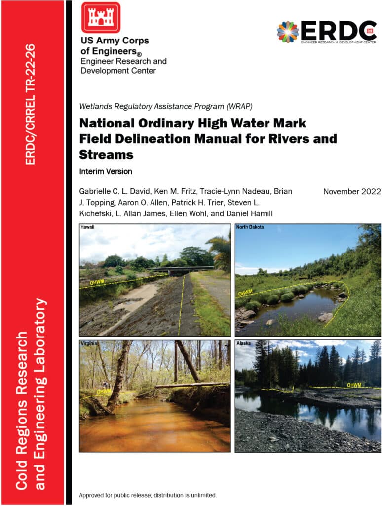
An image of the cover of the National Ordinary High Water Mark Field Delineation Manual for Rivers and Streams.

Diving into the National Ordinary High Water Mark (NOHWM) Manual

The National Ordinary High Water Mark (NOHWM) Manual serves as a detailed guide for environmental professionals to accurately identify the Ordinary High Water Mark (OHWM) in various landscapes. The OHWM represents the boundary between jurisdictional waters and upland areas, making it a crucial concept for environmental assessments.

Key Components of NOHWM:

  1. Physical Characteristics: The manual outlines physical indicators that signify the presence of an OHWM. These include:
  • Clear Natural Line: Look for a visible line on the bank formed by the regular presence of water.
  • Soil Changes: Notice differences in soil color, texture, or composition that indicate historical water presence.
  • Vegetation Patterns: Identify areas where terrestrial vegetation is absent or altered due to frequent inundation.
  • Litter and Debris: Examine the accumulation of organic and inorganic materials deposited by water flow.
  1. Regional Adaptations: The NOHWM Manual acknowledges the diversity of the US landscape, providing region-specific guidelines to account for varying hydrological and geomorphological conditions.
  2. Field Procedures: The manual details systematic field procedures, ensuring consistency and accuracy across assessments. This includes standardized data collection techniques, field forms, and documentation practices.

The Weight of Evidence Approach in NOHWM

A critical concept in the NOHWM approach is the “weight of evidence” (WOE) methodology. This approach ensures that multiple lines of evidence are considered when determining the OHWM, providing a more robust and defensible delineation.

Weight of Evidence Approach:

  1. Multiple Indicators: Instead of relying on a single indicator, the WOE approach integrates various physical, hydrological, and biological indicators. This multi-faceted analysis helps in cross-verifying the presence and extent of OHWM.
  2. Corroborative Evidence: Indicators such as changes in soil, vegetation patterns, and physical markings on the bank are examined together. Consistency among these indicators strengthens the determination of OHWM.
  3. Contextual Analysis: The WOE approach considers the broader landscape and hydrological context, including historical data and regional characteristics, ensuring that the delineation is not only accurate but also contextually relevant.
  4. Documentation and Transparency: Detailed documentation of all evidence and indicators used in the assessment is crucial. This transparency enhances the defensibility of the OHWM determination.
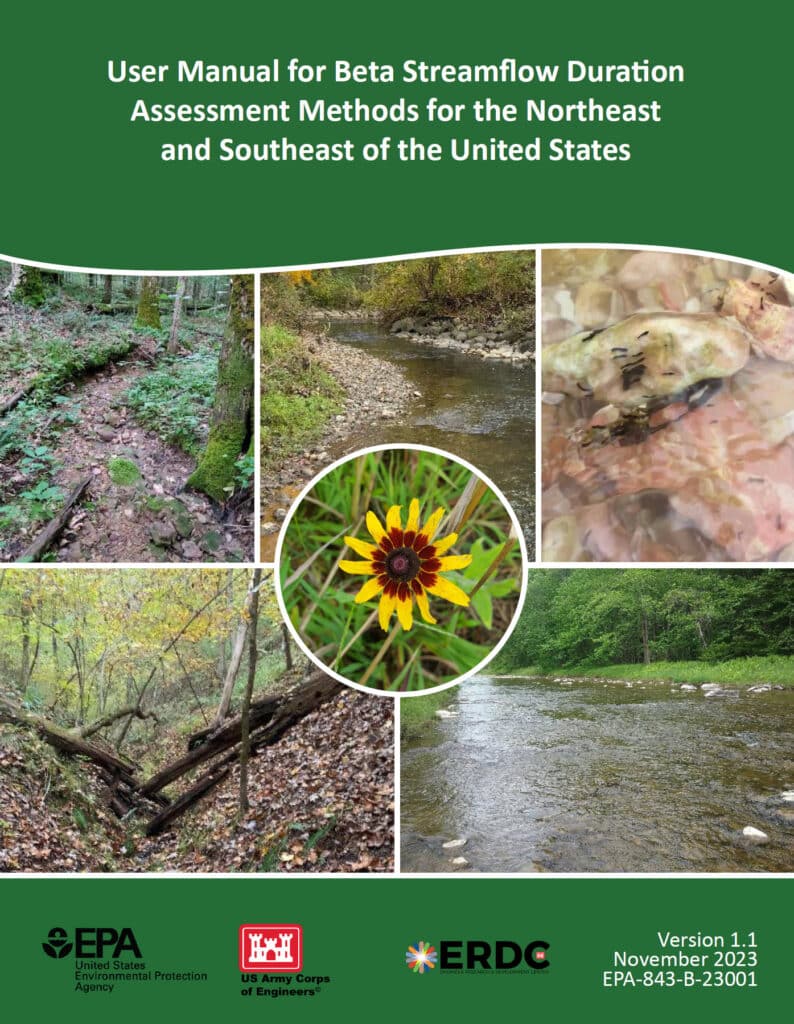
An image of the cover of the User Manual for Beta Streamflow Duration Assessment Methods for the Northeast and Southeast of the United States

Stream Duration Assessment Method (SDAM): A Closer Look

For scientists engaged in stream assessments, the Stream Duration Assessment Method (SDAM) is a game-changer. It allows for precise classification of streams based on their flow duration, which is essential for determining their jurisdictional status.

Stream Classifications:

  1. Ephemeral Streams: These streams flow only during and immediately after precipitation events. As a scientist, identifying ephemeral streams involves recognizing temporary water flow patterns and minimal biological activity.
  2. Intermittent Streams: These streams flow during certain times of the year, such as the wet season, but not continuously. Intermittent streams show clear signs of seasonal aquatic life and sediment patterns.
  3. Perennial Streams: Perennial streams flow year-round and are typically considered jurisdictional. These streams support continuous aquatic habitats and show persistent hydrological and biological indicators.

SDAM Assessment Process:

  1. Field Observations: Conduct site visits to observe physical characteristics like bed and bank features, sediment deposits, and biological indicators such as the presence of aquatic organisms and specific plant species.
  2. Hydrological Data Review: Examine historical flow records, precipitation data, and stream gauge information to understand the stream’s flow regime over time.
  3. Biological Indicators: Identify the presence of certain aquatic organisms and plant species that thrive in continuous or seasonal water flow, offering insights into the stream’s duration and consistency.

Integrating NOHWM and SDAM for WOTUS Determinations

The integration of the NOHWM and SDAM methodologies provides a robust framework for determining whether a water body qualifies as WOTUS. For environmental scientists, this integration involves a meticulous blend of physical, hydrological, and biological assessments.

Determination Process:

  1. Preliminary Assessment: Begin with a thorough desktop review, using maps, aerial photos, and existing hydrological data to identify potential jurisdictional waters.
  2. Field Verification: Conduct on-site inspections to validate preliminary findings. Observe physical indicators of OHWM and perform SDAM assessments to classify stream types accurately.
  3. Data Integration: Combine field observations with historical and current hydrological data. This comprehensive dataset aids in making well-informed determinations of a water body’s jurisdictional status.
  4. Documentation and Reporting: Prepare detailed reports that document findings, methodologies, and justifications for the jurisdictional status. These reports provide transparency and serve as a basis for regulatory decisions.

The Environmental Significance of NOHWM and SDAM

For environmental scientists, the accurate identification of jurisdictional waters is paramount. Here’s why:

  1. Protecting Ecosystems: Correctly delineating WOTUS ensures the preservation of vital aquatic ecosystems, protecting them from pollution and degradation.
  2. Ensuring Compliance: Clear identification helps landowners, developers, and other stakeholders understand their obligations under the Clean Water Act, preventing unauthorized activities that could harm protected waters.
  3. Resource Management: Informed decision-making for water resource management, conservation planning, and habitat restoration efforts becomes possible, benefiting both the environment and the communities that rely on these resources.

Conclusion

The National Ordinary High Water Mark Manual (NOHWM) and the Stream Duration Assessment Method (SDAM) are indispensable tools for environmental scientists working to delineate jurisdictional Waters of the United States (WOTUS). By applying these methodologies, the US Army Corps of Engineers ensures that water bodies deserving of protection under the Clean Water Act are accurately identified and managed. For environmental professionals, mastering these methods is not just about regulatory compliance—it’s about playing a critical role in safeguarding the health and integrity of our nation’s precious water resources. Through diligent application of NOHWM and SDAM, we can continue to protect and sustain our aquatic ecosystems for future generations.

Unlocking Wetland Potential: Your Guide to USDA’s Wetland Mitigation Banking Program

farm near wetland

Introduction to the USDA Wetland Mitigation Banking Program (WMBP)

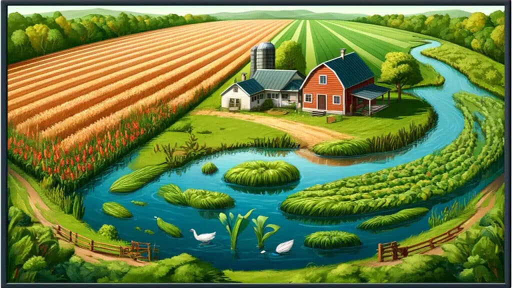
Illustration of a farm adjacent to a wetland.

The U.S. Department of Agriculture (USDA) has allocated nearly $5 million in grants to support the Wetland Mitigation Banking Program (WMBP). This funding enhances the restoration, creation, or enhancement of wetlands to offset impacts from other locations. Since 2016, over $12.4 million has been awarded to partners in 11 states, leading to the establishment of 21 wetland bank sites.

The USDA recently presented a webinar focused on the Wetland Mitigation Banking Program (WMBP), which supports the development of mitigation banks to restore, create, or enhance wetlands. The webinar provided detailed insights into the process and requirements for establishing a wetland mitigation bank, covering topics such as program overview, application process, site selection, interagency review, Mitigation Banking Instrument (MBI), monitoring and management, credit release and sales, and case studies.

Webinar Summary

The WMBP Applicant Webinar provides detailed insights into the process and requirements for establishing a wetland mitigation bank. The following key topics are covered:

1. Program Overview

Wetland mitigation banking is a market-based approach that involves restoring, creating, enhancing, or preserving wetlands to compensate for unavoidable impacts on wetlands elsewhere. The program aims to ensure no net loss of wetland functions and values. Mitigation banks offer credits to developers and other entities needing to offset their environmental impacts.

2. Application Process

The application process involves several critical steps:

  • Project Proposal: Outline the purpose, need, and benefits of the proposed mitigation bank.
  • Site Plan: Provide detailed plans including maps, design specifications, and ecological goals.
  • Financial Assurances: Demonstrate financial capability to complete the project and manage the site long-term.

3. Site Selection and Design

Selecting an appropriate site is crucial. Key criteria include:

  • Ecological Viability: The site should support the target wetland type and functions.
  • Hydrology and Soils: The site must have suitable hydrological and soil conditions.
  • Connectivity: Proximity to other wetlands or protected areas can enhance ecological benefits.

Design considerations involve creating a site plan that outlines:

  • Grading and Hydrologic Modifications: Ensure proper water flow and retention.
  • Vegetation Plans: Use native species to establish a resilient wetland ecosystem.

4. Interagency Review

The Interagency Review Team (IRT) plays a pivotal role in evaluating and approving mitigation bank proposals. The IRT typically includes representatives from:

  • USDA: Provides guidance on agricultural and conservation practices.
  • USACE: Oversees compliance with the Clean Water Act.
  • EPA: Ensures environmental protection standards are met.
  • State and Local Agencies: Address regional environmental concerns and regulations.

5. Mitigation Banking Instrument (MBI)

The MBI is a detailed agreement that outlines the terms and conditions of the mitigation bank, including:

  • Objectives: Clear goals for wetland restoration or creation.
  • Site Plans: Detailed maps and design specifications.
  • Credit Release Schedule: Timeline for when credits become available based on performance milestones.
  • Long-Term Management: Plans for ongoing maintenance and monitoring to ensure sustainability.

Public notice and comment are integral to the MBI approval process, allowing stakeholders to review and provide feedback.

6. Monitoring and Management

Continuous monitoring is essential to track the bank’s progress and ensure it meets ecological performance standards. Key aspects include:

  • Monitoring Plan: Outlines methods for assessing vegetation, hydrology, and wildlife.
  • Adaptive Management: Strategies to address unforeseen issues and make necessary adjustments to management practices.

7. Credit Release and Sales

Credits represent the restored or enhanced wetland functions and are released in phases as performance milestones are met. The process involves:

  • Performance Milestones: Specific ecological benchmarks that must be achieved.
  • Credit Sales: Developers and other entities purchase credits to offset their environmental impacts, providing financial support for the bank.

8. Case Studies

The webinar highlights several successful wetland mitigation banks to illustrate best practices and lessons learned. These examples showcase innovative approaches to site selection, design, and management that have led to successful restoration and long-term sustainability.

Conclusion

Setting up a wetland mitigation bank with the USDA involves detailed planning, interagency coordination, and commitment to long-term ecological monitoring and management. Adhering to these steps ensures the success and sustainability of wetland mitigation banks. For more information, watch the full webinar here.

North Carolina’s Weird and Wonderful: Eastern Narrow-mouthed Toad

Illustration of several toad species resting on a log by a temporary wetland in a lush forest.

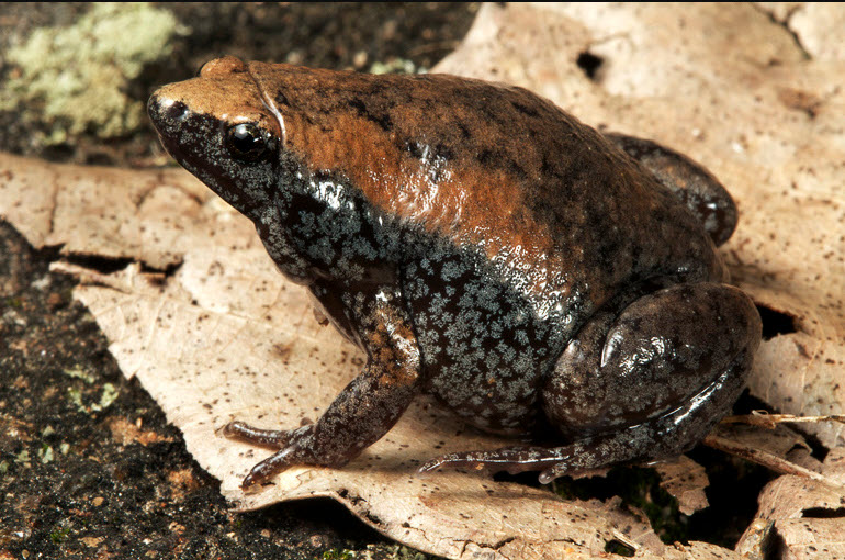
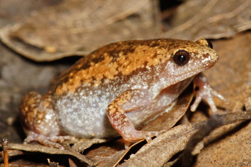
North Carolina is home to many amphibians, but unfortunately for all you Order Caudata fans out there, this article will not be about a salamander (our state is home to over 60 species, making it the place for salamander diversity in the world). No, today we are going to focus on the Eastern Narrow-mouthed toad. This small, somewhat tear-dropped shaped creature more closely resembles a frog: they have smooth, moist skin and lack warts. Their name comes from the tiny, inconspicuous mouth that they have on their small, pointy heads. Narrow-mouthed toads come in a variety of colors, ranging from gray to brown and reddish brown, but all tend to have a lighter-colored band along each side of their body. A fold of skin stretches across the back of their head, putting the finishing touch on these weird little toads.

Close-up photograph of a darker-colored Eastern Narrow-mouthed Toad.

Close-up photo of Gastrophryne carolinensis, Eastern Narrow-mouthed Toad, by Todd Pierson. Courtesy of Herps of NC

Small, plump, and nocturnal, these toads are often hard to spot in the wild, though their call, a nasally, lamb-like bleat, is distinctive. If you are in the Mountain or upper Piedmont regions of the Carolinas and Virginia, you probably will not hear them; but if you travel to the lower Piedmont and the Coastal Plain areas, there is a good chance you will start to hear their call beginning in April and continuing all the way into October. Narrow-mouthed toads (due to their, well, narrow mouths) cannot eat very large prey items. They can, and do, spend their nights feasting on small ants and termites, often being spotted near anthills, if they are spotted at all. Their skin secretions protect them from the ants and, as an added bonus, are also irritating to the eyes and mucous membranes of humans. During the day, these weird and wonderful animals stay put, hiding in moist areas under logs, leaf litter, and rocks.

Close-up photograph of a lighter-colored Eastern Narrow-mouthed Toad.

Close-up photo by Kevin Stohlgren. Courtesy of Herps of NC.

Breeding for this species occurs from April through the fall on warm nights, usually during or after heavy rains. Narrow-mouthed toads tend to gather around temporary wetlands, such as ditches, puddles, and flooded fields. Black-and-white eggs are laid in packets on the water’s surface, with each packet containing around 850 eggs. Once they hatch, the tadpoles will metamorphose into tiny toads in anywhere from three to ten weeks. Narrow-mouthed toads are not an endangered or threatened species in North Carolina; however, they are vulnerable to the same pressures facing other amphibian species in the state. Protecting natural spaces where temporary pools of water can form will aid many amphibians. In order to ensure that the narrow-mouthed toad remains in existence for many years to come, we need to exercise good stewardship of the numerous wetland ecosystems found within our wonderfully species-diverse, amphibian-rich state.

Understanding the 2023 Revised WOTUS Rule: Aligning Federal Water Regulations with Supreme Court Guidance

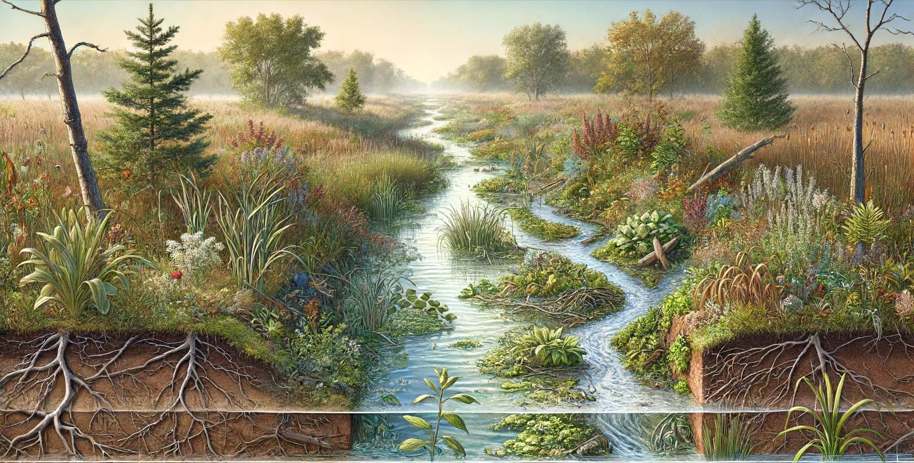
A beautifully illustrated waterway

The revised rule defining “Waters of the United States” (WOTUS) under the Clean Water Act was significantly influenced by the Supreme Court’s decision in the case of Sackett v. EPA. This 2023 amendment refines the scope of waters that are federally regulated, emphasizing the necessity for them to have more permanent, physical connections to traditional navigable waters.

Key Elements of the Revised WOTUS Rule:

  1. Narrowed Definition: The new rule focuses on waters that are:
    • Traditionally navigable waters, including oceans and large rivers.
    • Perennial and intermittent tributaries that contribute flow to traditional navigable waters.
    • Certain lakes, ponds, and impoundments of jurisdictional waters.
    • Wetlands adjacent to other jurisdictional waters that meet specific criteria for a direct hydrological surface connection.
  2. Exclusions: The rule specifically excludes:
    • Features that only contain water in response to rainfall.
    • Groundwater.
    • Many ditches, including most roadside and farm ditches.
    • Prior converted cropland.
    • Waste treatment systems.
  3. Implementation Status: As mentioned, the implementation of this rule is currently mixed due to ongoing litigation:
    • In 23 states, plus the District of Columbia and U.S. Territories, the 2023 rule is in effect.
    • In 27 other states, authorities continue to use the pre-2015 regulatory definitions pending further court decisions.
  4. Legal and Regulatory Framework: The rule is designed to align with the Supreme Court’s narrower interpretation which limits federal jurisdiction to those waters with a significant nexus to navigable waters.
  5. Impact on Regulatory Practices: This revision affects how businesses and landowners manage their land and water resources, particularly concerning permits for development and land use changes.

The practical application of these changes means that permit requirements may vary significantly depending on the state and the nature of the water bodies involved. This complexity underscores the need for ongoing legal guidance and compliance strategies for those affected by these regulations.

For complete details on the regulatory definitions and implications, you can view the official documentation and additional resources provided by the EPA on their WOTUS Rule Information Page.

Wetland Jobs: April 12, 2024

Wetland Jobs

🌿 Swamp School’s Weekly Wetland Scientist Jobs Update! 🌿

Happy Friday, eco-enthusiasts! 🎉 Every week, we bring you the freshest opportunities in the field of wetland science. Dive into our curated list of the top 10 wetland scientist positions that have been posted in the last 15 days, sourced directly from employers across the United States.

Whether you’re a recent graduate looking to start your career, or a seasoned professional seeking new challenges, our list has something for everyone interested in conserving and studying our precious wetlands.

🔍 What’s included:

  • Job title, location, and employer
  • Brief description of the role
  • Link to the job posting for more information.

Stay informed and stay ahead in your career with Swamp School. Don’t forget to check back every Friday for new postings!

👉 Start exploring today and make a splash in your career!

  1. Seasonal Biological Field Technician
    Employer: Olofson Environmental, Inc.
    Location: San Francisco Bay Area, CA
    Description: Seasonal fieldwork role.
    More Information
  2. Environmental Protection Specialist
    Employer: Federal Emergency Management Agency
    Location: Oakland, CA
    Description: Involves environmental protection duties.
    More Information
  3. Seasonal Wetland Ecology Technician
    Employer: City of Boulder, Open Space and Mountain Parks
    Location: Boulder, CO
    Description: Seasonal ecological and conservation work.
    More Information
  4. Wetland Technician
    Employer: City of Boulder
    Location: Boulder, CO
    Description: Focus on wetland-related tasks and assessments.
    More Information Here
  5. OPS F&W Biological Scientist II
    Employer: U.S. Environmental Protection Agency
    Location: Gulf Breeze, FL
    Description: Focuses on biological science within wetlands.
    More Information
  6. Visiting Scientific Specialist, Wetlands Geology
    Employer: Illinois State Geological Survey, Prairie Research Institute
    Location: Champaign, IL
    Description: Role involves scientific research in wetlands geology.
    More Information
  7. Program Assistant (Farm Bill)
    Employer: USDA Natural Resources Conservation Service
    Location: Ellsworth, ME
    Description: Assists with conservation programs under the Farm Bill.
    More Information
  8. Wetland Scientist / Project Manager
    Employer: Hancock Associates
    Location: Boston or Danvers, MA
    Description: Combines project management with wetland science.
    More Information
  9. Biologist
    Employer: Montana Department of Transportation
    Location: Helena, MT
    Description: Involves biological assessments and environmental compliance.
    More Information
  10. Wetland Services Program Leader
    Employer: TRC Companies
    Location: Liverpool, NY (remote possibility)
    Description: Leadership role in wetland services and program management.
    More Information

North Carolina’s Weird & Wonderful: Carnivorous Plants

North Carolina is home to many unique species, including 36 species of carnivorous plants. These plants consume small, unsuspecting invertebrates that fall into their traps. Now, you might be wondering, why do these plants eat meat? Don’t they get their food from sunlight through photosynthesis? Well, yes, these plants do photosynthesize, and are able to produce sugars from that process. However, these species live in wet areas with nutrient-deficient soils, thus they have adaptations that allow them to get nutrients from insects, arachnids, and aquatic prey items. There are five groups of carnivorous plants in North Carolina: butterworts, sundews, bladderworts, pitcher plants, and, of course, the Venus flytrap.

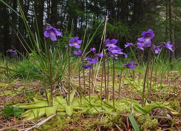
Common Butterwort, Pinguicula vulgaris, photo courtesy of Stuart Anthony and the North Carolina Extension Gardener Plant Toolbox

Butterwort species are in the genus Pinguicula, and these plants, found throughout the southeastern United States in very sunny, wet locations, have small leaves with sticky hairs. Often appearing greasy in texture, the leaves form the trap, and insects get stuck in the residue. The struggling of the insect triggers the butterwort to release more of the sticky fluid; once the residue has fully encased the food item, special cells in the leaves will begin releasing digestive enzymes. Believe it or not, this process gets even cooler! Butterworts also release a strong chemical that kills bacteria. This prevents the dead insect from rotting while it is slowly being digested.

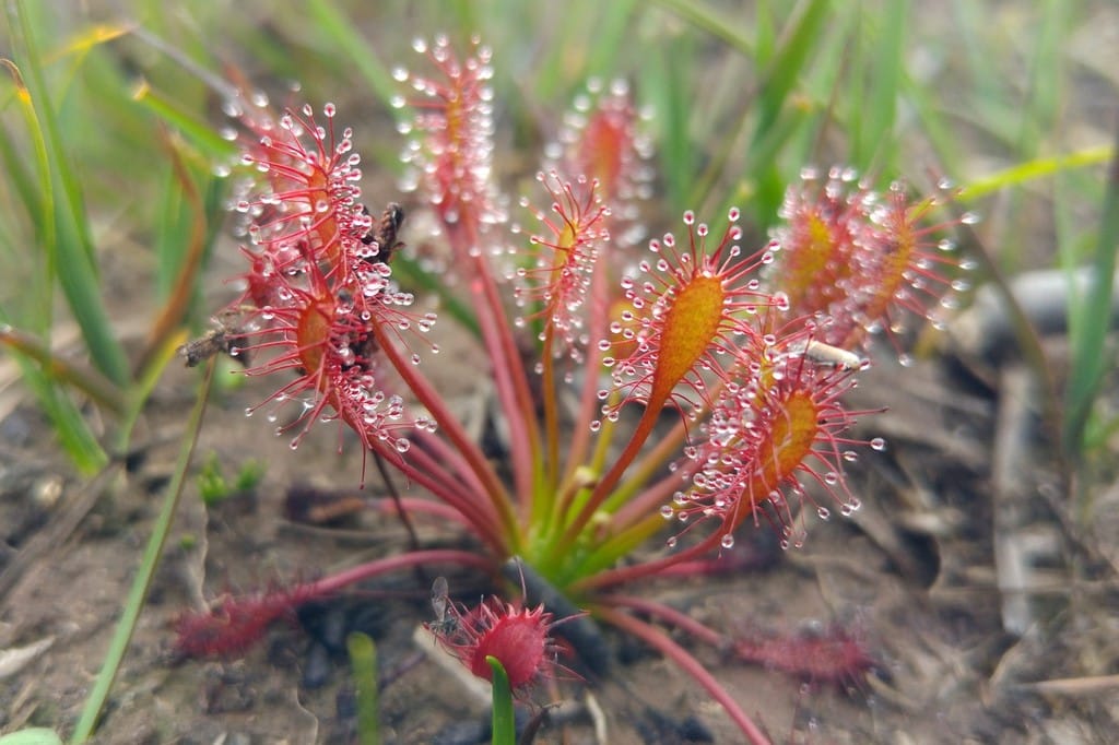
A sundew species, photo courtesy of Phil Champion and the North Carolina Extension Gardener Plant Toolbox

Sundews, which are in the genus Drosera, are one of the largest groups of carnivorous plants. In addition to species native to North Carolina, there are sundews found all over the world, found in bogs, fens, and marshes ranging from tropical climates to colder climates. Sundews are similar to butterworts in that their leaves, which are pad-like, are covered in sticky hairs. More struggling results in the fluid stickiness increasing; but instead of fully encasing the insect in a residue, the leaf pads will slowly curl up around the insect before digestion begins. Due to their small size, sundews’ prey items are very tiny, often small gnats and ants.

Swollen Bladderwort, Utricularia inflata, photo courtesy of Robby Deans and the North Carolina Extension Gardener Plant Toolbox

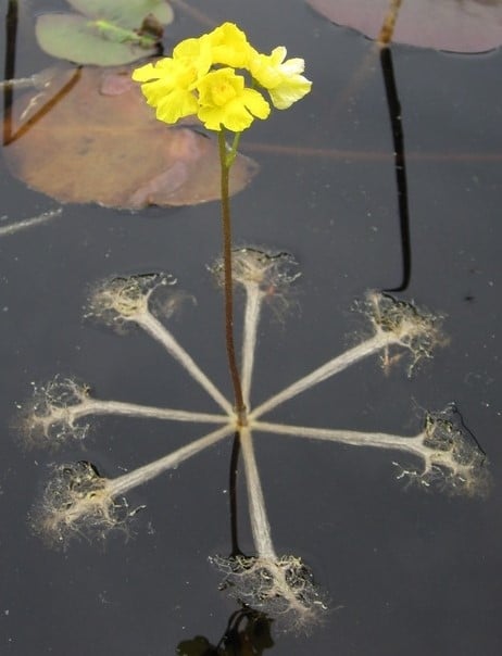
The genus Utricularia contains the bladderworts, and it is the largest genus of carnivorous plants. Aquatic species of bladderworts grow fully submerged, except for the stem and blossom, and they may float freely in the water or attach themselves to a surface. Other bladderwort species that are more tropical are epiphytic, and still other species grow in very wet soil. The bladderworts are unlike any other carnivorous plant in that they have a unique bladder system. These bladders have a trap door covered in tiny hairs. When a prey item touches the hairs, it triggers the trap door to open in a millisecond and the bladder sucks in the prey, closing in about 2.5 milliseconds! So, in about 3.5 milliseconds, the bladderwort has caught its food. How weird and wonderful is that?

Purple Pitcher Plant, Sarracenia purpurea, photo courtesy of David Midgley and the North Carolina Extension Gardener Plant Toolbox

Now pitcher plants, in the genus Sarracenia, are probably some of the more recognizable carnivorous plants in the world. In North Carolina we have the purpurea species, so named because of the color of the flowers and the pitchers themselves. This species is often found in marshes and bogs but is also right at home in wet forest floors and pinelands. The purple pitcher plant’s leaves form pitchers that are open to the sky and collect rainwater. Insects are attracted to little droplets of nectar that are produced along the rim of the pitcher, and as they crawl inward, they encounter tiny hairs that point downwards. This results in a surface that is very easy to climb down, but impossible to climb up! Eventually the insects fall into the pool of water, which also contains digestive enzymes that the plant has produced. What is really cool about the purple pitcher plant is that it is pollinated by a member if the pitcher plant fly genus, Fletcherimyia. The larvae of these flies live in the fluid inside of the pitchers, feeding on some of the insects that have gotten trapped!

The Venus Flytrap, Dionaea muscipula, photo courtesy of Lucy Bradley and the North Carolina Extension Gardener Plant Toolbox

There is only one more carnivorous plant to discuss: North Carolina’s official state carnivorous plant, the Venus flytrap. Venus flytraps, Dionaea muscipula, are mainly found in southeastern North Carolina, though some small populations have been found in northeastern South Carolina. This plant has specialized, folded leaves covered in large and small hairs. When an insect touches those hairs, it triggers the two halves of the leaf to close around the insect, trapping it. Like the butterwort, special cells on the leaves release digestive enzymes, and in about two weeks, the leaf will reopen and be ready to catch another insect. We North Carolinians love Venus flytraps so much that, not only has it been declared the state carnivorous plant, but there is also a house bill to authorize the Venus Flytrap Specialty License Plate! If House Bill 734 passes, some of the proceeds from each license plate renewal will go towards the Friends of Plant Conservation and the North Carolina Botanical Garden Foundation, which will use the money to fund plant conservation education and research.

The Venus flytrap, and many of the other carnivorous plant species, are endangered. Habitat destruction and overharvesting are the two major threats facing these plants today. These species require specific habitat conditions in which to grow and thrive, and if even one of those conditions is thrown off, the plants will start to decline. Gardening and houseplant fever unfortunately results in wild plants of all kinds, not just carnivorous ones, being poached in order to meet the demand. If you have to have a carnivorous plant, purchase one from a reputable nursery. There are many other amazing plants that share the same habitat needs as the meat-eaters, so consider creating a small bog or marsh garden in your backyard. In North Carolina, nurseries such as Carolina Habitats and Plant Delights can be excellent resources for learning how to recreate plant communities in a garden setting. State cooperative extension offices and their Master Gardeners programs would be a good resource for region-specific knowledge. Finally, if you want to see carnivorous plants in action, plan a trip to Carolina Beach State Park, south of Wilmington, North Carolina. These weird and wonderful plants are sure to make a lasting impression.

Special thanks to the North Carolina Extension Gardener Plant Toolbox and all of their amazing photographers for the photographs in this blog and for being a source of great information on the many carnivorous plant species in the state. https://plants.ces.ncsu.edu/

Enhancing Nationwide Wetland Permitting: Integrating the Stream Duration Assessment Model (SDAM) with State-Specific Approaches Across the U.S

The U.S. Army Corps of Engineers (USACE) has developed the Stream Duration Assessment Model (SDAM), a groundbreaking tool that significantly enhances the regulatory oversight and protection of the nation’s water resources. This model plays a critical role in managing and safeguarding streams and wetlands, crucial for maintaining biodiversity, water quality, and flood mitigation. The SDAM is designed to classify streams based on their flow characteristics—perennial, intermittent, or ephemeral—crucial for determining the jurisdictional status of water bodies under the Clean Water Act (CWA). This article explores the integration of state-established models with the SDAM for regulatory purposes and highlights its nationwide applicability for wetland permits.

The SDAM employs a science-based approach, integrating hydrological data, GIS analyses, and field observations to assess stream flow characteristics accurately. This standardized method is vital for delineating the scope of regulatory oversight, ensuring environmental impacts are thoroughly evaluated and mitigated, particularly in the context of Section 404 of the CWA, which governs the discharge of dredged or fill material into waters of the United States.

State-established models of stream flow complement the SDAM by providing detailed insights into the flow regimes of streams within specific geographic areas. These models, developed based on localized data, enhance the precision of the SDAM by incorporating nuanced understandings of stream behavior, reflecting the unique ecological conditions of different regions. Integrating these models involves aligning methodological approaches, standardizing stream type definitions, and harmonizing data analysis techniques to ensure consistency across jurisdictions.

The combined use of the SDAM and state models offers a more nuanced assessment of streams for regulatory purposes. It facilitates more informed decisions regarding wetland permits by identifying streams with significant ecological functions or those critical to maintaining watershed health. This approach supports a more adaptive and responsive regulatory framework, allowing for updates with new data as environmental conditions change, ensuring the relevance and effectiveness of stream assessments.

Nationwide, the applicability of the SDAM, enhanced by state-specific models, encourages collaboration among federal, state, and local agencies. This collaborative approach improves the regulatory process’s efficiency and fosters a shared commitment to protecting water resources. It exemplifies the balance between economic development and environmental stewardship, promoting the sustainable management of aquatic ecosystems.

Furthermore, the integration of state models with the SDAM highlights the USACE’s commitment to using science and technology to improve environmental regulation. It reflects a shift towards data-driven decision-making, setting a precedent for future innovations in water resource management. As the model is refined and updated, its utility for regulatory purposes will continue to improve, ensuring that development and infrastructure projects proceed in an environmentally responsible manner.

The integration of the Stream Duration Assessment Model (SDAM) with state-specific methods, such as the North Carolina (NC) method for assessing stream flows, exemplifies a tailored approach to environmental regulation and water resource management. North Carolina has developed its own methodologies for classifying streams and assessing their ecological significance, which can complement the broader framework of the SDAM.

Example: North Carolina’s Stream Identification Method

North Carolina’s method for stream identification and classification is designed to meet the unique ecological and hydrological conditions of the state, which range from the Appalachian Mountains in the west to the coastal plains in the east. This method involves detailed field assessments, including the examination of physical, chemical, and biological indicators to determine stream types and their jurisdictional status under state and federal regulations.

Key aspects of the NC method include:

  1. Physical Indicators: These include the presence of a well-defined channel, bed and banks, and evidence of flow (e.g., water marks, sediment sorting) to distinguish between perennial, intermittent, and ephemeral streams.
  2. Biological Indicators: The presence of aquatic life, such as fish and macroinvertebrates, which are indicative of perennial or intermittent streams capable of supporting diverse biological communities.
  3. Hydrological Data: Use of historical precipitation, stream gauge data, and other hydrological models to predict flow durations and patterns throughout the state’s diverse landscapes.

Integrating the NC method with the SDAM allows for a comprehensive assessment that leverages local expertise and data while aligning with national standards for water resource management. This integration enhances the precision of stream classifications and the effectiveness of regulatory processes, including permitting for activities that impact water resources.

For example, when a developer proposes a project in North Carolina that may affect waterways, the combined use of the NC method and the SDAM ensures a thorough evaluation of potential impacts on stream flow and aquatic habitats. This dual approach facilitates informed decision-making regarding permit issuance, mitigation measures, and conservation efforts, balancing development needs with environmental protection.

Nationwide Implications

The example of North Carolina illustrates how state-specific methods can enhance the effectiveness of the SDAM in managing water resources across the U.S. By integrating localized approaches with the broader framework of the SDAM, states can ensure that regulatory processes are adapted to their unique environmental conditions, promoting sustainable water resource management and protection at both the state and national levels. This collaborative approach underscores the importance of tailored strategies in addressing the complex challenges of environmental stewardship and water resource regulation.